


The wind switches direction today with a surface high-pressure system working into the plains. This, combined with a minor cold front, will also cool us off even further. Most of the state reaches highs in the 70s to low 80s this afternoon.
Fires will blow back onto themselves today as winds switch from westerly to northeasterly. They will continue to burn, but this should not allow them to grow as much as they have in recent days, unless a new fire breaks out. Gusts could reach 20-30 MPH today, and we will remain dry and mostly sunny.
Smoke will be present in western Montana today and tomorrow, but with improving fire weather conditions in our state, smoke production will lessen each day.
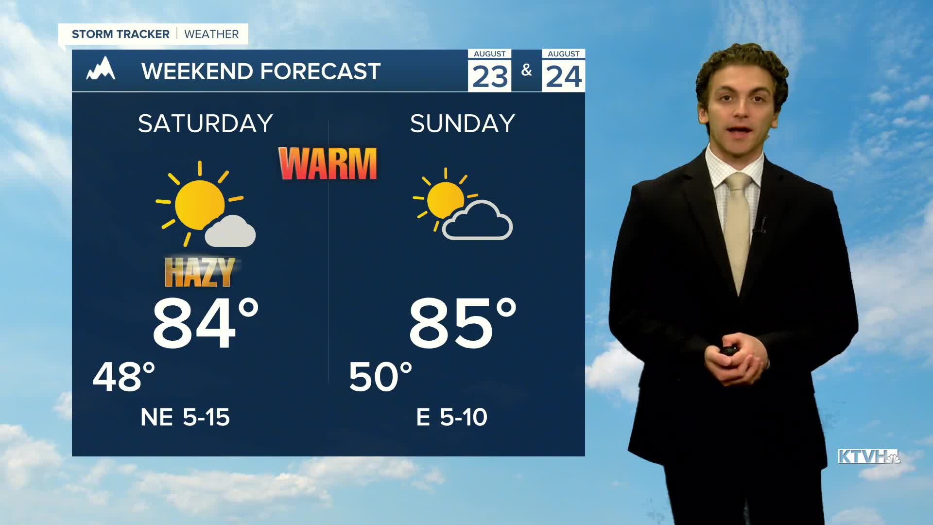
Temperatures warm to the upper 70s to mid 80s over the weekend with dry conditions sticking around.
The warmest our area will reach is the upper 80s for highs before another weather system starts to make its way into the area late next week, bringing some thunderstorms back to the forecast.
——————————————————————————————————————————
WEATHER ALERTS:
A LAKE WIND ADVISORY has been issued for Fort Peck Lake from 11 AM Friday until 7 PM Friday
——————————————————————————————————————————
Helena Temperature Records Today:
High: 97 (2006)
Low: 33 (1992)
AVG: 83/51
Great Falls Temperature Records Today:
High: 98 (1976)
Low: 32 (1992)
AVG: 81/49
Have a great Thursday
Joey Biancone
Meteorologist


