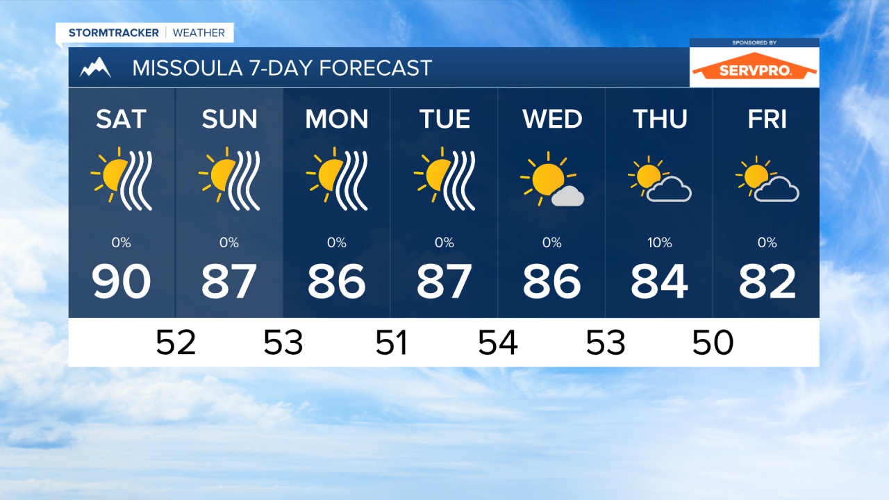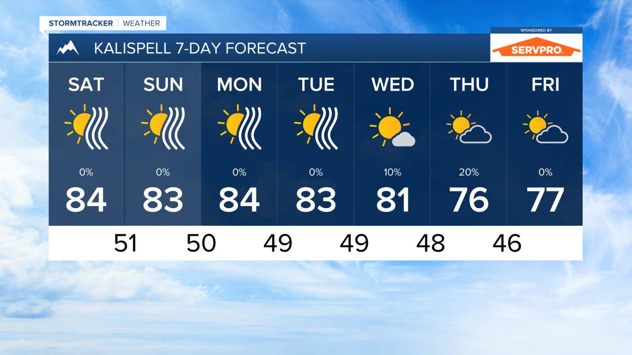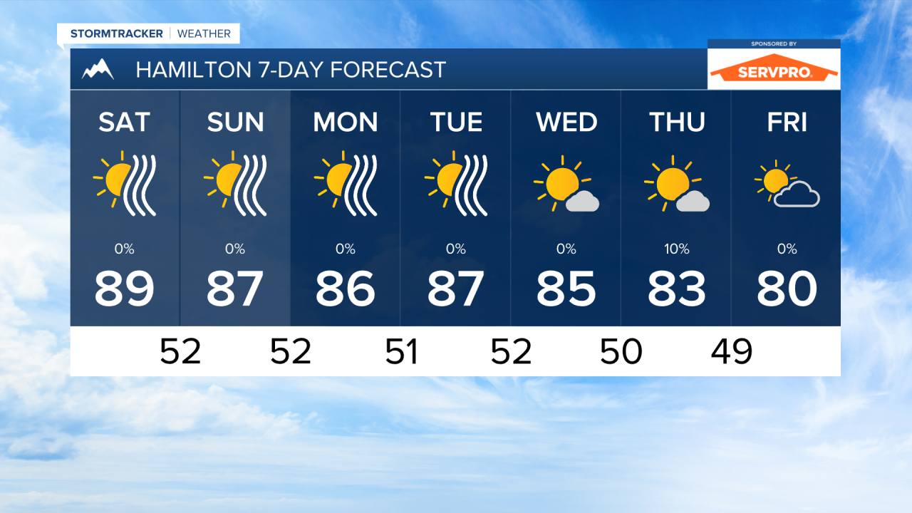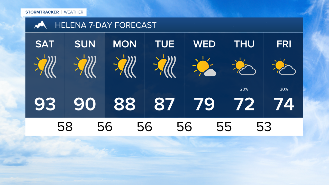


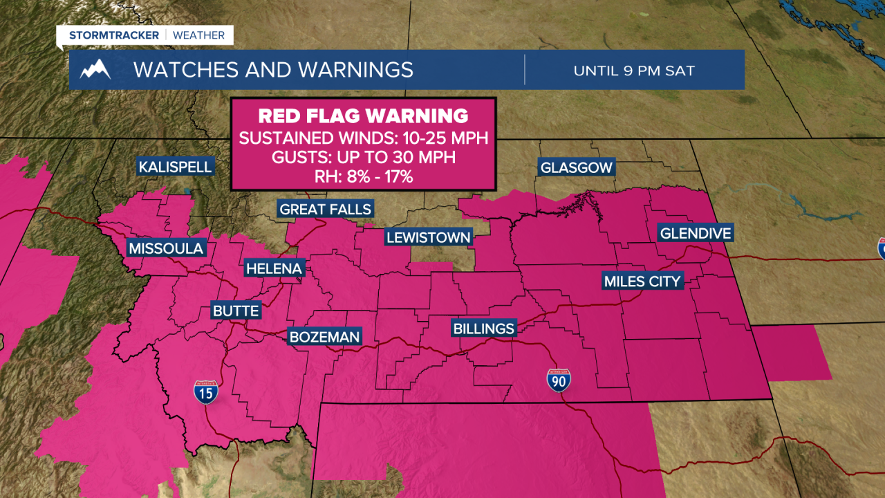
MISSOULA — Breezy conditions and low relative humidity will create elevated fire weather conditions over the next couple of days. We have already seen rapid growth in fires through southwest Montana. We will likely see fire conditions worsen before they get better.
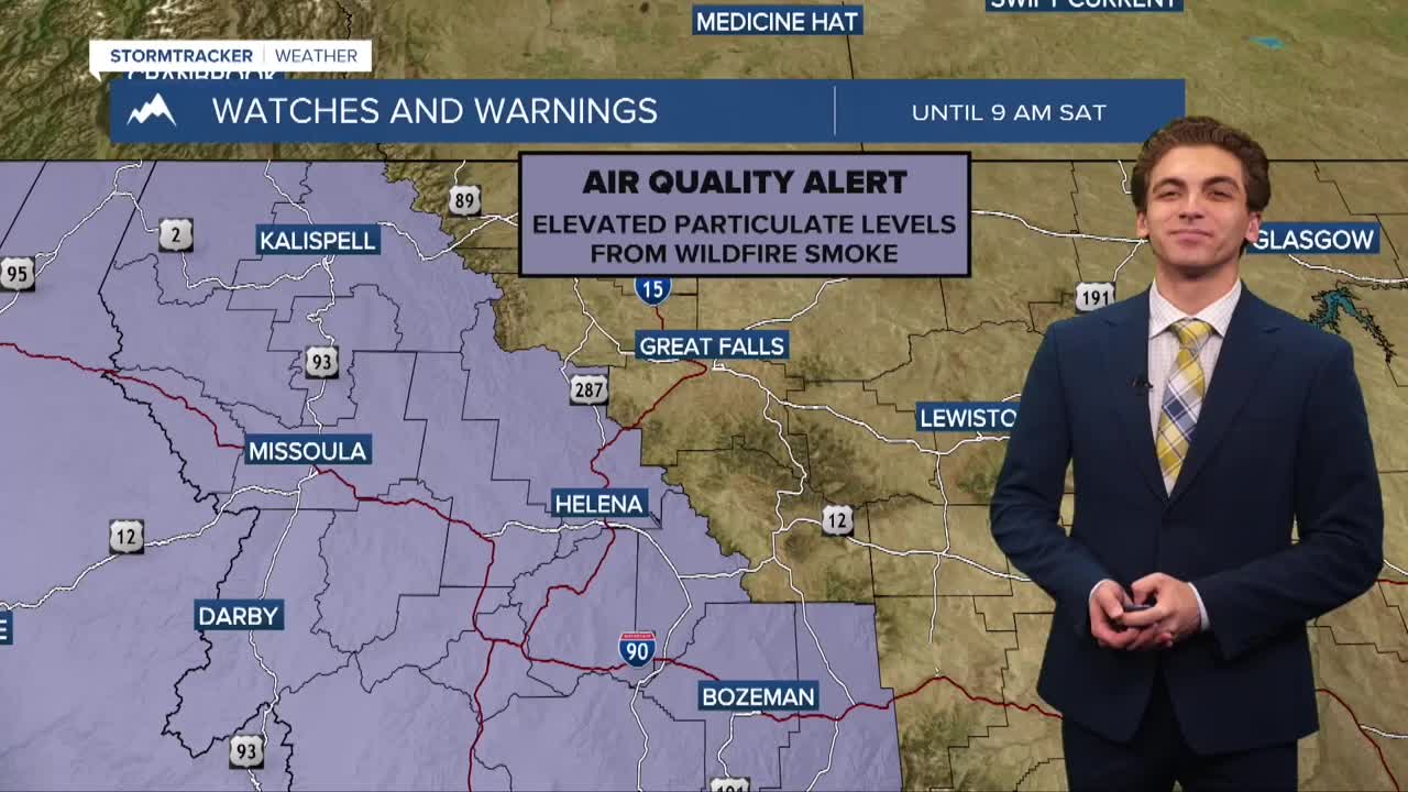
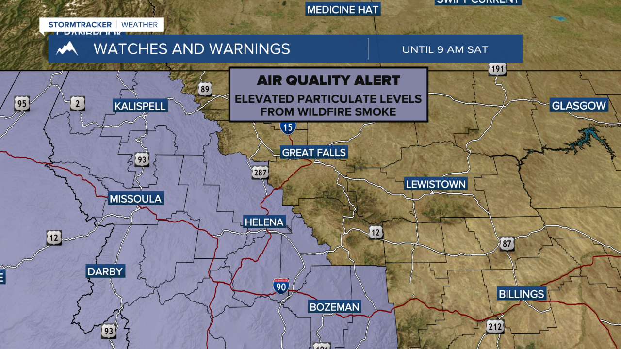
Heavy smoke continues to impact air quality across a large chunk of Montana. I expect the smoke to stick around for quite a while, even into next week. A series of weak cold fronts from Canada may help clear some of the smoke out of north-central Montana at times.
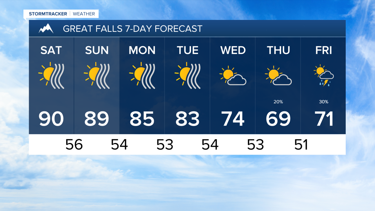
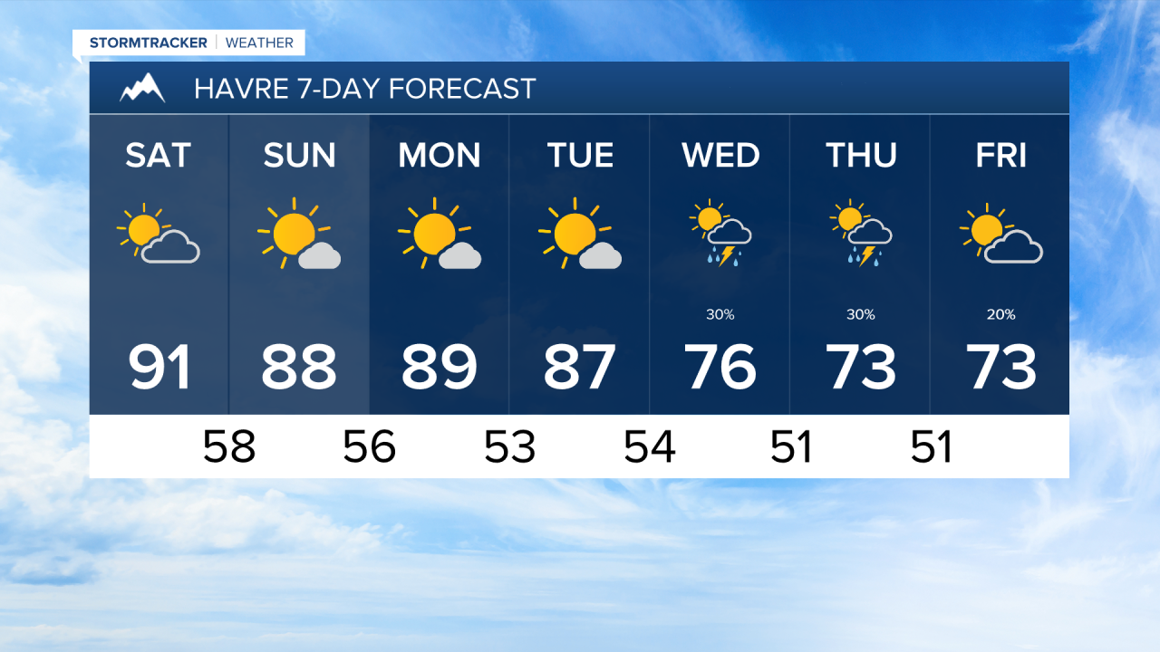
Temperatures will be in the upper 80s to 90s over the next couple of days. We will be on a slight cooling trend over the next week until most of us only have highs in the 70s by the end of next week.
There is no precipitation in the forecast until at least the middle of next week, when a trough of low pressure begins to move into the area. This will bring isolated showers and thunderstorms back to northern parts of the state. Models are trending towards scattered thunderstorms returning next weekend.
——————————————————————————————————————————
MONTANA WEATHER ALERTS:
——————————————————————————————————————————