


Some remaining mountain snow showers are making travel over some mountain passes, like MacDonald Pass, difficult this morning. Warmer and drier weather is on the way for most of the week.
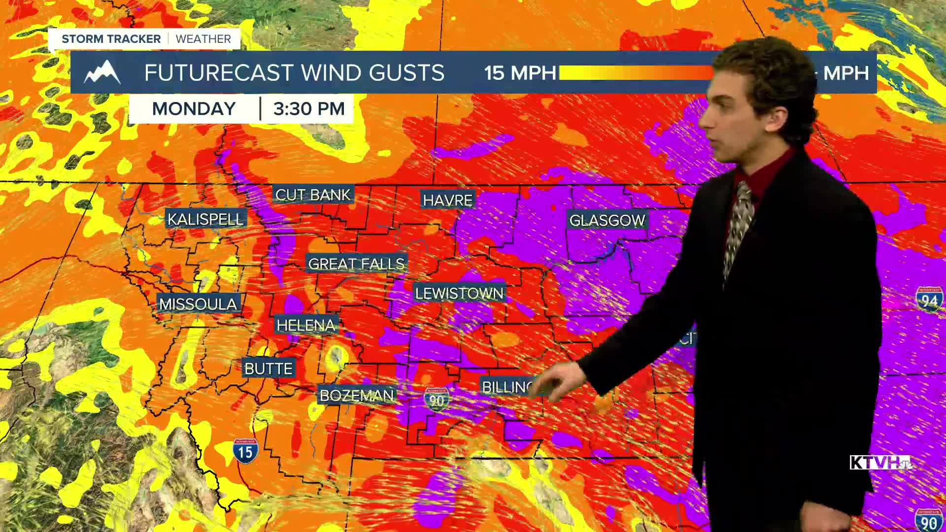
The wind will stay gusty at times today, with most of the stronger bursts occurring east of the central island mountain ranges. Expect gusts in western Montana to reach around 30-40 MPH this afternoon.
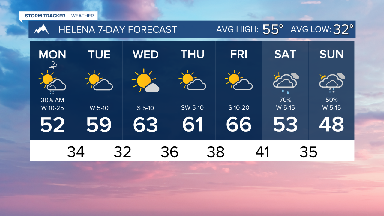
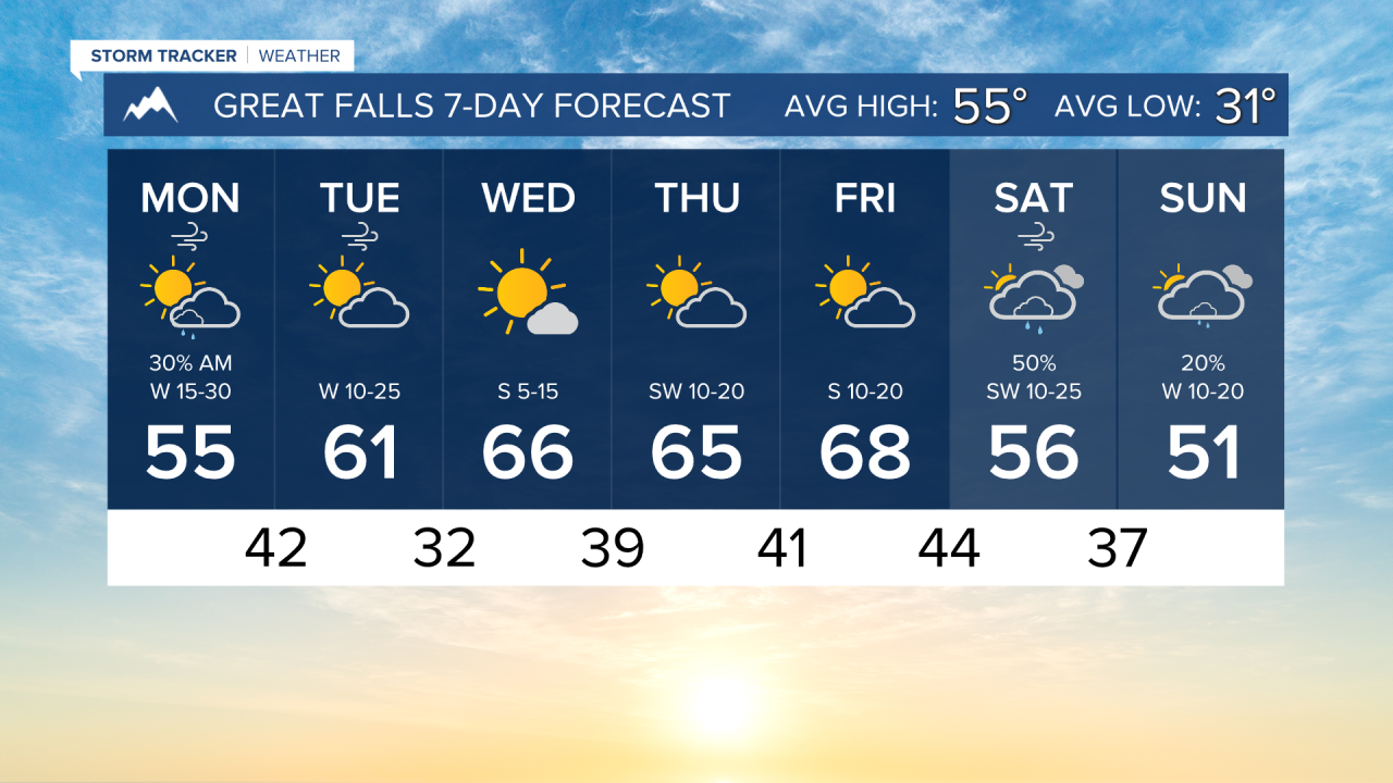
Dryer conditions take hold this afternoon and will last through Friday. A ridge of high pressure begins to build over the region.
Highs this week will reach the 50s and 60s, with the warmest day occurring on Friday ahead of our next weather system.
Some rain and snow will move in along a cold front on Saturday. The unsettled weather will last into Sunday.
——————————————————————————————————————————
WEATHER ALERTS:
A WINTER WEATHER ADVISORY continues for the high elevations of the back country and mountains, as well as Highway 93 Sula to Lost Trail Pass until 9 AM Monday
A WINTER WEATHER ADVISORY continues for the Little Belt and Highwood Mountains until noon Monday
A LAKE WIND ADVISORY continues for Fort Peck Lake until 9 PM Monday
——————————————————————————————————————————
Helena Temperature Records Today:
High: 81 (2023)
Low: 18 (1995)
AVG: 55/32
Great Falls Temperature Records Today:
High: 81 (1974)
Low: 16 (1984)
AVG: 55/31