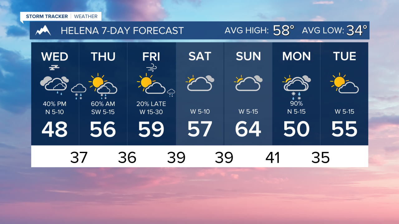
Another storm system enters Montana today, bringing lower elevation rain and higher elevation snow to areas east of Interstate 15.
Areas of patchy fog may develop again this morning. Cloudy skies are expected once again through the day today with isolated showers around the Helena area. Highs will reach the mid to upper 40s.
A cut-off low-pressure system is expected to pass through Montana this evening and tomorrow. Rain and snow showers will redevelop along and east of Interstate 15. Heavy snowfall is possible in the Beartooth Mountains. We could see another round of light snow in the mountains around Helena, but we are expecting mostly rain in the lower elevations
Overall, drier and warming conditions take hold towards the end of the week. Temperatures return to the 50s and 60s by the weekend with a west wind picking back up.
Wind will be gusty through north-central Montana and on the Continental Divide on Friday, Saturday, and Sunday. Peak wind gusts could exceed 40-50 MPH.
——————————————————————————————————————————
WEATHER ALERTS:
A DENSE FOG ADVISORY continues for Carter and Power River Counties until 9 AM Wednesday
——————————————————————————————————————————
Helena Temperature Records Today:
High: 83 (1991)
Low: 16 (1969)
AVG: 58/34
Great Falls Temperature Records Today:
High: 80 (1991)
Low: 11 (1899)
AVG: 57/33