


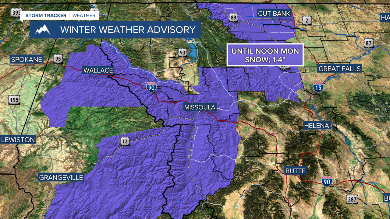
MONDAY, MARCH 16TH: Winds begin to pick back up today in north-central Montana. This is creating blowing snow near the Rocky Mountain Front with dangerous driving conditions. Icy road conditions should be expected as you head out the door this morning.
Afternoon temperatures will warm above freezing, which will begin to melt snow and ice, as well as reduce the blowing snow threat. Highs will reach the 40s.
A few rain showers will form over central Montana as a warm front moves through the area with cloudy conditions.
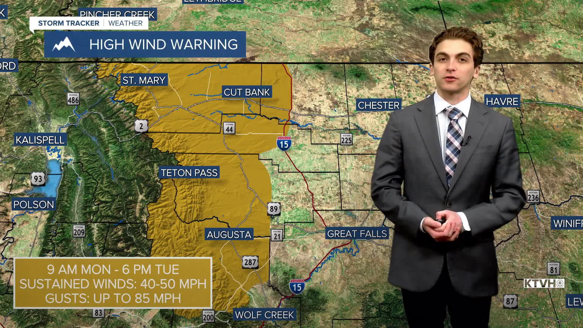
Wind gusts in north-central Montana will reach up to 85 MPH west of I-15 by the afternoon. Gusts for the rest of the area will reach up to 50 MPH. The Helena area will not be as windy this time around. Winds will be around 10-25 MPH this afternoon. It's important to note that this week's wind is not expected to be as intense as last Sunday and Thursday.
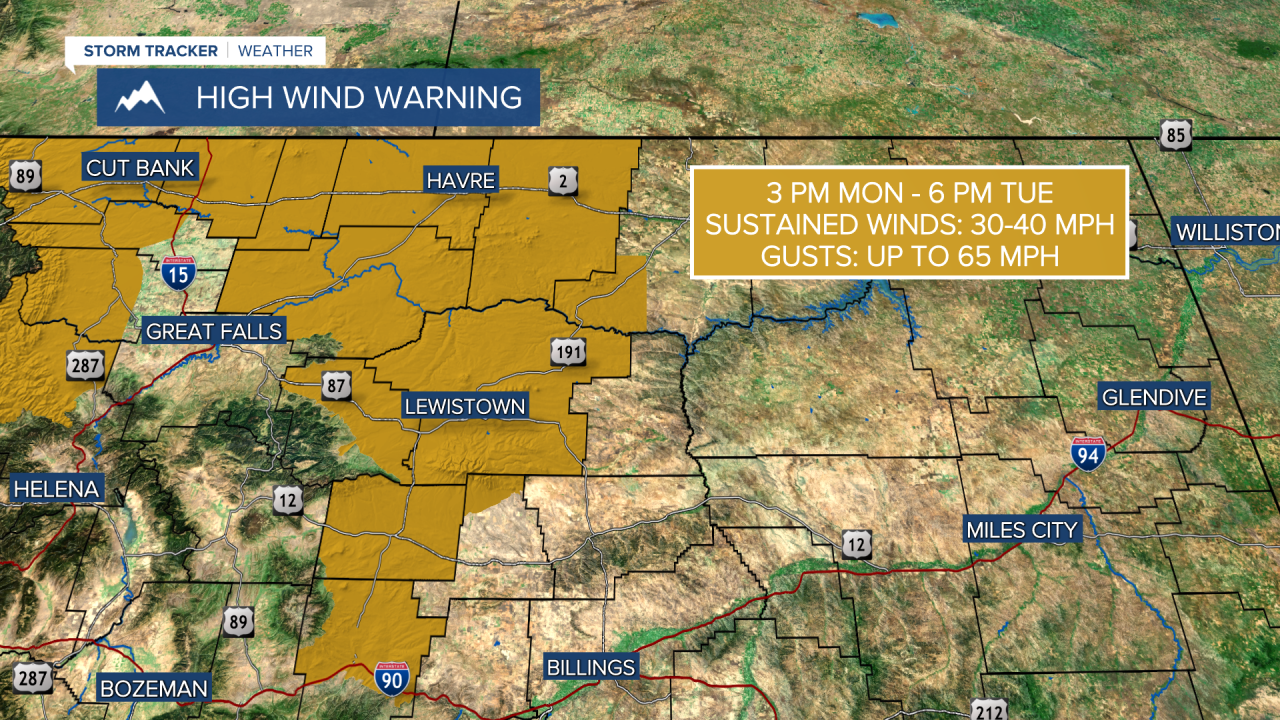
ST. PATRICK'S DAY: Winds will continue to be strong as High Wind Warnings are in effect for most of central Montana. At this time, Helena and Great Falls are NOT included in these warnings. Winds are not expected to reach the warning threshold.
Light snow and freezing rain may fall in the early morning around the Glasgow area. But elsewhere, morning lows will not dip below freezing in lower elevations.
Most of the snow will melt on Tuesday in the lower elevations, as temperatures continue to warm into the 50s and 60s. Expect mostly cloudy skies and isolated rain showers, especially near the Continental Divide.
WEDNESDAY, MARCH 18TH: Temperatures will reach much above normal, with highs in the 60s and low 70s. Most, if not all, lower elevation snow will be melted. Winds will continue to gust near 40 to 60 MPH across north-central Montana. Helena will gust near 30-40 MPH. Most of the state will be dry under mostly cloudy skies.
THURSDAY, MARCH 19TH: Most of the state continues to warm, with afternoon temperatures approaching record highs in the 70s. Similar to Wednesday, winds continue to stay relatively strong. Expect partly to mostly cloudy skies.
LONG-RANGE FORECAST: Warm and windy conditions continue through Friday, before a cold front moves through the state on Friday, bringing rain and snow showers back to the forecast. The wind will die down over the weekend.
——————————————————————————————————————————
WEATHER ALERTS:


——————————————————————————————————————————
Helena Temperature Records Today:
High: 70 (1994)
Low: -10 (1906)
AVG: 48/25
Great Falls Temperature Records Today:
High: 68 (2010)
Low: -12 (1943)
AVG: 45/22


