


Lows dipped below zero for the majority of our area this morning. Air temperatures were as low as the -20s for some, the coldest in the contiguous United States.
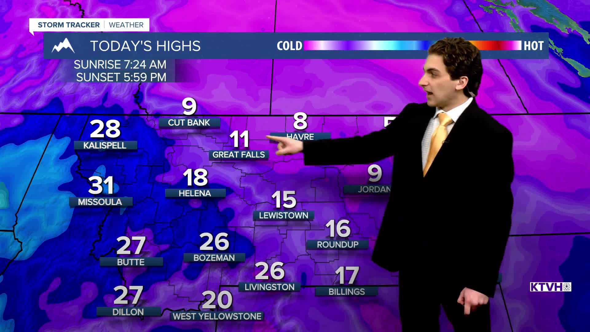
THURSDAY, FEBRUARY 19TH: Today will be another cold day. Lows have dipped into the -20s for some, with wind chills in northeast Montana between -30° and -40°. Highs only reach the single digits and teens. Pop-up snow showers will form in the mountains of southwestern Montana in the afternoon, causing minimal impacts to most.
Be careful on the roads today. A lot of the Helena area is snow-covered and very slick.
FRIDAY, FEBRUARY 20TH: Temperatures will begin to warm slightly on Friday, but not by much. Morning lows will be in the single digits above and below zero. Highs will reach the teens and 20s. More light snow will come through western Montana in the afternoon and evening. Accumulation should be around 1-2 inches in the mountains, with another coating possible in lower elevations.
SATURDAY, FEBRUARY 21ST: Morning lows dip into the single digits and teens. Highs will reach the 20s and 30s with mostly sunny to partly cloudy skies. Snow moves out temporarily.
SUNDAY, FEBRUARY 22ND: Sunday will be similar to Saturday. Highs reach the 30s and 40s under partly cloudy skies.
LONG-RANGE FORECAST: Wind will begin to pick up on Monday, warming most locations back above normal. Wind will be strong and gusty through at least the middle of next week. Some more rain and snow will enter the state on Tuesday.
——————————————————————————————————————————
WEATHER ALERTS:
——————————————————————————————————————————
Helena Temperature Records Today:
High: 64 (1981)
Low: -23 (1882)
AVG: 38/18
Great Falls Temperature Records Today:
High: 67 (1981)
Low: -29 (2025)
AVG: 38/15


