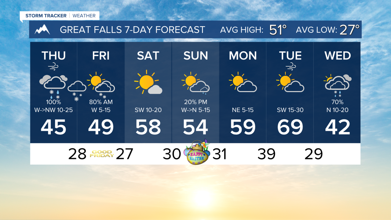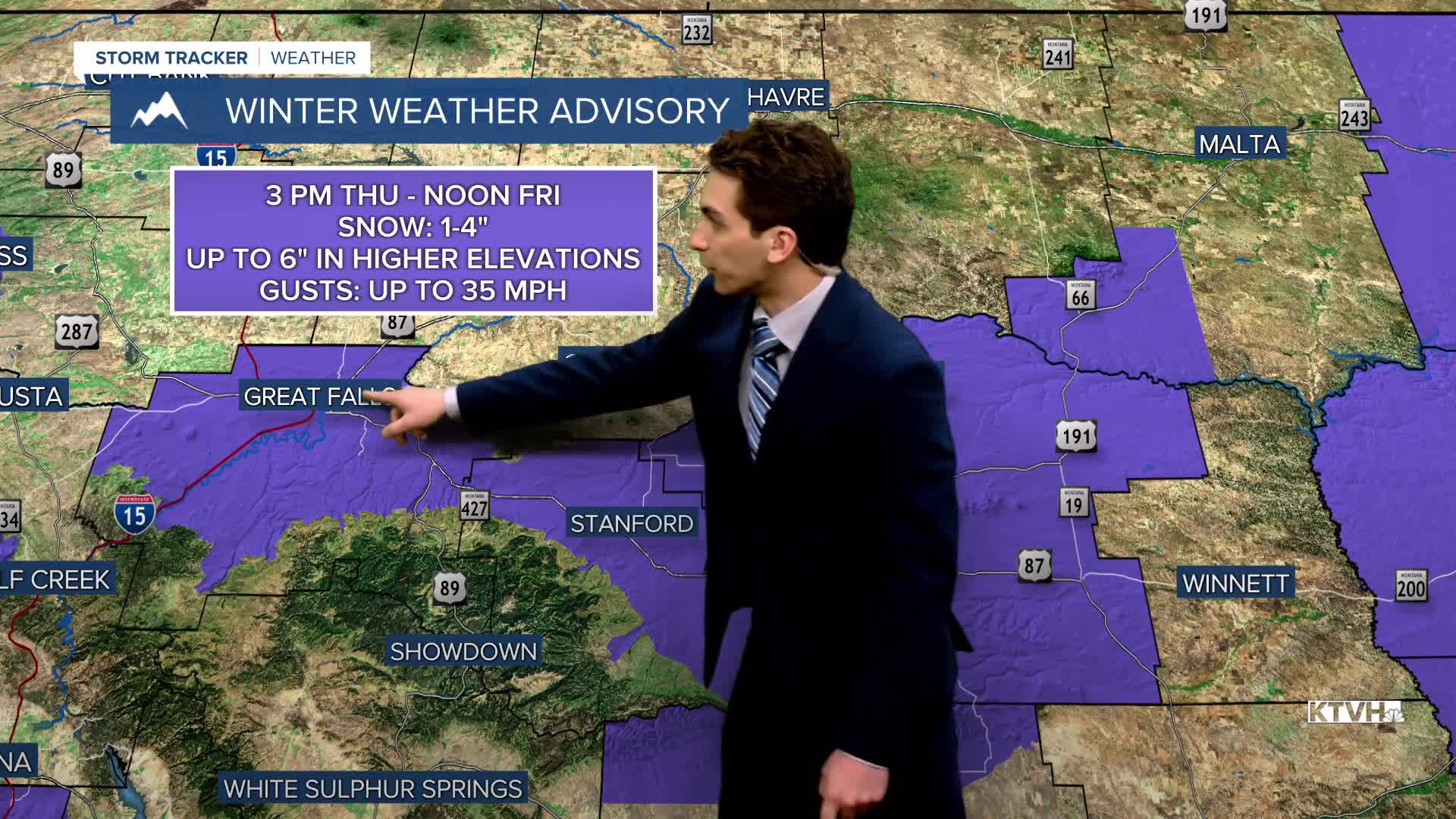


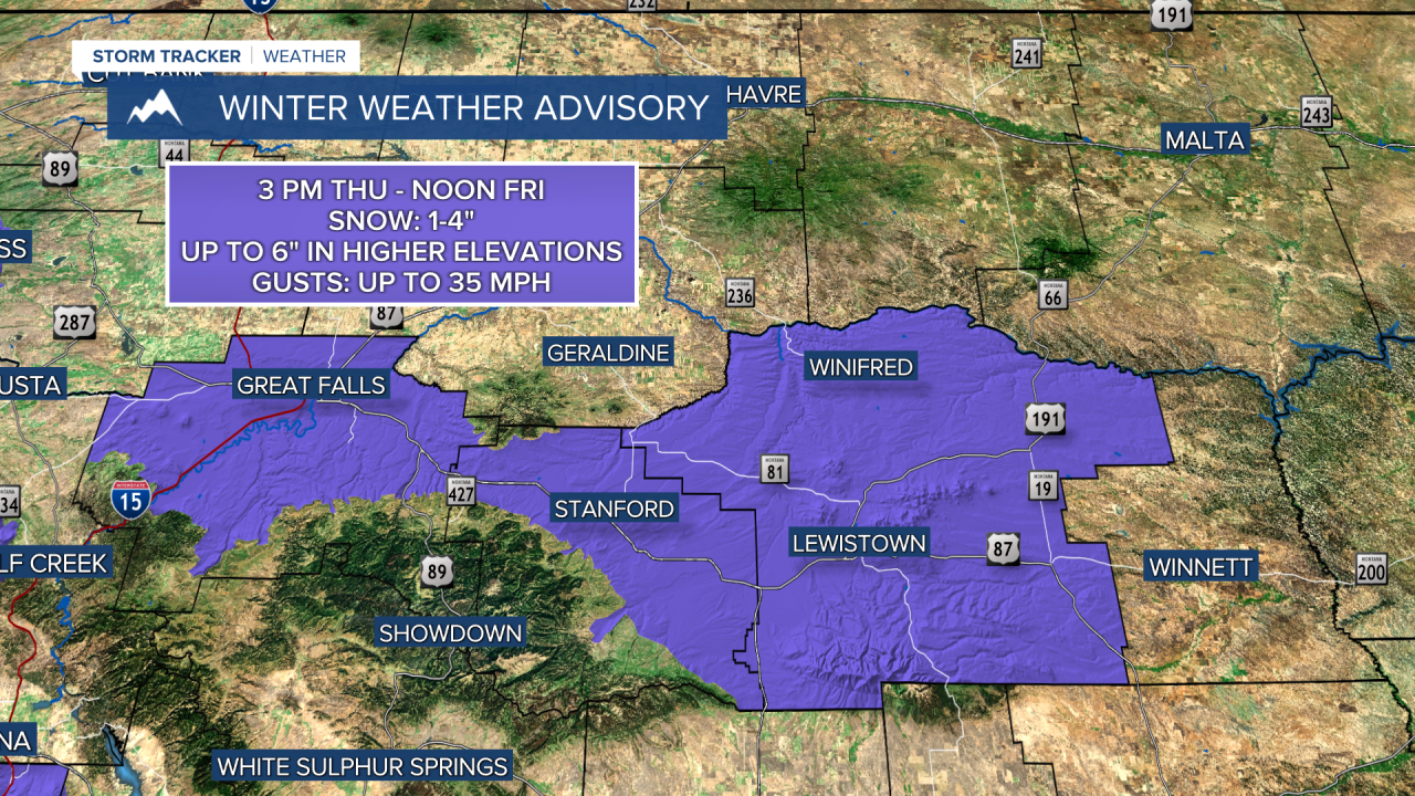
THURSDAY, APRIL 2ND: The way this low is tracking in current model runs, it is in a favorable position to bring lower elevation snow to the state. Highs will only reach the 30s and 40s. On and off precipitation will be around the area for most of the day.
It is important to note that most lower-elevation locations will see rain to begin the morning. As the center of low pressure moves closer this afternoon and evening, it will bring slightly cooler air, allowing the conversion to snow.
This system will generally bring light snow totals to lower elevations of about 1-4". Most of that will fall overnight. The heaviest totals will be in the Absaroka and Beartooth Mountains, with up to 18" possible.
No matter the snow totals, most areas will receive very beneficial precipitation, with about 0.25" to 1" of rainfall.
Blowing snow is a possible hazard over the next 24 hours, with wind gusts in most areas approaching 30-40 MPH.
GOOD FRIDAY: Moderate to heavy snow continues through the morning, moving out of the area by the afternoon. It will be cloudy to begin the morning, clearing to partly cloudy conditions in the afternoon. Highs will reach the 40s.
SATURDAY, APRIL 4TH: Any snow left from Thursday and Friday in the lower elevations will melt off. The state will be dry and warmer to begin the holiday weekend. The morning will start on a chilly note with temperatures in the 20s, but quickly warm up into the 50s and low 60s. Expect mostly sunny skies.
EASTER: A very minor cold front moves through the plains, bringing slightly cooler air and a couple of rain showers. This will not impact Easter plans. Morning temperatures will be in the 30s, warming to the 50s and 60s in the afternoon.
LONG-RANGE FORECAST: A minor boundary bringing isolated showers and slightly cooler temperatures for north central Montana moves in on Easter Sunday and Monday, but no major impacts to travel are expected, and most areas will stay dry.
——————————————————————————————————————————
WEATHER ALERTS:


——————————————————————————————————————————
Helena Temperature Records Today:
High: 76 (1990)
Low: -5 (1936)
AVG: 53/29
Great Falls Temperature Records Today:
High: 76 (1992)
Low: -10 (1936)
AVG: 51/27