


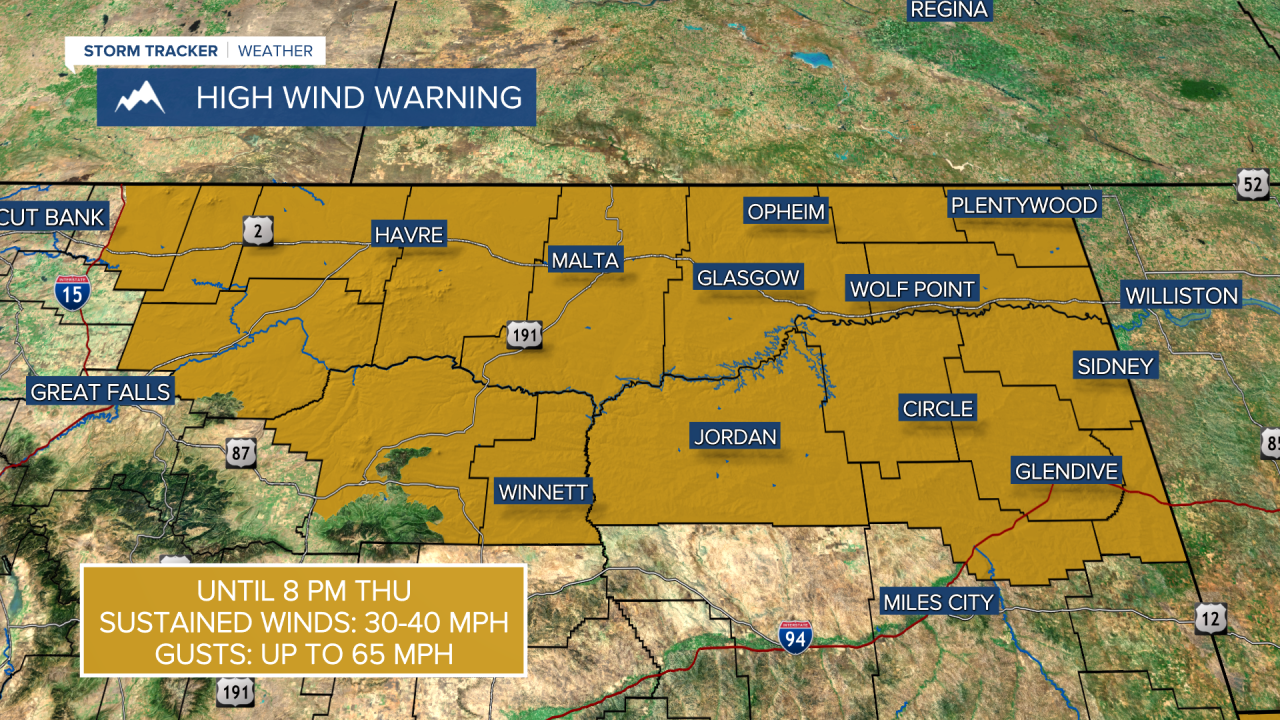
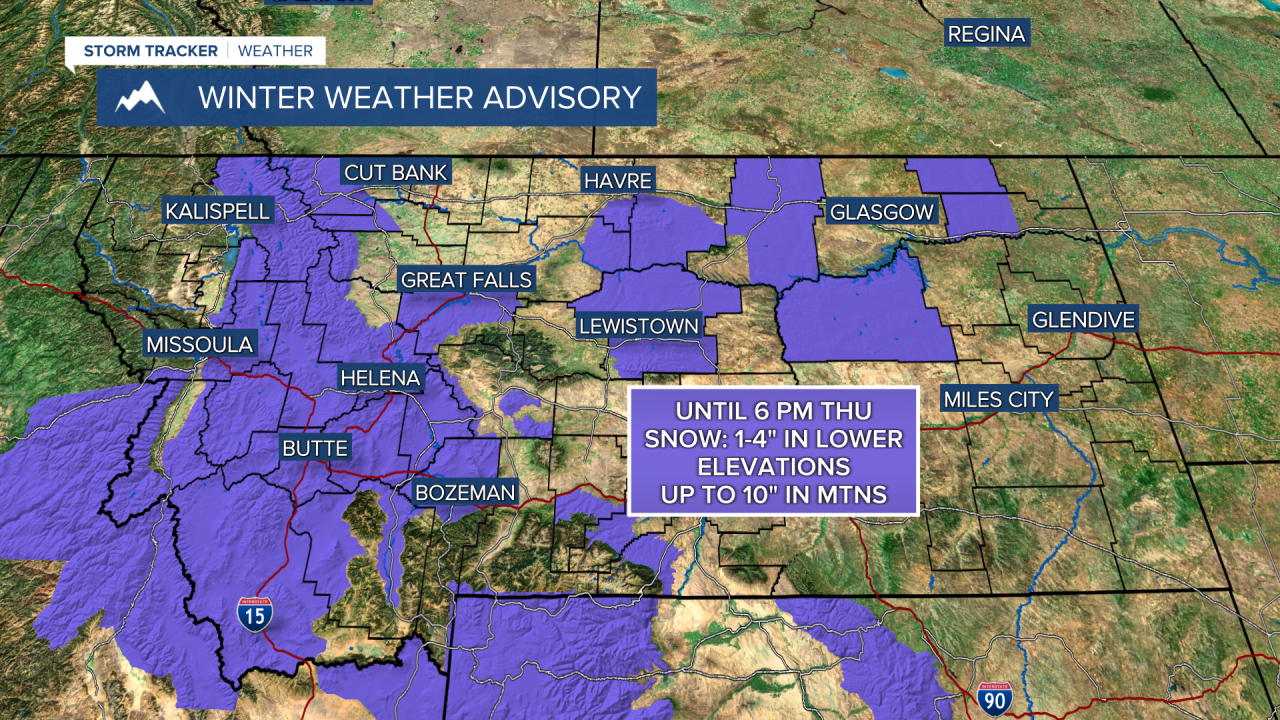
THURSDAY, APRIL 23RD: A potent center of low is bringing blizzard conditions to northeast Montana this morning. Expect those conditions to persist near Glasgow until about 3 PM.
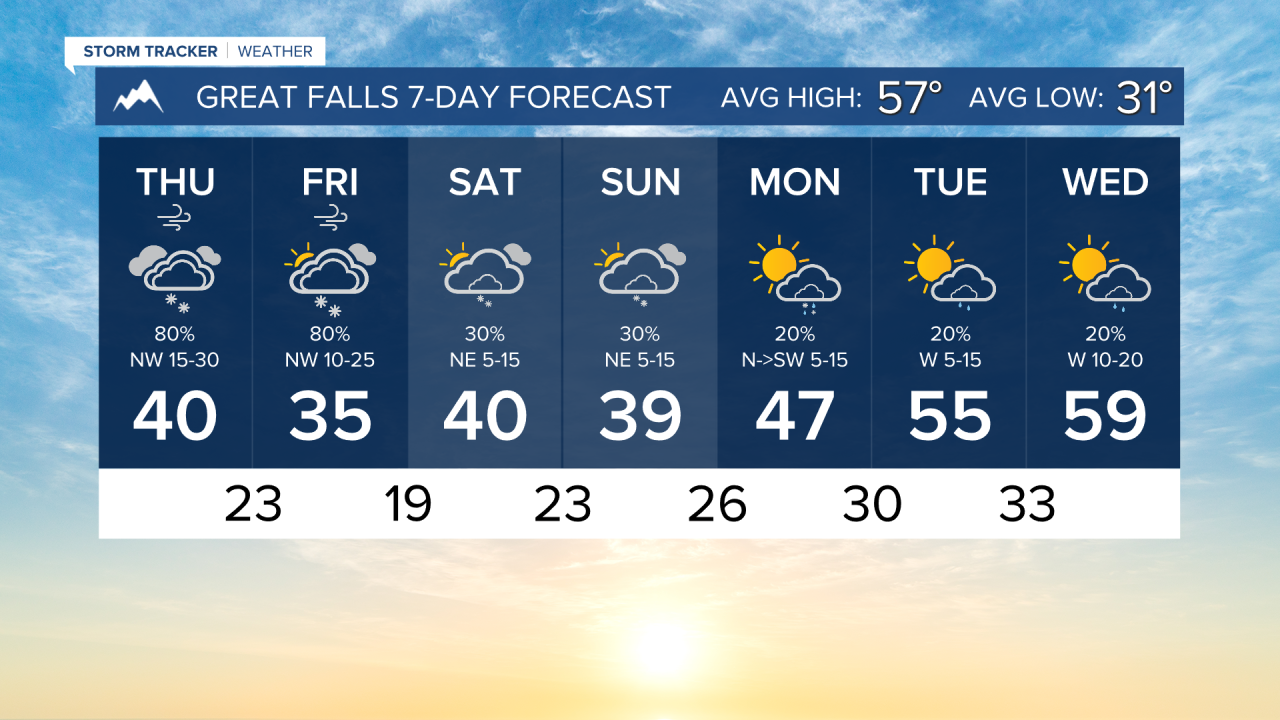
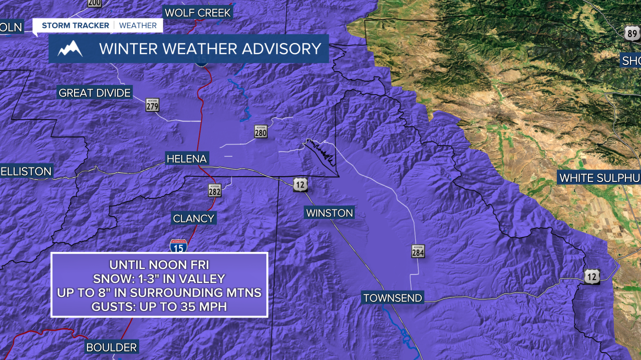
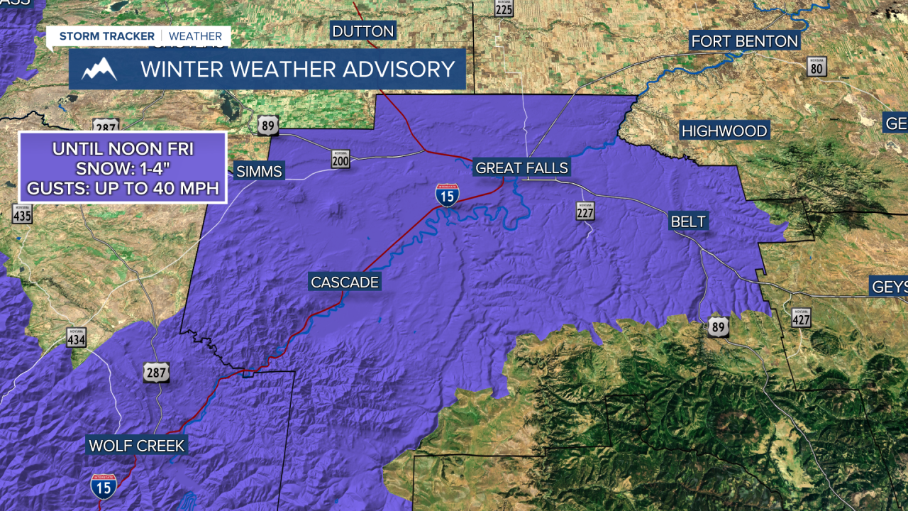
Heavier snow is also falling near the north side of the Big Belt and Little Belt Mountains. North winds are upsloping on the ranges, allowing locally heavier precipitation near Wolf Creek, Cascade, Belt, and Geyser.
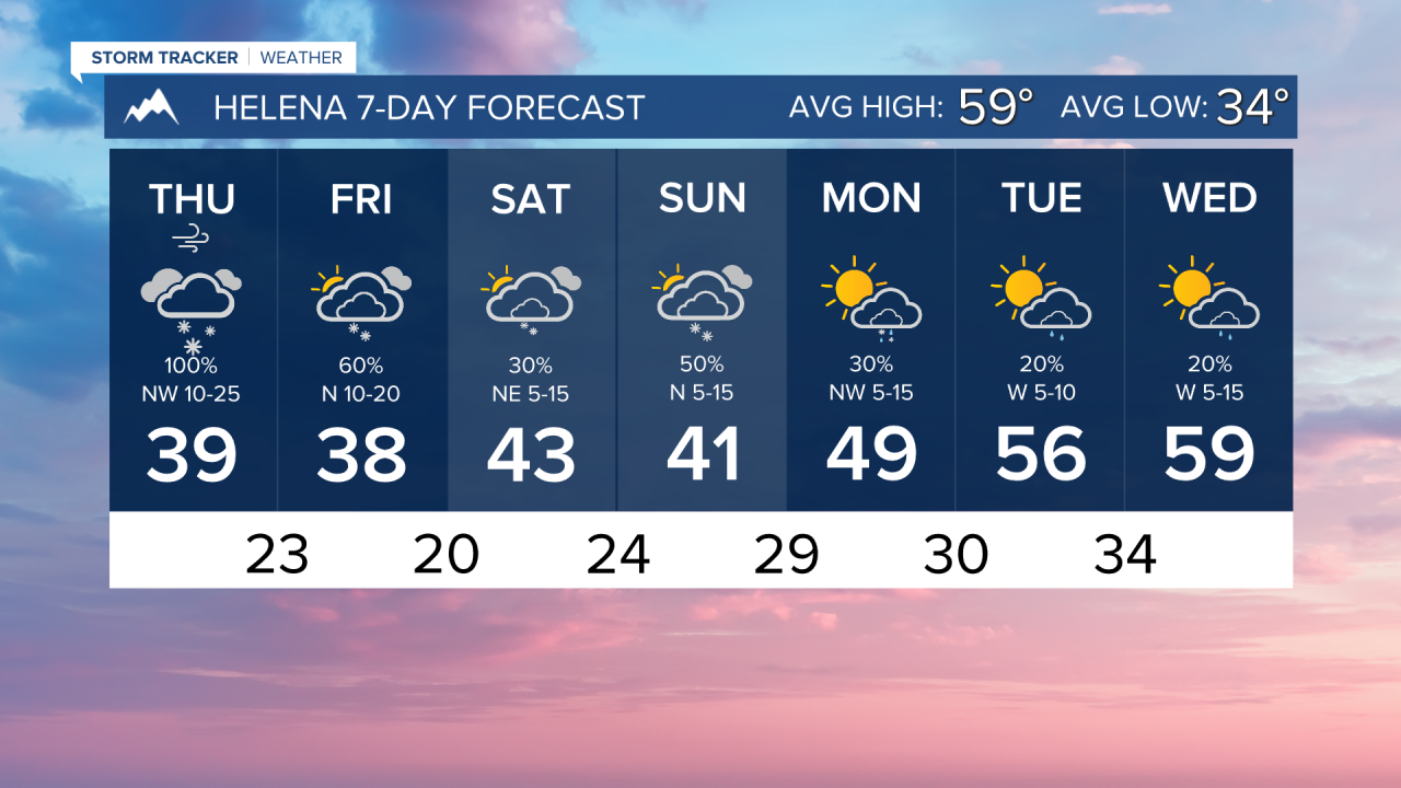
Rain briefly converted to snow in Helena this morning. After a dry period, by around 9 AM, snow will start to fall for most of the day.
High temperatures will only reach the 30s and 40s, a significant cool-down compared to earlier in the week.
Wind will be very gusty through the northern plains. Gusts up to 65 MPH are possible today. Great Falls will gust near 40 MPH at times. Helena will gust up to around 35 MPH. Sustained winds will be out of the northwest at 10-25 MPH.
FRIDAY, APRIL 24TH: The storm system will backtrack a bit on Friday in a stalling atmospheric pattern. This will allow numerous snow showers to form over a majority of Montana, especially in the afternoon.
Additional light snow accumulation in the lower elevations is possible throughout the day, creating slick roads. A few showers may produce quick bursts of heavy snow.
Morning lows will be in the 20s, and high temperatures will only reach the 30s.
SATURDAY, APRIL 25TH: Morning temperatures will be cold, in the teens and 20s. Afternoon temperatures will warm into the upper 30s to low 40s. Isolated snow showers will develop over the mountains. Expect partly to mostly cloudy skies with light winds out of the north from 5 to 15 MPH.
SUNDAY, APRIL 26TH: Another weak disturbance will come through southwest Montana on Sunday. Scattered snow showers will form in the mountains and some of the valleys, including Helena. Accumulation will be light, and major impacts are not expected.
Morning lows will be in the 20s, and afternoon temperatures will only warm into the 30s and 40s.
——————————————————————————————————————————
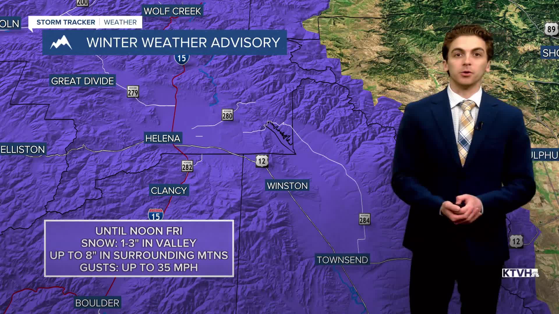
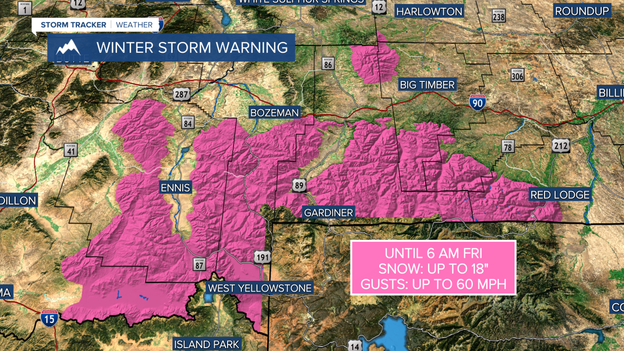
WEATHER ALERTS:


——————————————————————————————————————————
Helena Temperature Records Today:
High: 83 (2012)
Low: 14 (1931)
AVG: 59/34
Great Falls Temperature Records Today:
High: 84 (2012)
Low: 16 (1931)
AVG: 57/31