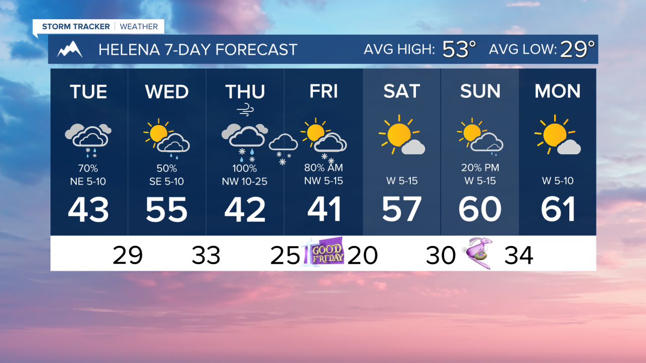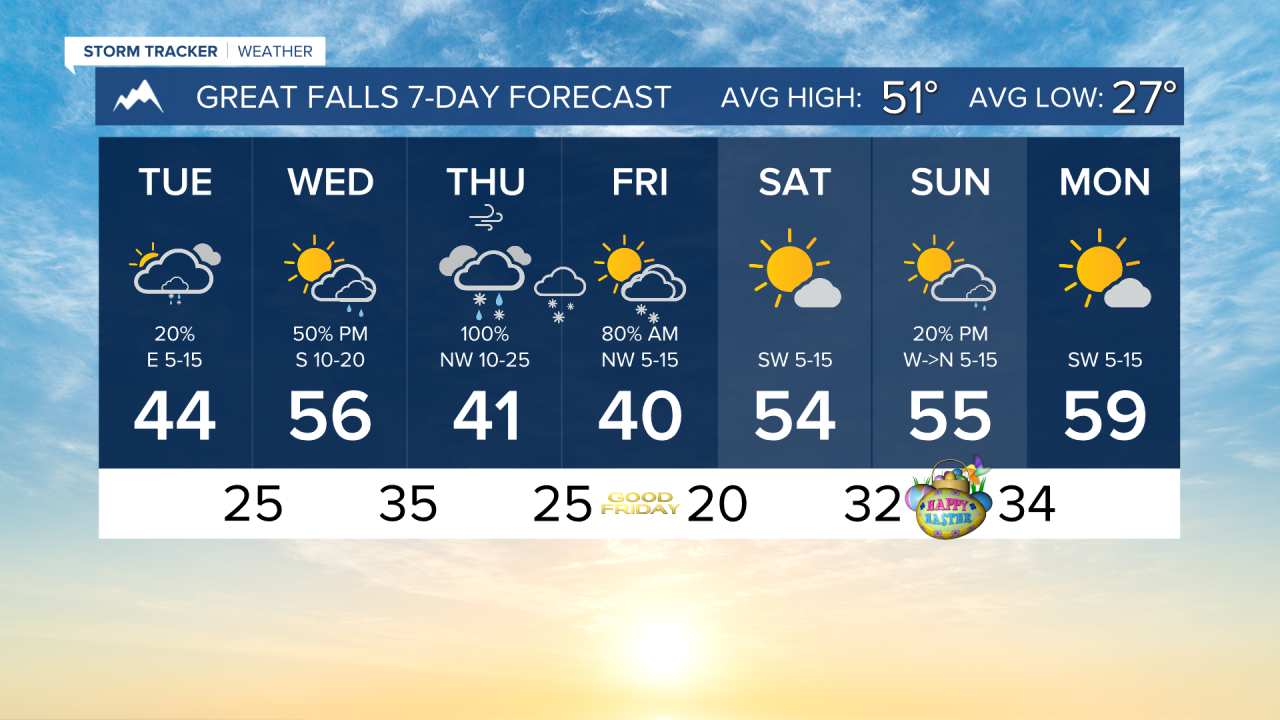


TUESDAY, MARCH 31ST: Scattered snow showers move into the Helena area around mid-morning. Showers will convert to rain by the afternoon. Highs reach the low to mid-40s today under cloudy skies. Snow impacts should stay low today, with only light accumulation in the mountains.
WEDNESDAY, APRIL 1ST: Morning lows will be in the 20s and low 30s. Highs reach the 50s under partly to mostly cloudy skies. Rain showers and even a thunderstorm or two will move in on Wednesday evening ahead of a low-pressure system. We will see a conversion to snow in the higher terrain by Wednesday night, with snow levels dropping progressively lower through the evening.
THURSDAY, APRIL 2ND: The way this low is tracking in current model runs, it is in a favorable position to bring lower elevation snow to the state. Highs will only reach the 30s and 40s. Precipitation will be around the area for most of the day. Lower elevations may see a rain-snow mix at the start of the day, but by the afternoon, we should see the transition to mostly snow. There will be some wind with this system as well, with gusts reaching about 30 MPH.
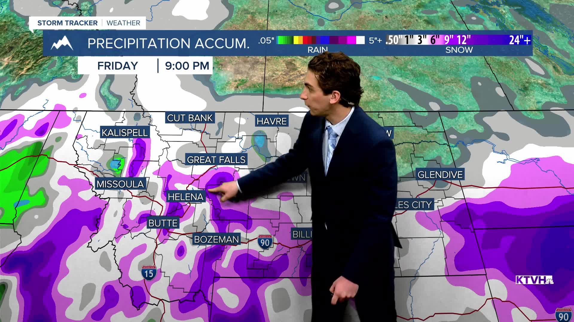
GOOD FRIDAY: Moderate to heavy snow continues through the morning, moving out of the area by the morning. Isolated mountain snow showers will remain in the afternoon. Highs will only reach the 30s and 40s. It will be cloudy to begin the morning, clearing to partly cloudy conditions in the afternoon.
LONG-RANGE FORECAST: Easter Weekend will be drier and warmer. Lows dip to the 20s and 30s. Highs will reach the 50s and low 60s with sunshine.
——————————————————————————————————————————
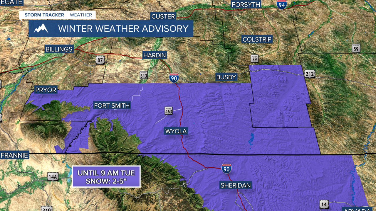
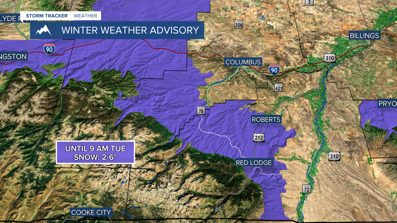
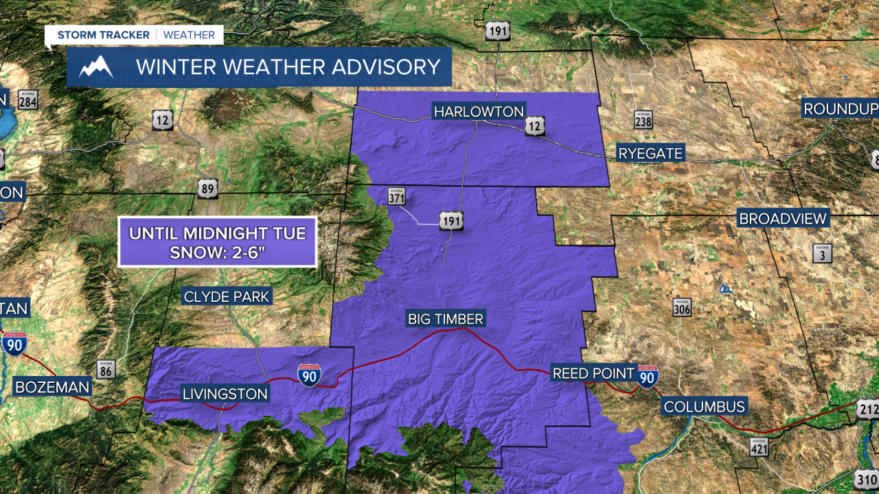
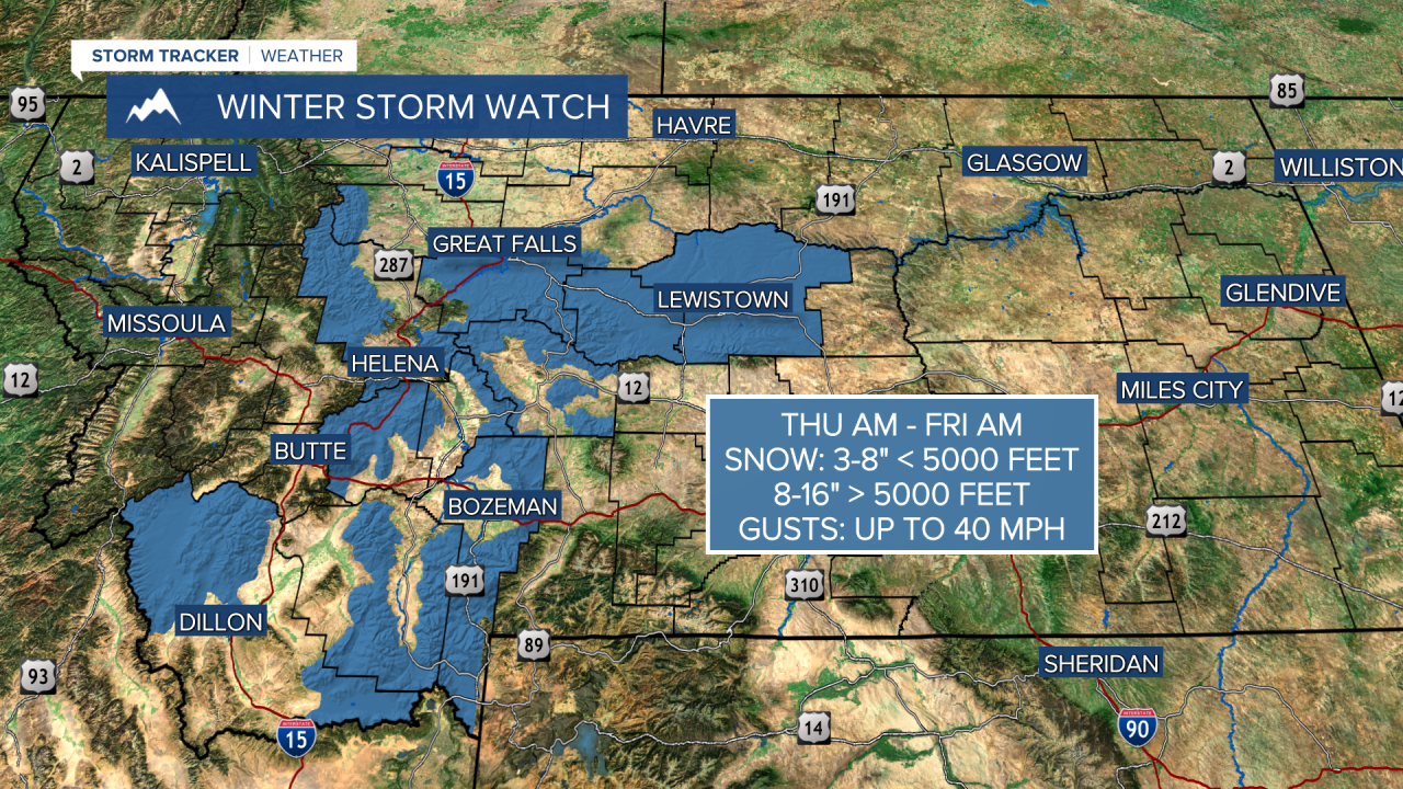
WEATHER ALERTS:
——————————————————————————————————————————
Helena Temperature Records Today:
High: 75 (2015)
Low: -3 (1935)
AVG: 53/29
Great Falls Temperature Records Today:
High: 76 (2015)
Low: -5 (1935)
AVG: 51/27