


WEDNESDAY, APRIL 1ST: Partly cloudy skies and a weak southerly flow will allow afternoon highs to reach the 50s under partly to mostly cloudy skies. Rain showers and even a thunderstorm or two will move into the area in the afternoon and evening ahead of a low-pressure system. We will see a conversion to snow in the higher terrain by tonight, with snow levels dropping progressively lower through the evening.
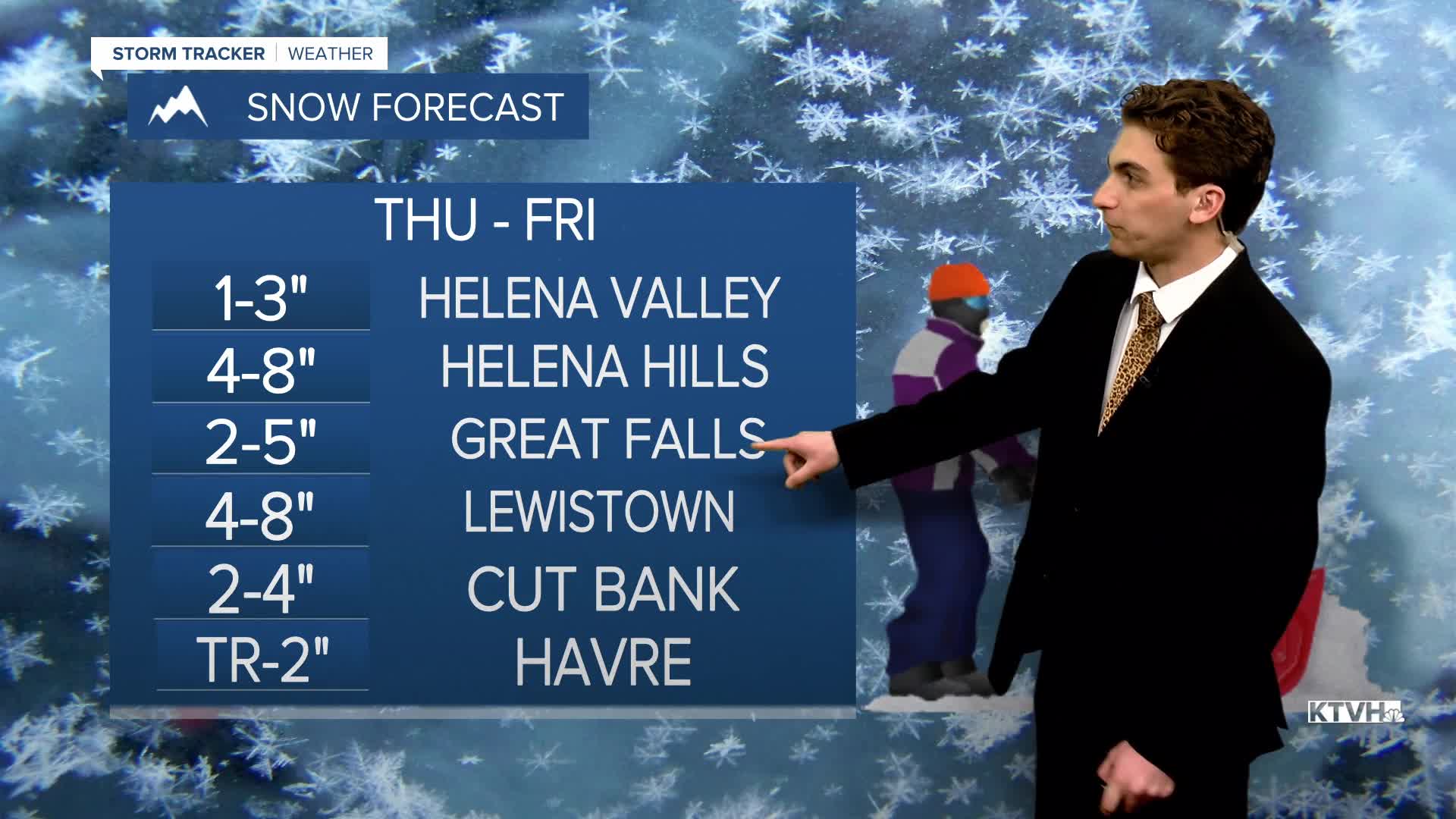
THURSDAY, APRIL 2ND: The way this low is tracking in current model runs, it is in a favorable position to bring lower elevation snow to the state. Highs will only reach the 30s and 40s. On and off precipitation will be around the area for most of the day. Lower elevations will likely see rain through most of the day, but by the late afternoon, we should see the transition to mostly snow. There will be some wind with this system as well, with gusts reaching about 35 MPH.
GOOD FRIDAY: Moderate to heavy snow continues through the morning, moving out of the area by the afternoon. It will be cloudy to begin the morning, clearing to partly cloudy conditions in the afternoon. Highs will only reach the 40s.
SATURDAY, APRIL 4TH: The state will be dry and warmer to begin the holiday weekend. The morning will start on a chilly note with temperatures in the 20s, but quickly warm up into the 50s and low 60s. Expect mostly sunny skies
LONG-RANGE FORECAST: A minor boundary bringing isolated showers and slightly cooler temperatures for north central Montana moves in on Easter Sunday and Monday, but no major impacts to travel are expetced and most areas will stay dry.
——————————————————————————————————————————
WEATHER ALERTS:


——————————————————————————————————————————
Helena Temperature Records Today:
High: 75 (1966)
Low: -10 (1936)
AVG: 53/29
Great Falls Temperature Records Today:
High: 71 (2021)
Low: -5 (1936)
AVG: 51/27


