


Clouds will be moving out of our area today with highs in the 50s. Although the weather will be nicer this afternoon, a cold front is expected to move in tomorrow night, bringing light rain and snow.
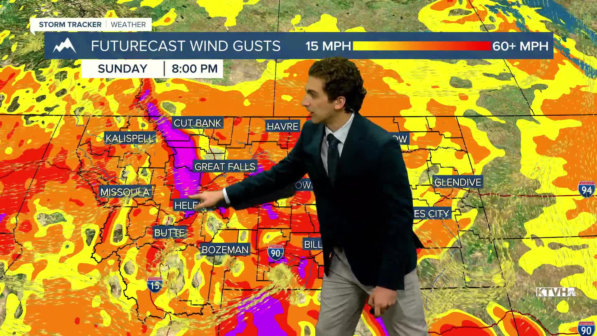
The wind will also pick up beginning this afternoon in north-central Montana. It will be particularly gusty on Friday and Sunday. Gusts exceeding 50 MPH are possible near the Rocky Mountain Front.
A Pacific cold front coming through the state is trending a bit earlier than past forecasts. This brings it in on Sunday afternoon. Rain showers will be common around southwest Montana, but limited near Helena and the north-central plains due to the wind activity.
A few snow showers will form in the mountains to begin next week, and breezy conditions continue until about Wednesday.
——————————————————————————————————————————
WEATHER ALERTS:
NONE
——————————————————————————————————————————
Helena Temperature Records Today:
High: 80 (1991)
Low: 12 (1946)
AVG: 58/33
Great Falls Temperature Records Today:
High: 85 (1914)
Low: 14 (1930)
AVG: 57/33


