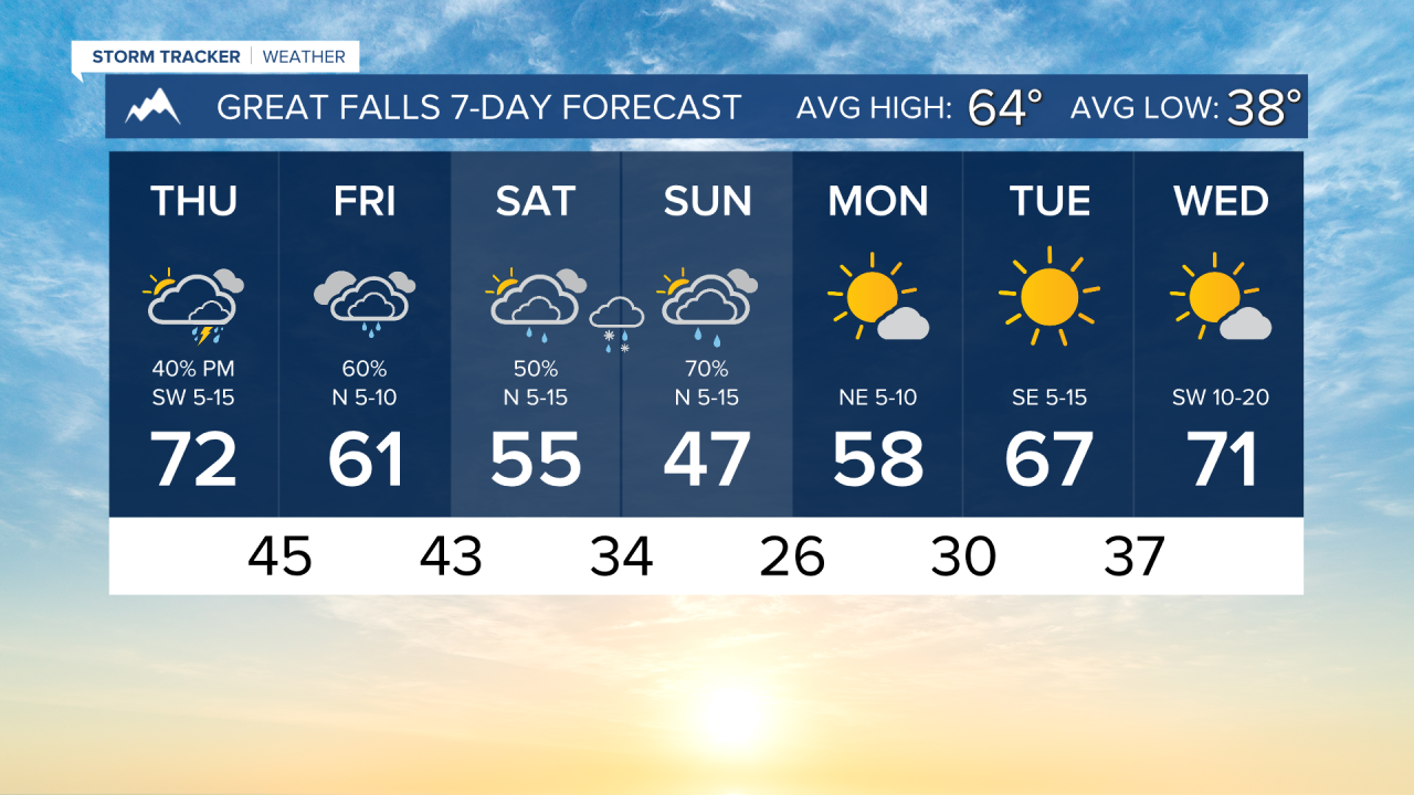


Temperatures continue to cool while rain moves into the area today. Snow will begin to fall in the mountains this weekend, with even a few snowflakes possible in the valleys and plains.
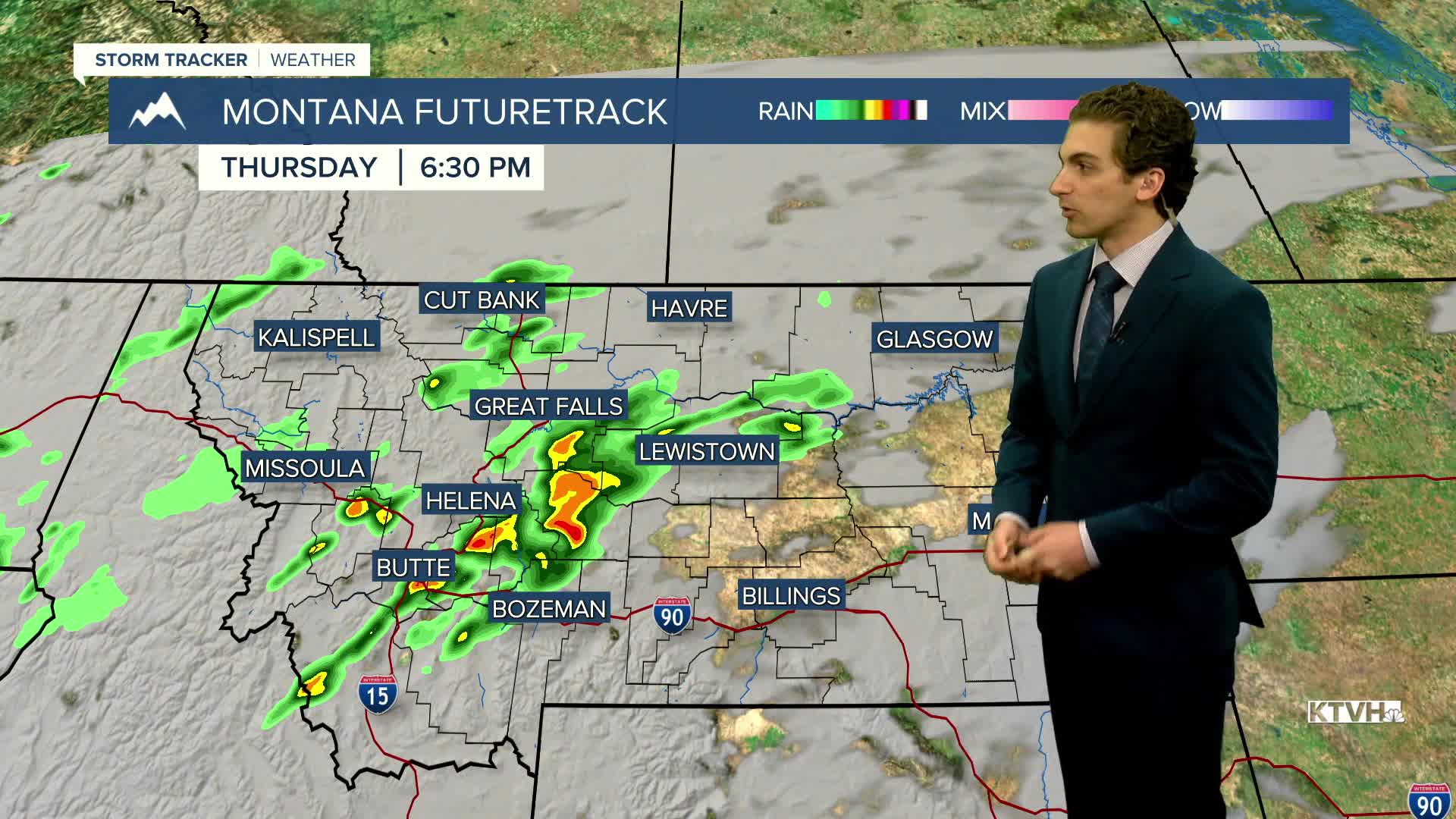
Cloud cover increases this afternoon with a few rain showers and thunderstorms around. Highs will reach the 60s and 70s.
A line of steady rain develops tonight into tomorrow across southwest and north-central Montana. Afternoon temperatures will decrease into the 50s and low 60s.
A cold front from the north will move through the state Saturday afternoon and evening. This will lower snow levels and allow for some accumulation in the mountains. The freezing point lowers to about 5-6k feet by Sunday morning, allowing for snow at mountain passes. Some flakes may fly in lower elevations as well, but accumulation is unlikely.
The first freeze for many lower elevations will come on Monday morning behind the storm system. Clear skies will allow for cooler morning temperatures next week.
——————————————————————————————————————————
WEATHER ALERTS:
NONE
——————————————————————————————————————————
Helena Temperature Records Today:
High: 85 (1992)
Low: 19 (1950)
AVG: 65/39
Great Falls Temperature Records Today:
High: 86 (1943)
Low: 17 (2019)
AVG: 64/38