We are in store for yet another day of potential severe weather across western and central Montana.
Storms will begin to pop over southwest Montana and the Rocky Mountain Front at around 2-3 PM. There are two main differences compared to yesterday. We are expecting overall more storm coverage today, and storms will generally move northward instead of northeastward.
In the strongest storms, wind gusts could reach around 60 MPH and hail could reach 1 to 1.5 inches in diameter. Be sure to head indoors if a warning is issued for your area.
Thunderstorm activity will diminish overnight, aside from isolated activity over northwest Montana.
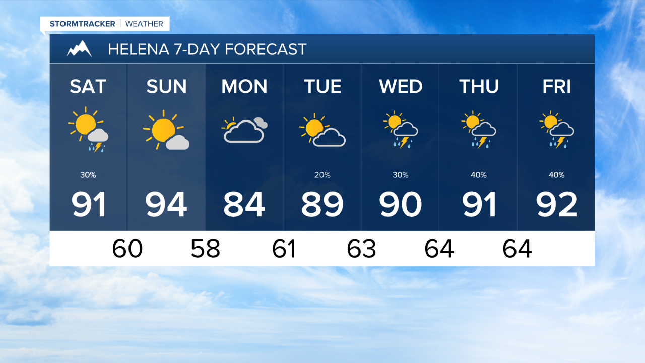
Saturday will feature more thunderstorms, a few of which could be on the stronger side once again. However, I think most of western Montana should be on the drier side. I exepct to see a few storms pop over the Bitterroot and Sapphire Mountains in the afternoon. The Helena and Great Falls areas have a better chance at seeing those storms come through in the afternoon.
It will be a hot weekend, with temperatures in the 90s for most areas.
The wind will pick up on Sunday, gusting to around 20-30 MPH in the afternoon. The fire danger may increase during this period. With winds coming out of the west, wildfire smoke is expected to blow in form fires burning in Washington, Idaho, and Oregon.
Thunderstorms will return towards the middle and end of next week.
——————————————————————————————————————————
MONTANA WEATHER ALERTS:


——————————————————————————————————————————