


A stormy weather pattern continues into at least Tuesday morning before drier and warmer weather returns for the rest of the week.
There will be a few showers and thunderstorms this afternoon with partly to mostly cloudy skies. Highs will only reach the 60s and 70s in western Montana. There will be a round of heavier rain moving through north-central Montana overnight, reaching the Helena area by tomorrow morning.
Stormy conditions slide east tomorrow. Decreasing cloud cover is expected throughout the day in western Montana. A stray shower cannot be ruled out. Highs will still only reach the 60s and 70s.
The storm system producing all of the inclement weather will be out of our area by Wednesday, allowing temperatures to warm into the 70s and 80s by the end of the week. Drier and mostly sunny conditions are expected.
There will be some wind moving in with the next round of active weather over the weekend and into early next week.
——————————————————————————————————————————
WEATHER ALERTS:
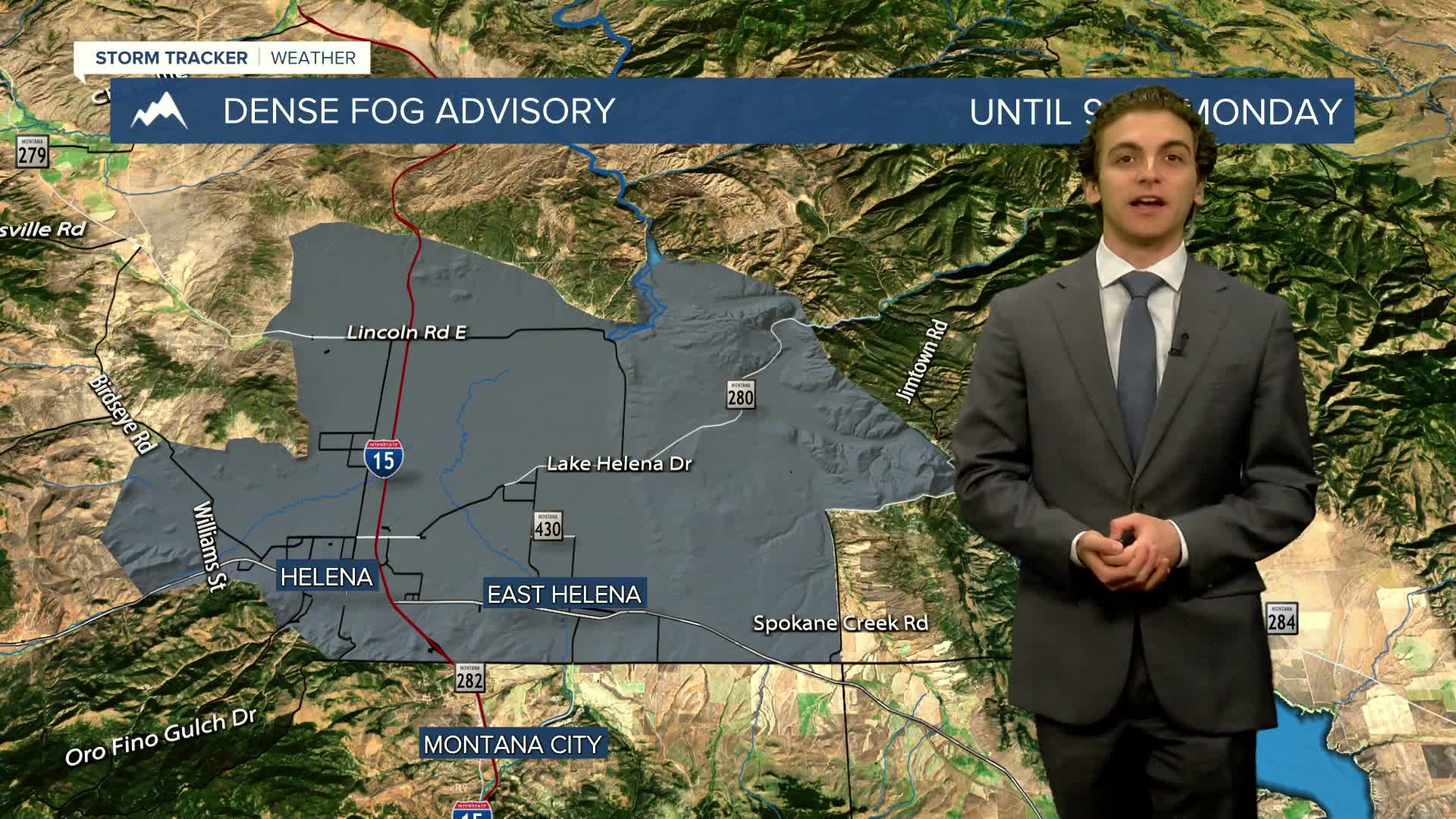
A DENSE FOG ADVISORY continues for the Helena Valley until 9 AM Monday
A DENSE FOG ADVISORY continues for Sheridan County until 9 AM Monday
——————————————————————————————————————————
Helena Temperature Records Today:
High: 94 (2000)
Low: 22 (1970)
AVG: 74/45
Great Falls Temperature Records Today:
High: 95 (2000)
Low: 29 (1982)
AVG: 72/43


