Happy Fourth! It will be a stormy day across the Treasure State. Highs will range from the low 70s to upper 80s statewide, getting warmer the further east you head. A strong low-pressure system will bring rounds of showers and thunderstorms to western Montana over the course of the afternoon and evening.

Some areas will be affected by rain after dark, which may cause some fireworks shows to be in jeopardy. Luckily, near Helena, it looks like the bulk of the moisture will be through before 10 PM.
The center of low makes its way into the north-central plains by early tomorrow morning, then changes direction and heads eastward through the day. This will trigger some severe storms in eastern Montana. Make sure you stay weather aware!
Highs will be cooler in western Montana, with some communities not getting out of the 60s. It will be a little warmer where the active weather is, with highs reaching the 70s and 80s.

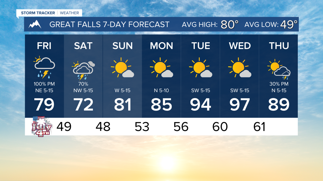
Sunday will be a much nicer day with mostly sunny skies returning and drying conditions. only a few showers will be present up on the Hi-Line. Temperatures warm into the 70s and 80s statewide.
Next week is looking hot and dry once again. Highs could reach the upper 90s to triple digits across Big Sky County on Tuesday and Wednesday.
——————————————————————————————————————————
WEATHER ALERTS:
NONE
——————————————————————————————————————————
Helena Temperature Records Today:
High: 99 (2015)
Low: 36 (1971)
AVG: 82/53
Great Falls Temperature Records Today:
High: 101 (1937)
Low: 35 (1915)
AVG: 80/49
Have a great holiday weekend!
Joey Biancone
Meteorologist