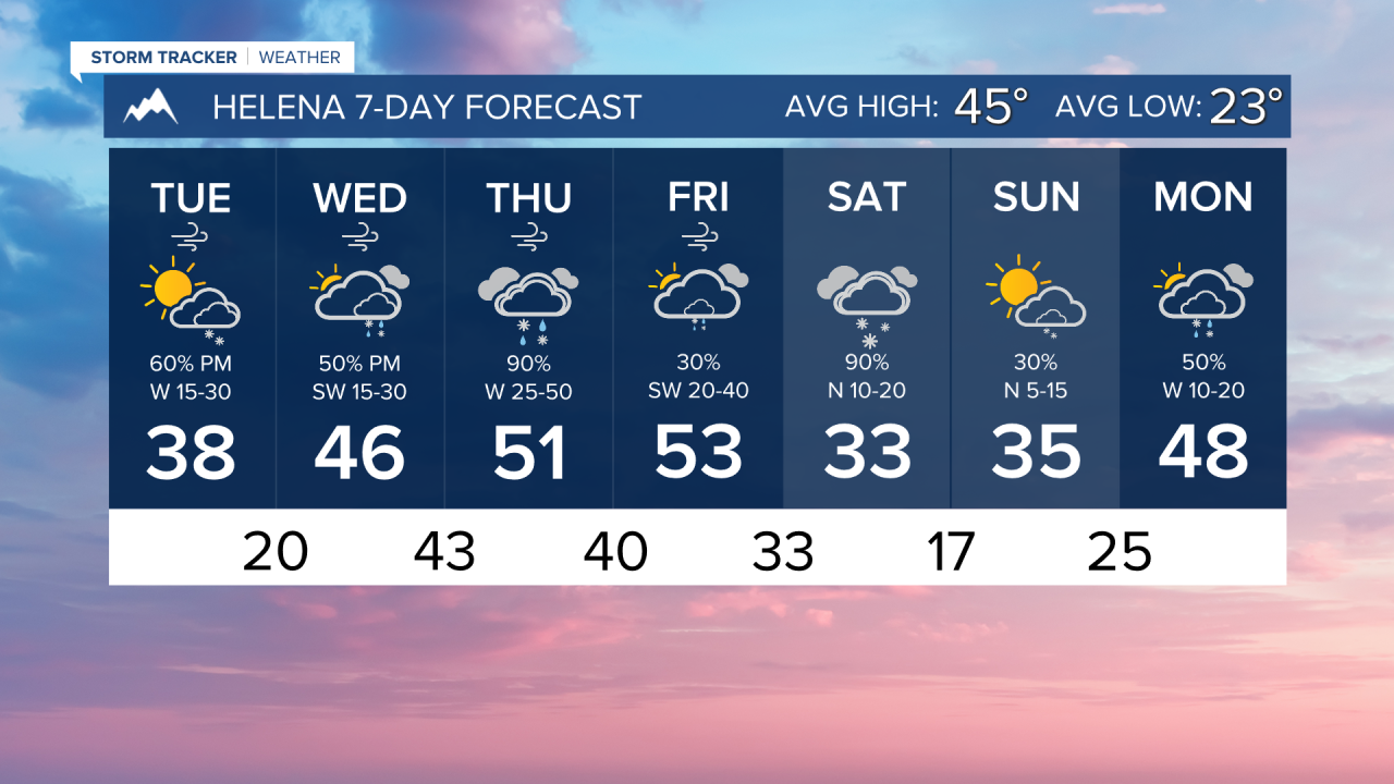


TUESDAY, MARCH 10TH: Wind continues to blow relatively strongly on Tuesday afternoon, with gusts ranging from 20-40 MPH.
Scattered afternoon snow showers will pop up for most of the state with a little instability. These showers will not amount to much accumulation, but they could cause a quick drop in visibility.
Highs only reach the 30s for most areas.
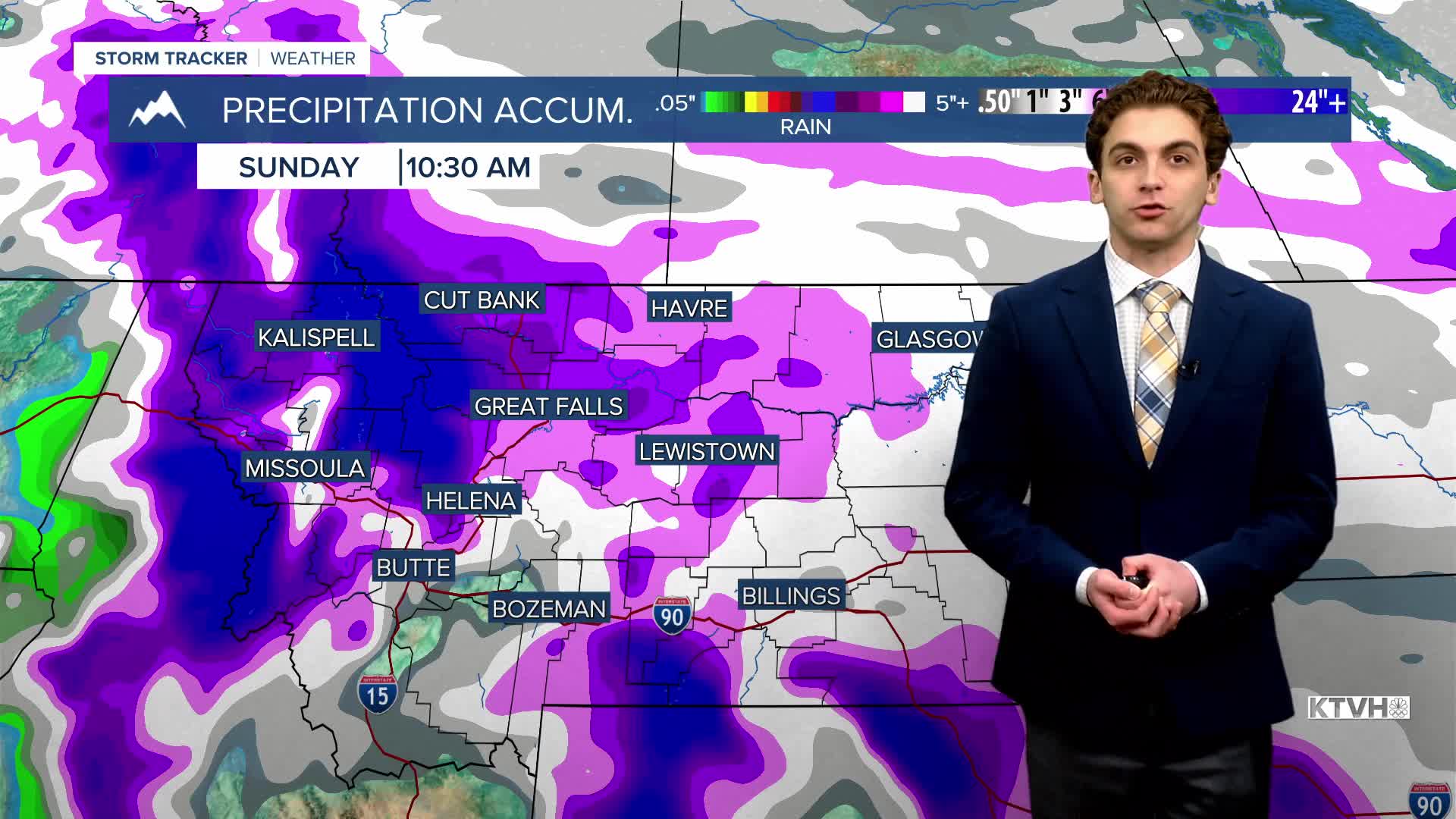
WEDNESDAY, MARCH 11TH: Most of the precipitation stays on and west of the Continental Divide during the day, but by Wednesday night, a plume of moisture moves over central Montana.
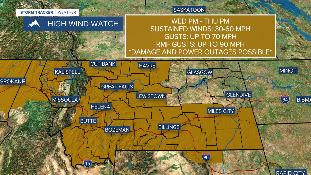
Even more gusty winds will pick up on Wednesday night as well. Gusts will be reaching 40-60 MPH.
Highs will reach the 40s and low 50s for most areas.
THURSDAY, MARCH 12TH: We are expecting another high wind event. Wind gusts will range from 60 to 80 MPH for lower elevations, with locally higher gusts possible. With the recent stresses on trees and infrastructure from Sunday's wind, more power outages and damage are possible.
Rain and snow will fall, especially in the mountains where feet of snow are expected. Lower elevations will see a rain/snow mix at times. This is not going to be a day when you'll want to be outdoors.
Highs reach the upper 40s and 50s.
FRIDAY, MARCH 13TH: A Canadian front will begin to make its way into north-central Montana. This will bring snow down to the lower elevations. This front will stall around the Great Falls area. Highs will be in the 40s and 50s south of Great Falls, and the 20s and 30s to the north.
LONG-RANGE FORECAST: Overcast skies with rain and snow are expected through the weekend. Blizzard-like conditions could persist in the higher terrain through Saturday. Lower elevation snow will fall as the cold front moves southward. Winds will begin to relax on Saturday for most areas.
——————————————————————————————————————————
WEATHER ALERTS:


——————————————————————————————————————————
Helena Temperature Records Today:
High: 70 (1983)
Low: -24 (1951)
AVG: 45/23
Great Falls Temperature Records Today:
High: 69 (1983)
Low: -32 (1932)
AVG: 44/20