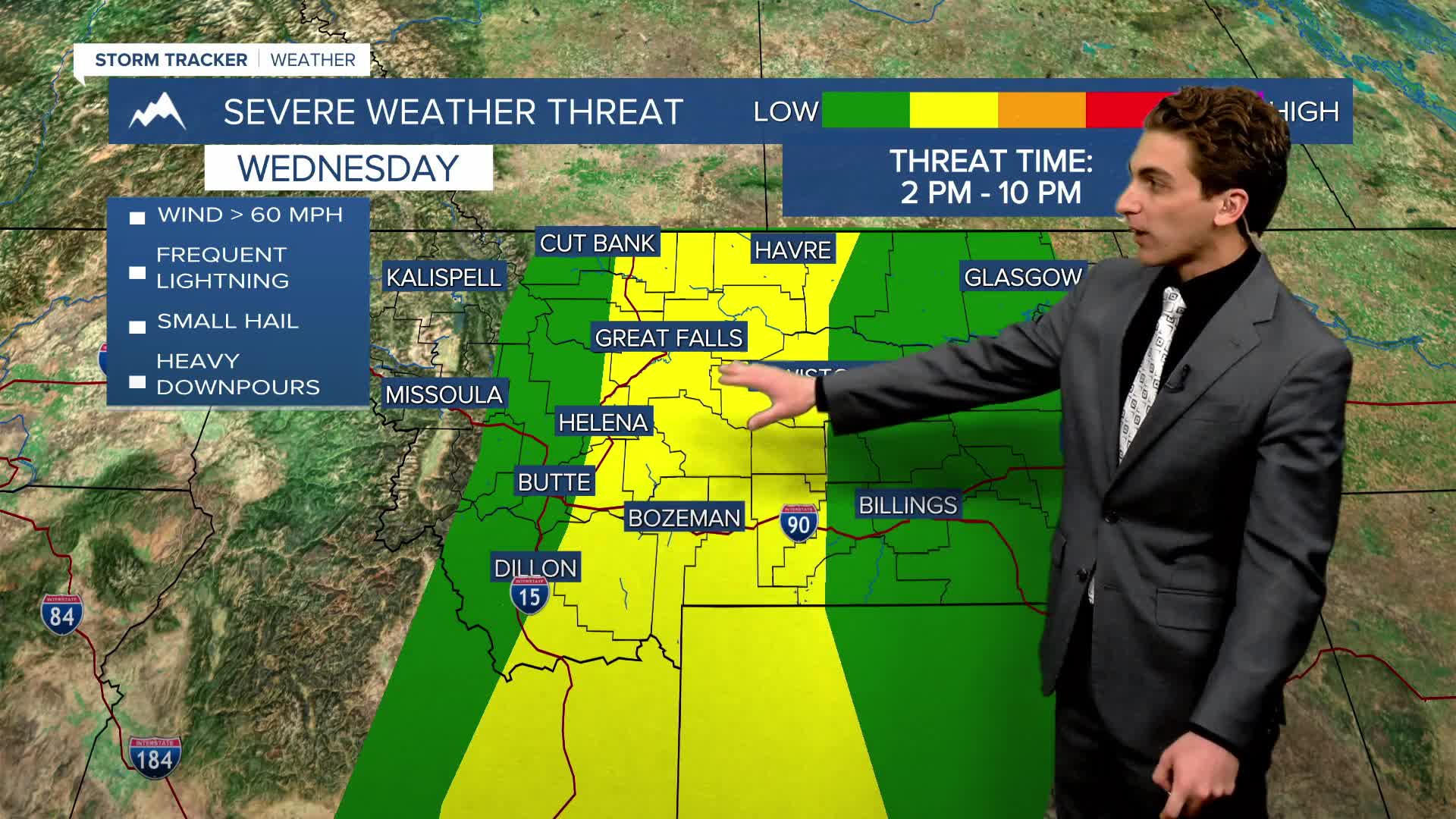


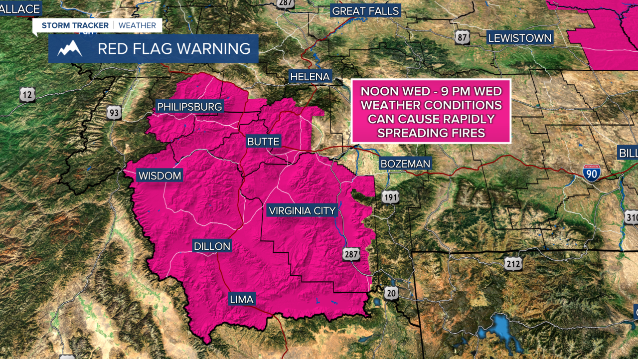
WEDNESDAY, MAY 13TH: A strong storm system moves into the state today, initially bringing strong winds and thunderstorms to southwest Montana in the early afternoon. This will increase the fire danger in the area with the likelihood of lightning strikes, low relative humidity, and gusty winds.
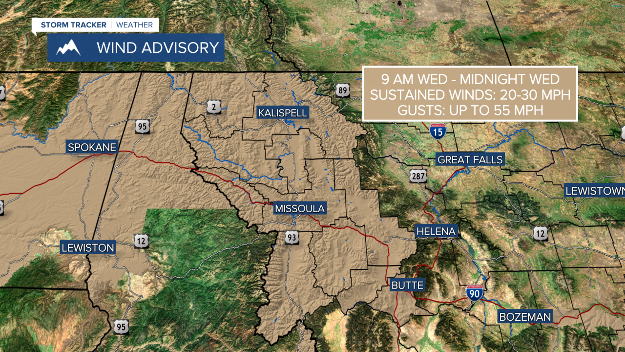
Fire danger is also at critical levels in northwestern Montana and parts of the Hi-Line, where dry air, gusty winds, and a few thunderstorms will create conditions for rapidly spreading wildfires.
Storms will move northeastward through the rest of the afternoon and evening, making it to Helena around 2 to 3 PM. Thunderstorms will be capable of producing gusty winds in excess of 60 MPH and small hail, generally less than 1 inch in diameter. Brief, heavy downpours are also possible with some of the more robust thunderstorms.
High temperatures will reach the 80s in the Helena and Great Falls areas today, while some locations in the eastern plains will record afternoon temperatures in the 90s.
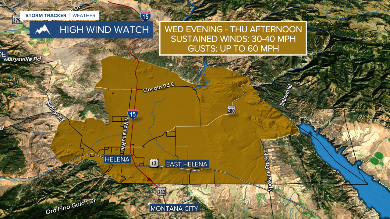
While thunderstorms will produce gusty downwind winds at the local level, a more synoptic (larger) scale wind event develops tonight across the Helena area and north-central Montana. Pressure is falling near the surface, and a powerful mid-level jet moves over the region. This will cause winds to be consistently gusty overnight. Gusts could be approaching 60 MPH at times.
THURSDAY, MAY 14TH: Strong wind gusts continue into Thursday morning, with wind gusts across north-central and eastern Montana with gusts approaching 60-70 MPH. The Helena area will gust up to 60 MPH. The Rocky Mountain Front could record gusts near 90 MPH. This will create dangerous travel conditions, especially for high-profile vehicles. High Wind Warnings have been issued for most areas east of the Continental Divide.
Aside from a bit of rain near the Hi-Line in the morning and some lingering showers on the Divide, Thursday will be mostly dry with clearing skies by the afternoon.
High temperatures will be significantly cooler than on Wednesday. Afternoon temperatures reach the 60s for most areas.
FRIDAY, MAY 15TH: The wind will not be as strong as Thursday, but wind gusts will still be approaching 30-40 MPH in the afternoon. Morning lows will dip to the upper 30s and low 40s. Afternoon highs will reach the upper 60s to low 70s. A few showers and a thunderstorm or two may pop up on and west of the Continental Divide, but most areas stay dry.
SATURDAY, MAY 16TH: Another storm system comes through the state for the weekend. This will bring high elevation snow and low elevation scattered light rain, and perhaps a thunderstorm or two. Highs will only reach the upper 50s and low 60s. Winds will continue to gust between 30 and 40 MPH.
LONG-TERM FORECAST: An overall unsettled pattern will continue next week, with more chances for rain, high elevation snow, and thunderstorms.
——————————————————————————————————————————
WEATHER ALERTS:


————————————————————————————————————————
Helena Temperature Records Today:
High: 89 (2001)
Low: 23 (1983)
AVG: 66/41
Great Falls Temperature Records Today:
High: 89 (1931)
Low: 20 (2004)
AVG: 64/37


