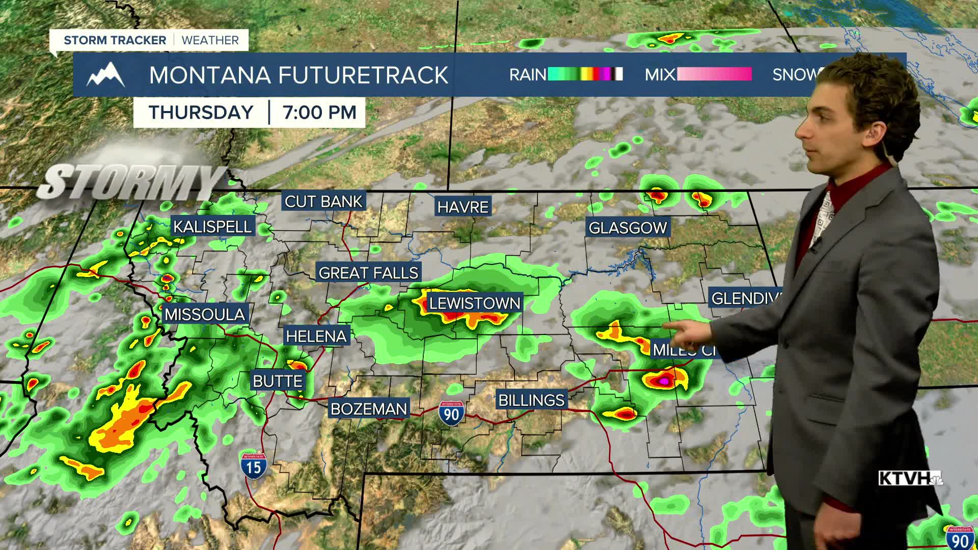


There is the potential for some stronger thunderstorms across Montana today as a center of low pressure enters the state.
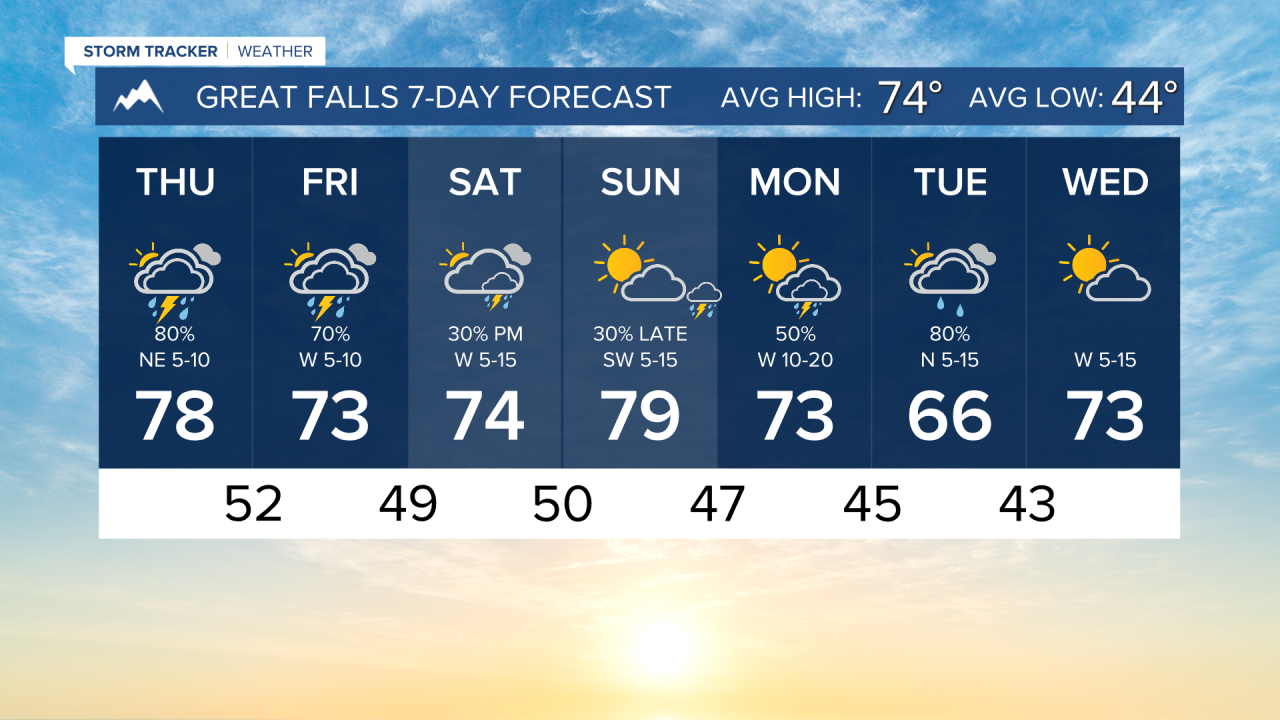
Stormy conditions have already begun in parts of the state this morning. There will be more thunderstorms for the majority of us by this afternoon. Highs only reach the 70s and low 80s today as storms and cloud cover roll in.
There is a severe weather risk in eastern Montana. The main threats will be gusty winds and large hail.
Storms will continue into the overnight. Mostly cloudy conditions and stormy weather stick around tomorrow. Highs will be relatively cool in the 70s for most.
The weekend is trending a bit drier in western Montana, but wet weather sticks around through about midday Sunday in the eastern plains.
Another storm system comes into the state towards the beggining and middle of next week which gives us another chance for wetter weather.
——————————————————————————————————————————
WEATHER ALERTS:
NONE
——————————————————————————————————————————
Helena Temperature Records Today:
High: 92 (1958)
Low: 27 (1890)
AVG: 75/46
Great Falls Temperature Records Today:
High: 93 (1919)
Low: 29 (1989)
AVG: 74/44
Have a great Thursday!
Joey Biancone
Meteorologist