


A LAKE WIND ADVISORY has been issued for Fort Peck Lake from 11 AM Wednesday through 9 PM Thursday.
——————————————————————————————————————————
Strong thunderstorms are ongoing across western Montana right now into tonight. The severe threat shifts to the east tomorrow with an upgraded outlook from the Storm Prediction Center.
Extremely warm surface temperatures combined with a moist southwest flow gave way to numerous thunderstorms forming ahead of a cold front today. They will last throughout the nighttime hours. A few of the storms could turn severe.

We are in a 1/5 (marginal) risk for severe weather though the rest of this afternoon and this evening for major cities like Helena, Great Falls, Missoula, Butte, Bozeman and Kalispell. The greatest risk is damaging wind and frequent lightning. Small hail is also possible.
Tomorrow morning we will see moderate to heavy rain showers push through the capital between 7-9AM. A few lightning strikes are possible. The severe threat shifts to the east tomorrow, where areas along the intimidate Montana/Dakotas borders were upgraded to a level 2/5 (slight) risk for severe weather. This will include the same risks as today, with the addition of larger hail potential.

Temperatures will be much more mild behind the cold front. Most locations will be in the 50s and 60s through Thursday.
Flash flooding is also a concern for higher elevations over the next couple of days, as heavy rain combined with snow-melt could lead to localized flooding.
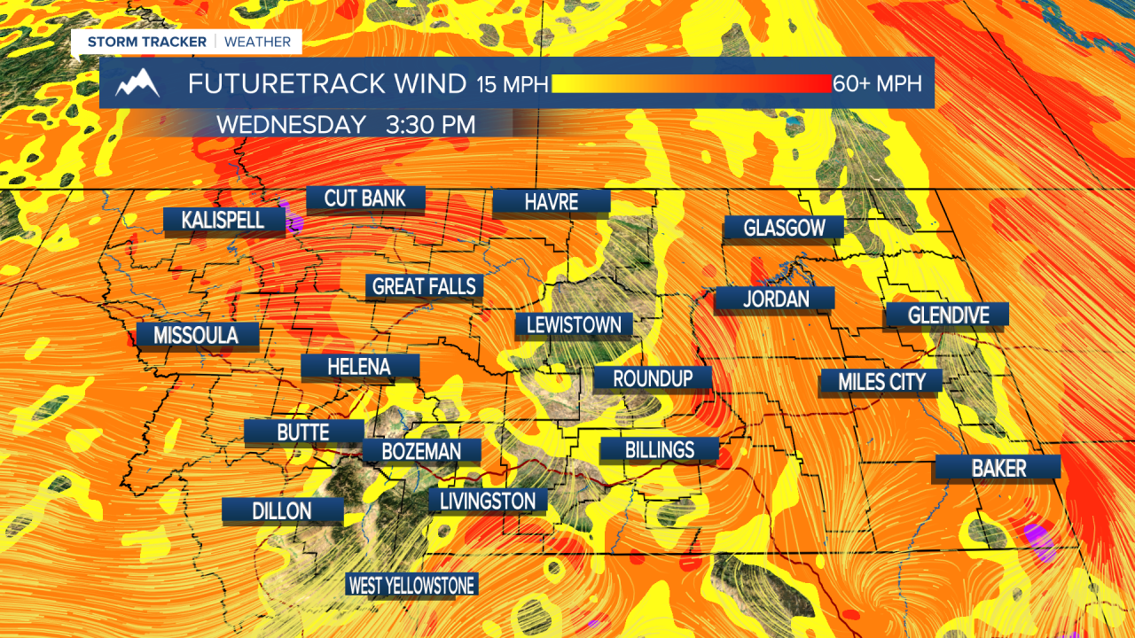
Strong west wind will affect most of the state tomorrow into Thursday. Wind gusts of over 45 MPH are possible for areas adjacent to the mountains.
Aside from some isolated storms in higher elevations, the weekend will be warm and mostly dry for lower elevations. 70s and 80s return next week.
Helena Temperature Records Today:
High: 95 (1919)
Low: 28 (1947)
AVG: 70/45
Great Falls Temperature Records Today:
High: 100 (1919)
Low: 27 (1947)
AVG: 68/42
Stay safe out there.
Joey Biancone
Meteorologist
Facebook: Meteorologist Joey Biancone
Instagram: joeybianconewx
Email: joey.biancone@ktvh.com
