


A weather disturbance will bring gusty winds and isolated showers tonight and tomorrow around Helena and Great Falls, as much above-normal temperatures are expected through the weekend.
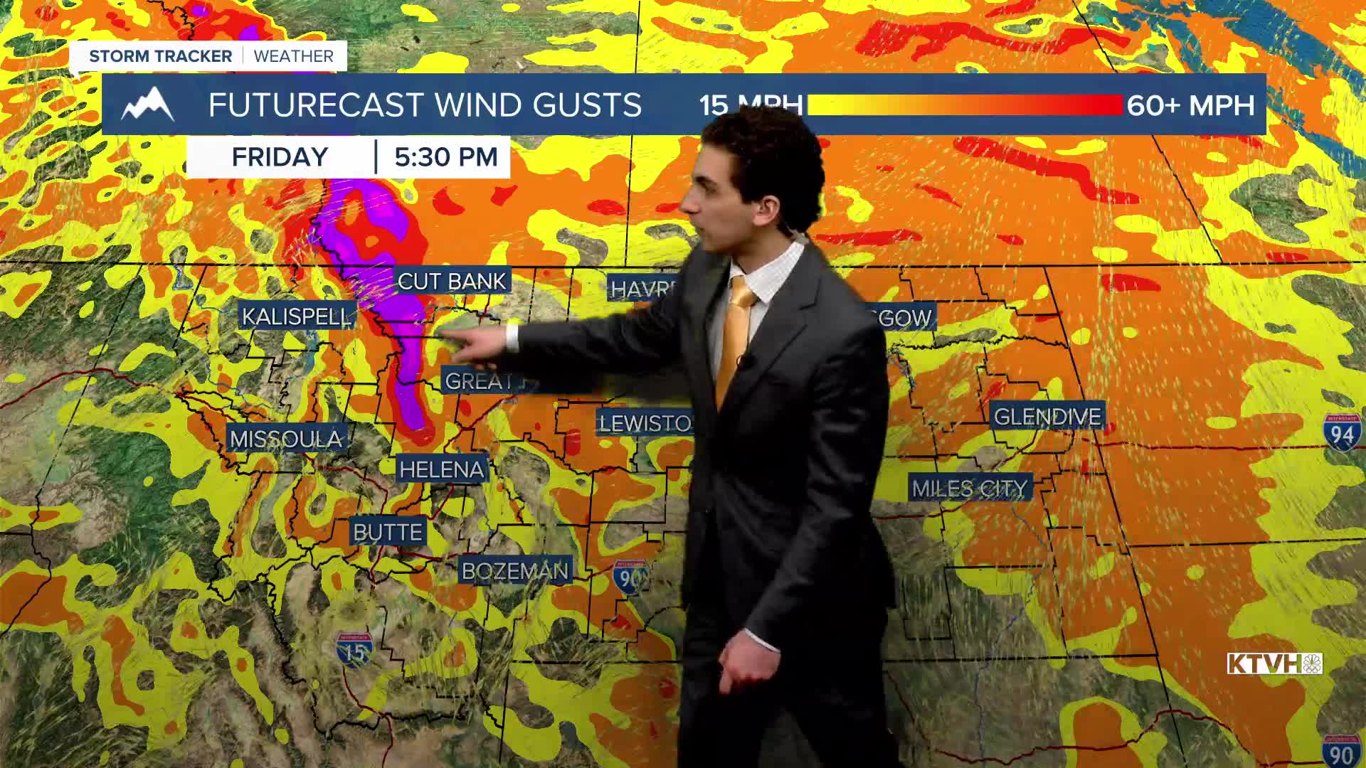
FRIDAY, JANUARY 30TH: Expect a day similar to Thursday near the Helena and Great Falls areas, aside from a little more cloud cover. There will be a little morning fog near the Malta area. Stronger winds will begin to pick up Friday night, gusting to about 80 MPH near the Rocky Mountain Front.
A few rain and snow showers will move through western Montana in the afternoon and evening, with accumulation staying very light to none at all. There could be up to 0.10 inches of ice on the ground in northeast Montana by Saturday morning due to freezing rain.
SATURDAY, JANUARY 31ST: This will be one of the warmest days of the week for many. Above-freezing temperatures spread into eastern Montana with gustier winds in the morning and early afternoon. Highs will reach the 50s to the east of the Continental Divide. It will be a partly to mostly sunny day.
Saturday morning will be the windiest, with gusts approaching 80 MPH along the Rocky Mountain Front. Wind in Helena could gust to around 30-40 MPH.
SUNDAY, FEBRUARY 1ST: Minor inversions will develop in the valleys of western Montana with highs in the 40s, but the plains will still reach the 50s and possibly low 60s with lighter winds.
MONDAY, FEBRUARY 2ND: Stronger winds and isolated light showers will return to the forecast with another weak upper-level disturbance passing through the area. High temperatures will be slightly cooler than the weekend, but still above normal.
——————————————————————————————————————————
WEATHER ALERTS:
A DENSE FOG ADVISORY continues for Central and Southeast Phillips, Garfield, and Northern Phillips Counties until 11 AM Friday
A WIND ADVISORY has been issued for the Beartooth Foothills and Livingston Area from 8 PM Friday through 11 AM Saturday
A WINTER WEATHER ADVISORY has been issued for most of northeast Montana from 8 PM Friday through 2 PM Saturday
A WINTER WEATHER ADVISORY has been issued for Carter, Custer, Fallon, Northern Rosebud, and Powder River Counties from 11 PM Friday through 11 AM Saturday
A HIGH WIND WATCH has been issued for the Rocky Mountain Front and adjacent foothills and plains from Friday evening through Saturday morning
A HIGH WIND WATCH has been issued for Judith Basin County and Judith Gap from Friday evening through Saturday morning
A HIGH WIND WATCH has been issued for Southern Wheatland County, the Melville Foothills, and Northern Sweet Grass County from Friday evening through Saturday afternoon
——————————————————————————————————————————
Helena Temperature Records Today:
High: 56 (1962)
Low: -32 (1916)
AVG: 34/15
Great Falls Temperature Records Today:
High: 62 (2024)
Low: -41 (1916)
AVG: 36/15
