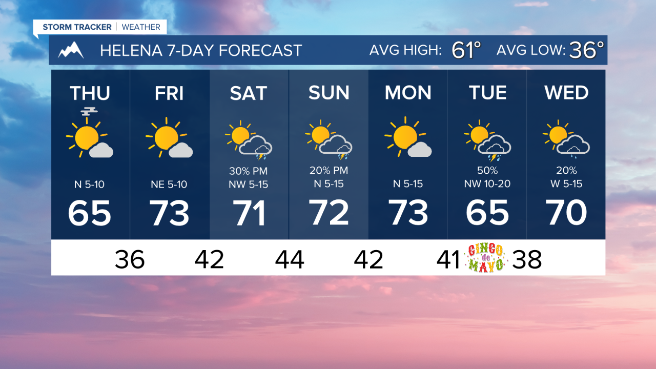
THURSDAY, APRIL 30TH: A couple of light snow showers are moving over the mountains this morning, with virga over the valleys. The skies will clear by the afternoon to mostly sunny conditions. Highs will reach the upper 50s to 60s across the state, with warmer temperatures further north. Winds are light at 5-10 MPH
FRIDAY, MAY 1ST: This will be the warmest day of the week for many. Afternoon temperatures will reach the low 70s under mostly sunny skies. Some clouds will move in later on in the day, but dry conditions will persist. Winds will be out of the west at 5 to 15 MPH.
SATURDAY, MAY 2ND: Warmer weather continues with highs in the upper 60s to low 70s. A small piece of energy moves into the state, allowing isolated thunderstorms to pop up in the afternoon. Storms will be few and far between, so nothing to cancel outdoor weekend plans for. Expect partly to mostly cloudy skies with winds out of the northwest at 5-15 MPH.
SUNDAY, MAY 3RD: Isolated storms will move further south in the state. They will form in the afternoon, mainly south of Helena. Highs will still reach the upper 60s to low 70s under partly cloudy skies. Winds will be out of the north at 5-15 MPH.
LONG-TERM FORECAST: Warmer weather continues into the first week of May with mainly dry days aside from Tuesday and Wednesday when a cold front moves through the area.
——————————————————————————————————————————
WEATHER ALERTS:
NONE
——————————————————————————————————————————
Helena Temperature Records Today:
High: 83 (1987)
Low: 13 (1909)
AVG: 61/36
Great Falls Temperature Records Today:
High: 85 (1987)
Low: 15 (2019)
AVG: 59/33