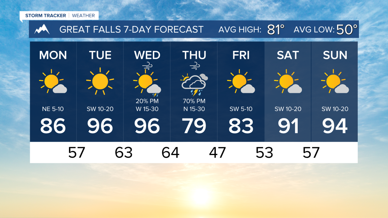
I hope everyone had a safe holiday weekend! It was very nice outside on Saturday and Sunday, but it gets hot to begin the week.
Today, dry and warm conditions take hold. Most communities will reach the mid to upper 80s this afternoon for the high temperature. Sunny to mostly sunny skies are expected.
It will be very hot, windy, and dry on Tuesday and Wednesday. With fire weather conditions heightened, we will be keeping watch for new wildfire starts. Do your part to prevent fires before they start. Highs will reach the 90s and low 100s for most of the state.
Some showers and thunderstorms form along a weak cold front in central Montana on Wednesday, but they will be very isolated, and rain might not reach the surface.
A strong front comes through on Thursday, bringing out the best chance for rain for the week. This will also give us some relief from the heat before it returns for the weekend.
——————————————————————————————————————————
WEATHER ALERTS:
NONE
——————————————————————————————————————————
Helena Temperature Records Today:
High: 98 (2017)
Low: 36 (1952)
AVG: 84/54
Great Falls Temperature Records Today:
High: 97 (2017)
Low: 41 (1993)
AVG: 81/50
Have a great Monday!
Joey Biancone
Meteorologist