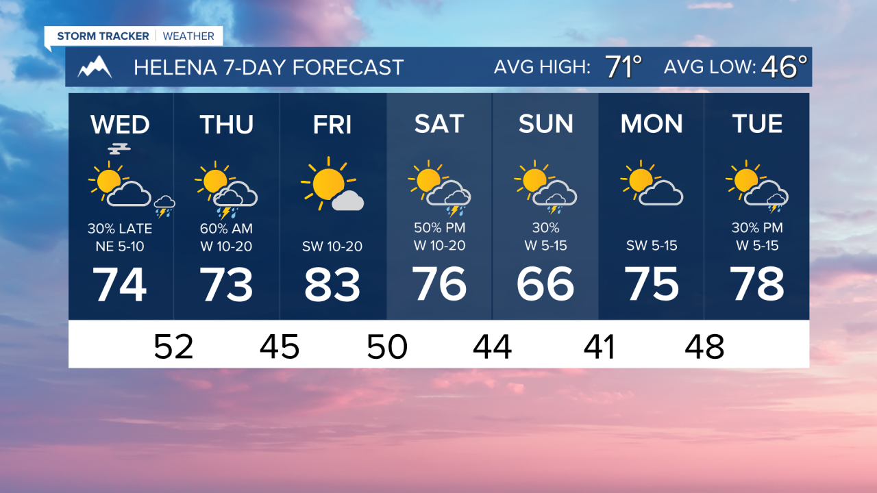


WEDNESDAY, JUNE 3RD: Our widespread rainstorm is moving out of the state, and most are seeing the return of the sun this morning. Areas of fog may form when moisture near the surface meets the clearer skies and cooler temperatures.
Afternoon temperatures will reach the 60s and 70s under partly cloudy skies.
Most of the day will be dry, but after sunset, isolated showers return to the Helena area.
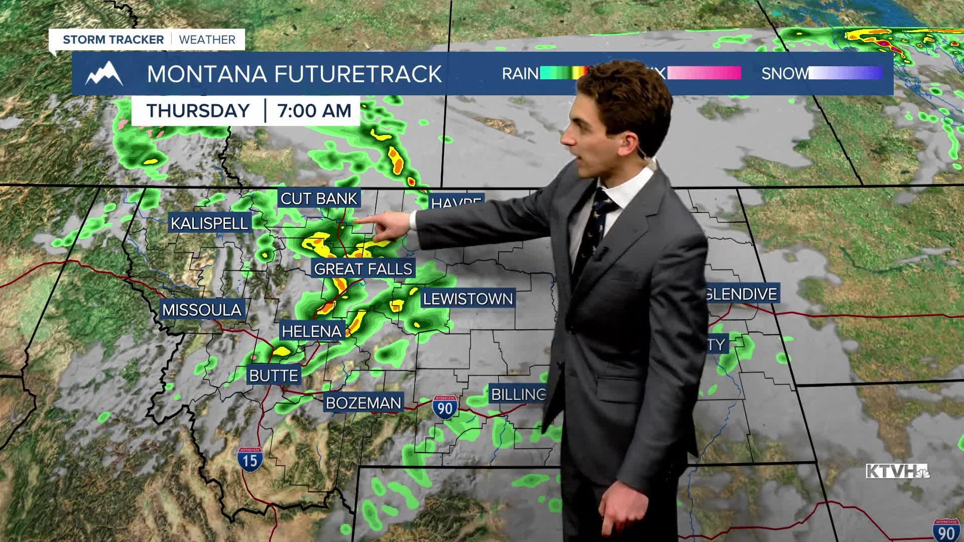
THURSDAY, JUNE 4TH: Another small disturbance moves through the state, triggering scattered thunderstorms in the morning. Conditions will be drier through western and central Montana by the afternoon, but eastern Montana will be dealing with strong to severe thunderstorms.
High temperatures will reach the 60s and 70s again.
FRIDAY, JUNE 5TH: It will be a beautiful day with highs in the upper 70s to low 80s under mostly sunny skies.
SATURDAY, JUNE 6TH: A cold front will begin to move through the state, bringing afternoon thunderstorms to the area. High temperatures will range from the 60s in western Montana to the 90s in eastern Montana. Expect partly cloudy skies.
LONG-RANGE FORECAST: We stay in an overall active pattern through the weekend and into next week, but no widespread precipitation is expected until at least Wednesday of next week.
——————————————————————————————————————————
WEATHER ALERTS:

——————————————————————————————————————————
Helena Temperature Records Today:
High: 94 (2021)
Low: 31 (1987)
AVG: 71/46
Great Falls Temperature Records Today:
High: 93 (2021)
Low: 33 (1943)
AVG: 69/44