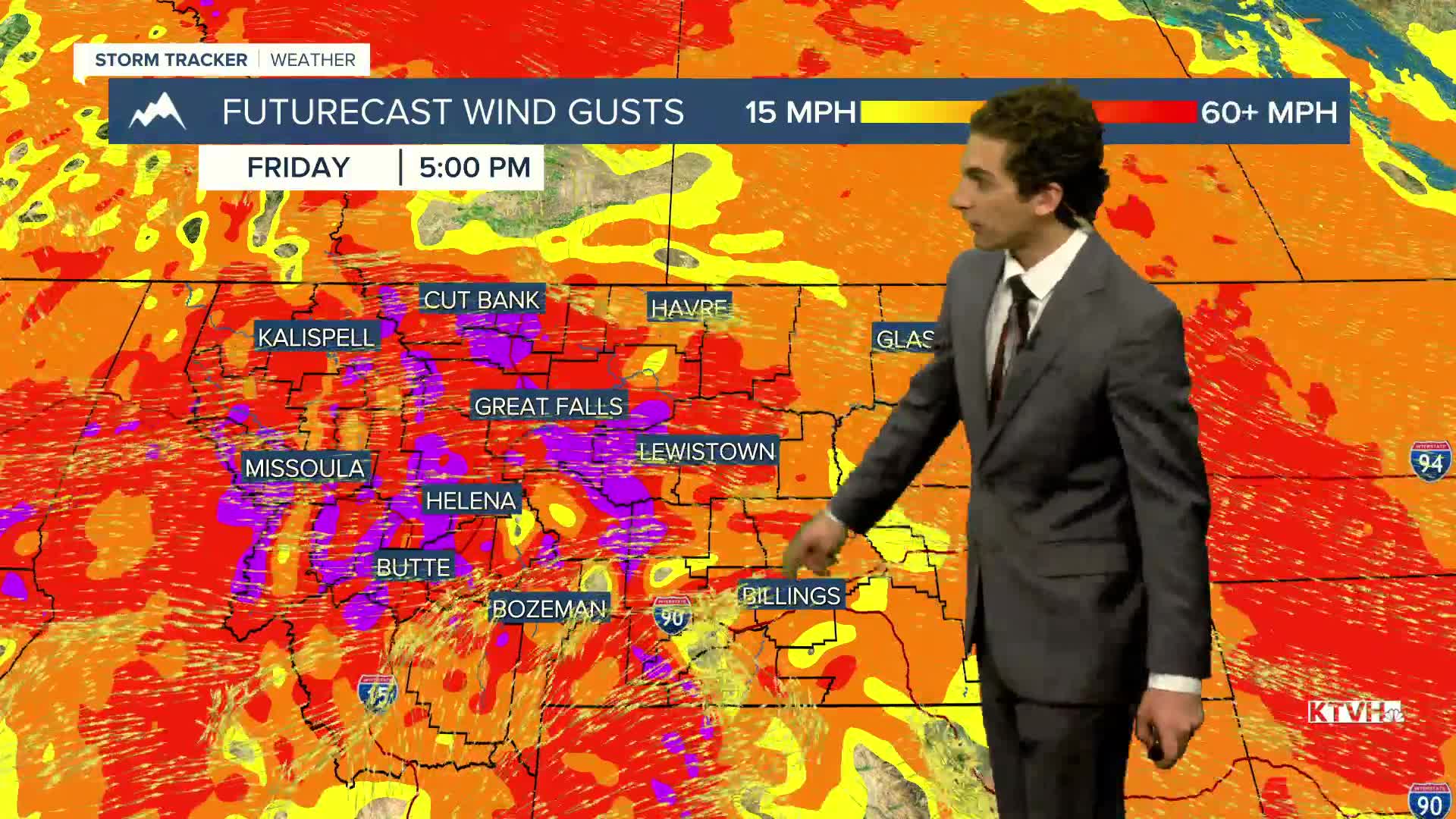


Strong, gusty winds will continue to impact Montana through the weekend and into early next week. The strongest will be observed today and Sunday.
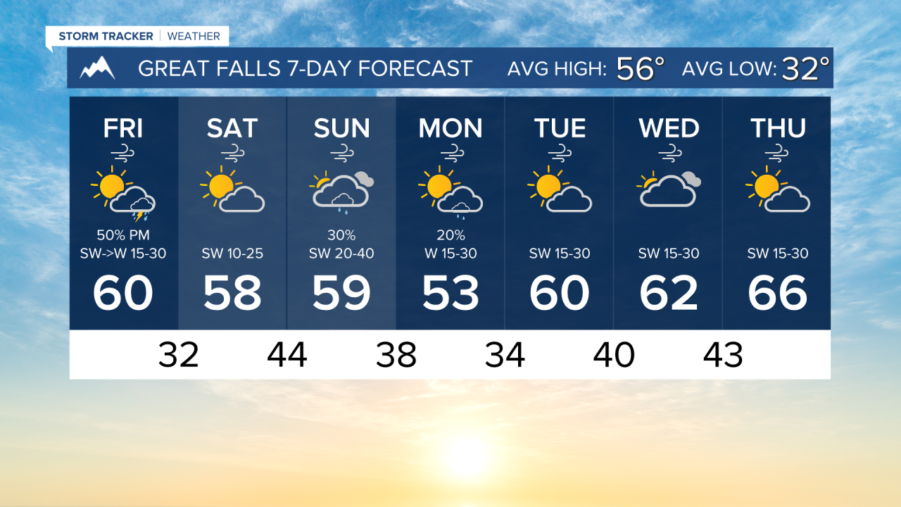
A cold front moves into our area this afternoon and evening. This will bring some light mountain snow and lower elevation rain. Highs will reach the 50s and low 60s.
Another cold front moves through the state is arriving a bit earlier than previously forecasted. This brings it in on Sunday. Rain showers will be common around southwest Montana, but limited near the north-central plains due to the wind activity.
A few snow showers will form in the mountains to begin next week, and breezy conditions continue until about Wednesday
——————————————————————————————————————————
WEATHER ALERTS:
A LAKE WIND ADVISORY continues for Fort Peck Lake until 9 PM Friday
A LAKE WIND ADVISORY has been issued for Flathead Lake and other area lakes around the Flathead and Mission valleys from 11 AM Friday until 7 PM Friday
A HIGH WIND WATCH has been issued for Eastern Glacier, Western Toole, and Central Pondera Counties, and Eastern Toole and Liberty Counties from Saturday evening until Sunday evening
——————————————————————————————————————————
Helena Temperature Records Today:
High: 82 (2003)
Low: 7 (1905)
AVG: 56/33
Great Falls Temperature Records Today:
High: 81 (2003)
Low: 6 (1905)
AVG: 56/32