


FRIDAY, MARCH 13TH: As the winds moved out last night, snow moved in. This wave of snow will last through Saturday evening for most of the north-central plains and mountain ranges across the state. The Helena Valley is where things get a little more complicated.
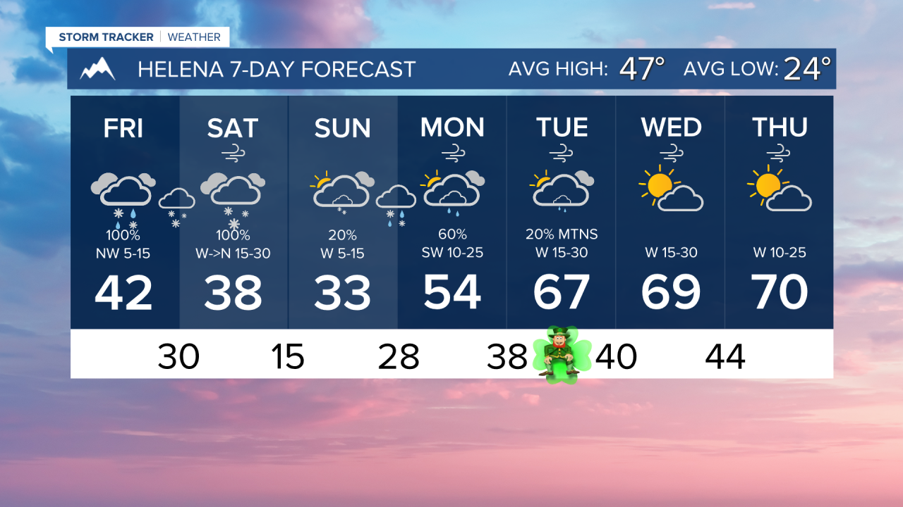
Helena stays on the warmer side of this system today. A rain/snow mix this morning turns to mostly rain for the lower elevations this afternoon, with a high temperature reaching the low 40s. We will see the conversion back over to snow tonight when the cold front finally pushes through our area. Snow totals are still on track for about 3-6" in the valley, with higher amounts near and in the mountains.
On the other hand, locations north of Helena will see consistent snow through the rest of today and into tonight. The Great Falls area may see as much as a foot of snow when all is said and done.
High temperatures in the plains only reach the 20s and 30s.
Mountain passes are of most concern when it comes to travel. Feet of snow will fall in those higher elevations. Prepare for dangerous pass conditions over the next couple of days. Even some lower-elevation roads will be dicey at times.
Great Divide is reporting up to a foot of new snow with yesterday's snow alone.
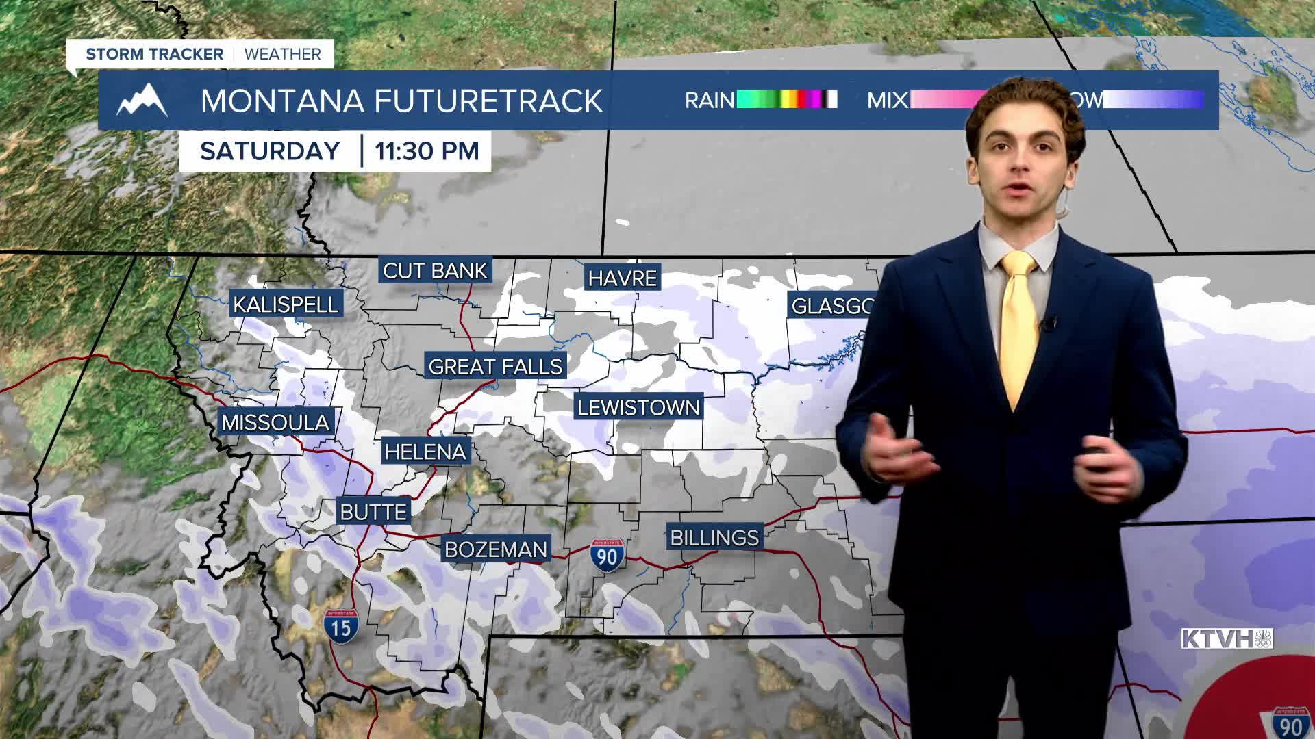
SATURDAY, MARCH 14TH: The cold front will continue its trek southward through the state Saturday morning, bringing moderate to heavy snow to most lower elevations.
Snow totals combining Friday and Saturday will be the most significant they have been all winter in north-central Montana and Helena. Winter storm warnings continue through Saturday evening for as much as 18" of total snowfall in the lower elevations of north-central Montana.
Snow squalls become a possibility in southwestern Montana on Saturday afternoon.
Temperatures will continue to decrease as highs only reach the 20s and 30s. Snow moves out of the area late Saturday night.
SUNDAY, MARCH 15TH: Widespread snow moves out of the area by Sunday morning, with just a few lingering mountain snow showers in the afternoon. It will be a very cold morning, with lows dipping into the single digits and teens. Due to snow on the ground, don't expect temperatures to be higher than the 20s and 30s.
MONDAY, MARCH 16TH: A warm front will rapidly usher in some warmer temperatures to the western half of the state, as well as a few rain and snow showers in the morning. Highs warm into the 40s and 50s under mostly cloudy skies.
The wind will be picking up to begin next week once again, although we don't expect it to be nearly as intense and widespread as Thursday.
LONG-RANGE FORECAST: A ridge of high pressure builds over the western United States, bringing much above normal temperatures and mainly dry weather back into the forecast for most of next week. Highs may reach the 70s for some parts of the state.
——————————————————————————————————————————
WEATHER ALERTS:


——————————————————————————————————————————
Helena Temperature Records Today:
High: 69 (2003)
Low: -14 (1969)
AVG: 47/24
Great Falls Temperature Records Today:
High: 69 (2003)
Low: -19 (1897)
AVG: 45/21