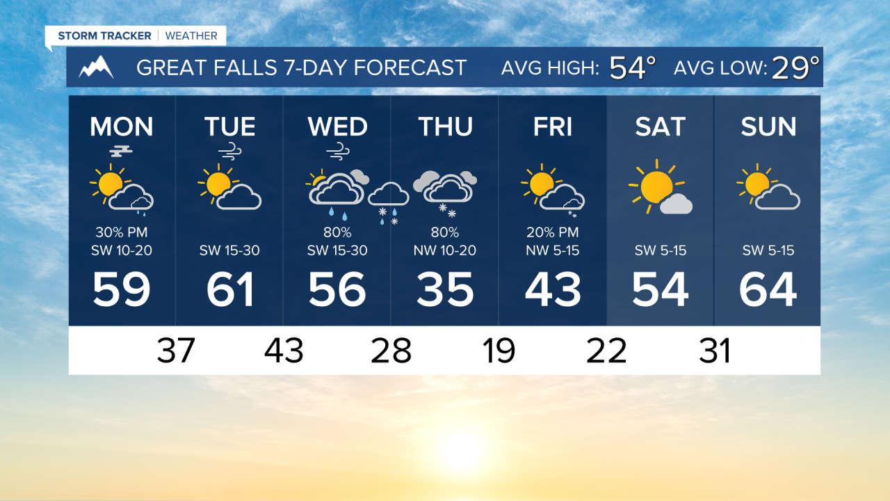


MONDAY, APRIL 13TH: Areas of fog have formed in central Montana due to high relative humidity near the surface in the wake of this weekend's showers and storms. It will be blown out within the next few hours with west winds picking up.
A few showers are present near the Hi-Line this morning as a center of low pressure makes its way through Montana. The Helena and Great Falls areas are dry, but watch for some pop-up showers and perhaps a thunderstorm or two later this afternoon.
High temperatures will reach the mid to upper 50s under partly to mostly cloudy skies.
TUESDAY, APRIL 14TH: We will be in between storm systems. Winds will be light in the morning, but they will be picking up to near 30 MPH at times in the afternoon.
Isolated mountain rain showers will be around, especially in the evening. I expect most lower elevations east of the divide to stay dry.
Afternoon temperatures will reach the upper 50s to low 60s under partly to mostly cloudy conditions.
WEDNESDAY, APRIL 15TH: Wind will remain gusty at times, with gusts approaching 30-40 MPH. Rain and snow showers will be around in the mountains for most of the day. Lower elevations will be mostly dry due to downslope winds until a cold front arrives on Wednesday night.
High temperatures will be in the 50s and low 60s again with mostly cloudy conditions.
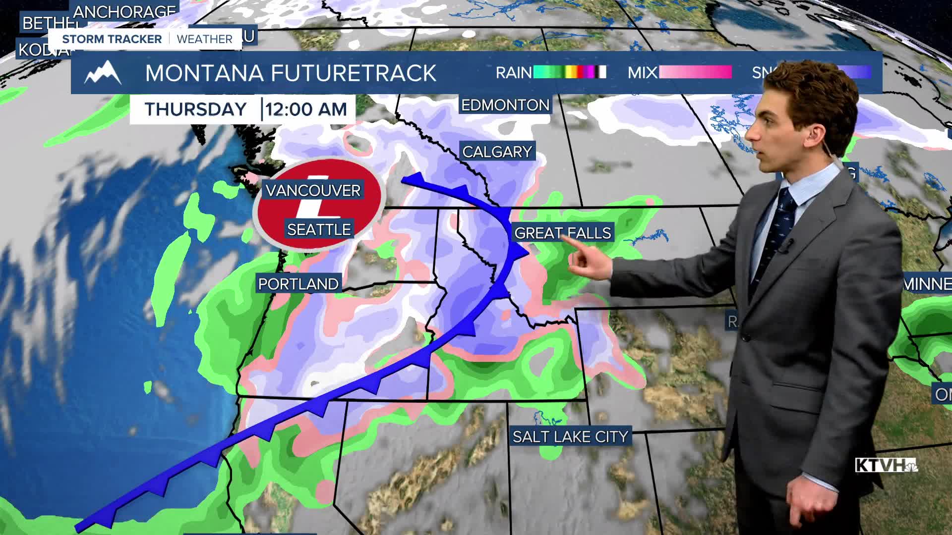
The cold front will bring rain initially to lower elevations, converting to snow once it passes.
THURSDAY, APRIL 16TH: Snow will fall through most of the morning, becoming intermittent by the afternoon. Heavy accumulation is expected in the mountains, while valleys and parts of the plains are expected to pick up 1 to 2 inches with the current storm track.
It will be much colder on Thursday behind the cold front. Highs will only reach the 30s and low 40s under cloudy skies.
LONG-RANGE FORECAST: Several storm systems are on the way next week, bringing cooler temperatures and overall wetter weather.
——————————————————————————————————————————
WEATHER ALERTS:
NONE
——————————————————————————————————————————
Helena Temperature Records Today:
High: 77 (2024)
Low: 12 (1986)
AVG: 56/32
Great Falls Temperature Records Today:
High: 82 (1932)
Low: 4 (2020)
AVG: 54/29