Most locations are going to remain dry tonight, but some isolated rain showers are possible, generally in locations along and south of a line from Helena to Lewistown, as a cold front passes through our area. We are also going to have partly cloudy skies tonight. It is also going to be cool tonight as lows are going to be in the 40s and low 50s in most locations. There is also going to be a little bit of a breeze around tonight, especially along the Hi-Line, as sustained wind speeds are going to be between 5 and 15 mph.
For tomorrow, we are going to have partly cloudy skies and mainly dry conditions. It is also going to be cooler tomorrow than it was today as highs are going to be in the mid to upper 60s and low to mid 70s in most locations. There is also going to be a little bit of a breeze around tomorrow, especially during the afternoon and evening, as sustained wind speeds are going to be between 5 and 15 mph.
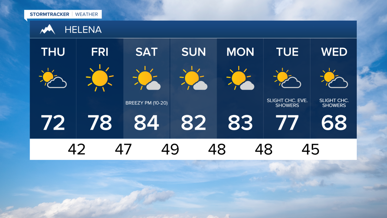
Nearly perfect weather is then expected on Friday as we are going to have mainly sunny skies, dry conditions, just a light breeze, and pleasant temperatures as highs are going to be in the 70s in most locations.
Mostly to mainly sunny skies are then expected this weekend and on Monday as an upper level ridge is going to be in control of our weather. The temperatures on these three days are also going to be well above average for this time of year as highs are going to be in the low to mid 80s in most locations. It is also going to be breezy on these three days, especially during the PM hours, as sustained wind speeds are going to be between 10 and 25 mph. This wind coupled with low relative humidity and warm temperatures is also going to create elevated fire weather conditions this weekend and early next week.
We are then going to have increasing clouds with a slight chance of evening showers on Tuesday, and partly cloudy skies with a slight chance of showers on Wednesday as a storm system approaches and passes through our area. The temperatures are also going to cool down some over these two days as highs on Tuesday are going to be in the mid to upper 70s and low 80s in most locations, and highs on Wednesday are going to be in the mid to upper 60s in most locations. There is also going to be a little bit of a breeze around on both of these days, especially during the PM hours, as sustained wind speeds are going to be between 10 and 15 mph.