


The weekend temperatures are staying above average around the Helena and Great Falls areas under partly cloudy skies. Winter will return next week.
The weekend will be mostly pleasant aside from isolated rain/snow showers moving throug late Saturday night. Highs warm into the upper 40s to 50s for our area on Sunday.
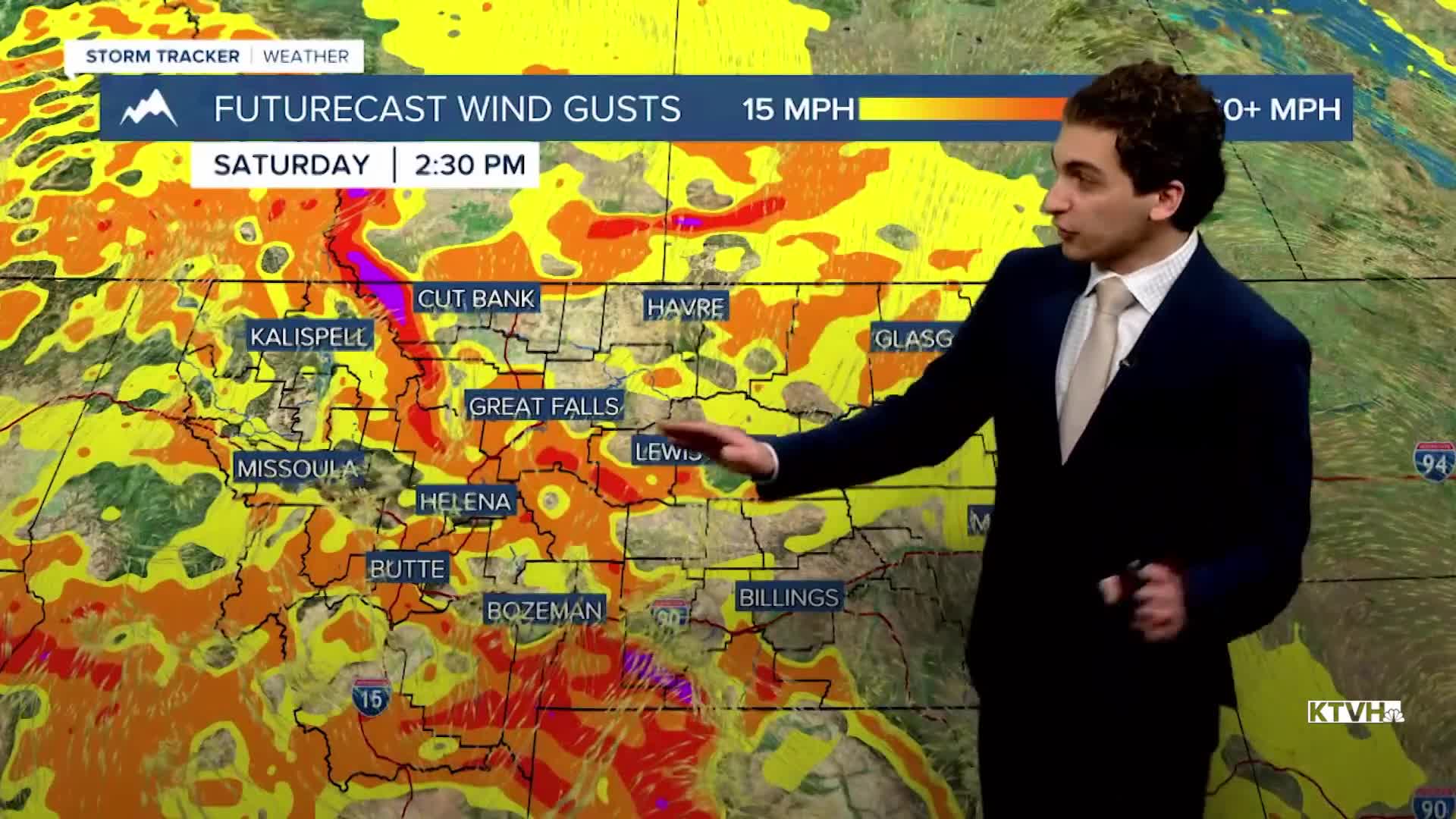
The wind continues in north-central Montana tomorrow and stays at least breezy through most of next week. Sunday, Monday, Tuesday, and Wednesday will be the windiest days. Gusts will reach between 30 and 50 MPH in Great Falls.
Helena will be breezy as well, with our windiest day coming up on Tuesday, where gusts can approach 30-40 MPH.
Colder weather and some isolated lower-elevation snow will return towards the end of next week.
——————————————————————————————————————————
WEATHER ALERTS:
A DENSE FOG ADVISORY continues for Central and Southeast Phillips, Central and Southern Valley, Daniels, Eastern Roosevelt, Northern Phillips, Northern Valley, Richland, and Western Roosevelt Counties until 11 AM Saturday
A WINTER WEATHER ADVISORY has been issued for Highway 37 Eureka to Libby, Highway 2 Kalispell to Libby, Highway 56 Bull Lake Road, and Highway 93 Eureka to Whitefish from 11 PM Friday until 11 AM Saturday
A WINTER WEATHER ADVISORY has been issued for Mission Valley, Polson, Flathead Valley, and Flathead Lake from 11 PM Friday until 11 AM Saturday
A WINTER WEATHER ADVISORY has been issued for Bad Rock Canyon, Glacier National Park, Highway 83 Bigfork to Swan Lake, Polebridge, Marias Pass, and Essex from 11 PM Friday until 11 AM Saturday
——————————————————————————————————————————
Helena Temperature Records Today:
High: 57 (1939)
Low: -26 (1950)
AVG: 31/12
Great Falls Temperature Records Today:
High: 65 (1918)
Low: -32 (1950)
AVG: 35/15


