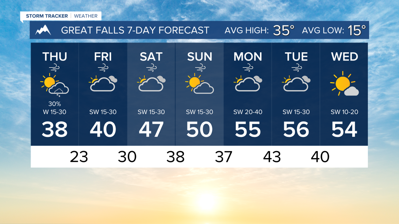


It's a cold morning for many across the state, but it's only up from here over the next week. Most of the state will have temperatures well above normal towards the beginning of next week
THURSDAY, JANUARY 8th: Cold air aloft will create enough instability to get some convective snow showers forming over the mountains by the afternoon. Afternoon highs will reach the 30s throughout most of the state.
I expect a few of the showers to produce heavy snow rates at times, but they will be fast-moving. Be careful over mountain passes. A few of these snow showers will be in and around the Helena Valley between 4 and 6 PM, with a little more widespread light snow developing overnight.
It will be windy again in north-central Montana. Gusts can reach around 30-40 MPH for most of the area early this afternoon.
FRIDAY, JANUARY 9th: Mostly cloudy conditions with some light snow showers in the mountains in the morning, drying up by mid-to-late afternoon. Highs will be slightly warmer than Thursday, but still on the colder side. I expect highs to reach the upper 30s to low 40s.
There is the potential to see a few stronger gusts along the Rocky Mountain Front approaching 50-60 MPH. It will be windy once again in the Great Falls area.
SATURDAY, JANUARY 10th: Higher pressure begins to settle in southwest Montana. This will usher in warmer air and drier weather. Highs will reach the 40s east of the Continental Divide. Wind will continue to be breezy in the Helena Valley and north-central Montana.
SUNDAY, JANUARY 11th: High temperatures continue to warm into the upper 40s to low 50s. A period of stronger winds begins to move in the evening with a tightening pressure gradient, especially in the plains of north-central Montana. Dry conditions continue.
LONG-RANGE FORECAST: Warmer and drier weather continues through Wednesday of next week. Some areas could even approach the low 60s for highs. A brief cooler and wetter pattern looks to return toward the end of the workweek.
——————————————————————————————————————————
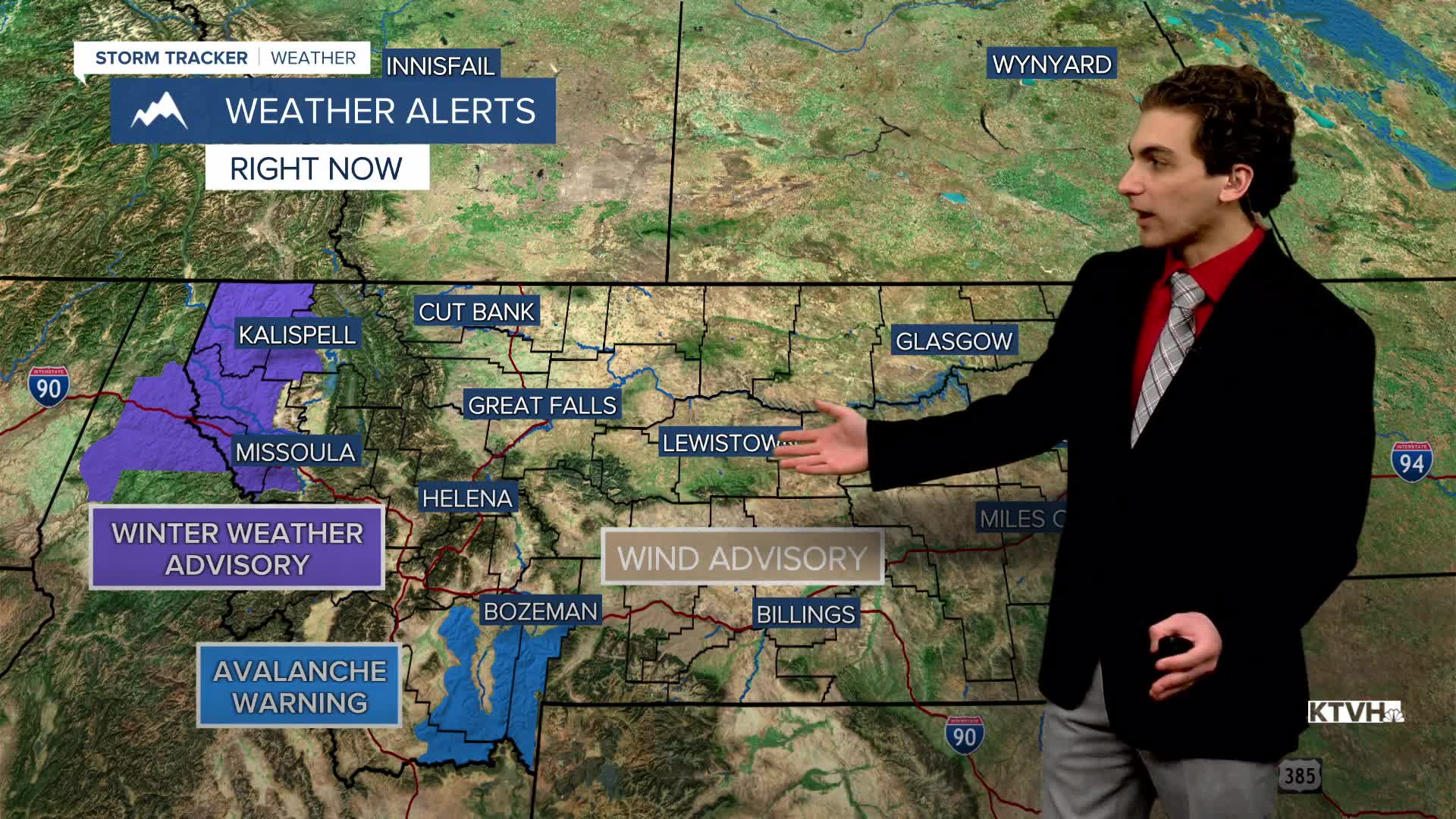
WEATHER ALERTS:
An AVALANCHE WARNING continues for the Lionhead area near West Yellowstone until Friday morning
A WINTER WEATHER ADVISORY continues for Highway 93 Eureka to Whitefish, Highway 2 Kalispell to Libby, Highway 37 Eureka to Libby, and Highway 56 Bull Lake Road until 11 AM Thursday
A WINTER WEATHER ADVISORY continues for Evaro Hill, Highway 200 Thompson Falls to Plains, Highway 200 Trout Creek to Heron, and I-90 Lookout Pass to Haugan until 11 AM Thursday
A WIND ADVISORY has been issued for the Beartooth Foothills and Livingston Area 11 PM Thursday until 11 AM Saturday
——————————————————————————————————————————
Helena Temperature Records Today:
High: 57 (1885)
Low: -32 (1888)
AVG: 32/13
Great Falls Temperature Records Today:
High: 55 (2002)
Low: -30 (1909)
AVG: 35/15