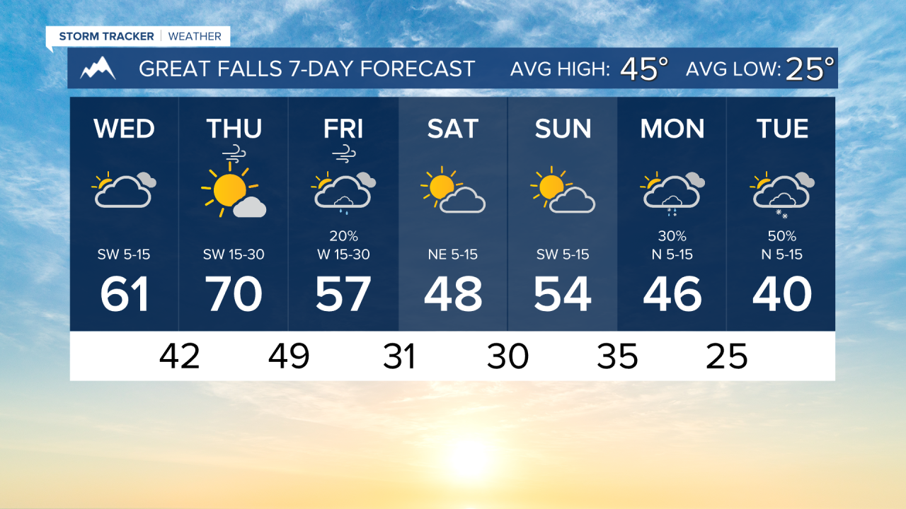


High temperatures reaching the 60s will continue today and tomorrow, but don't get too comfortable, colder air is coming next week.
Mostly cloudy skies will cover the sky today. Aside from some isolated sprinkles, most of the state will remain dry with highs reaching the upper 50s to low 60s. For those wanting to view the Aurora Borealis tonight, the cloud cover will make things difficult. Viewing conditions will be better after midnight.
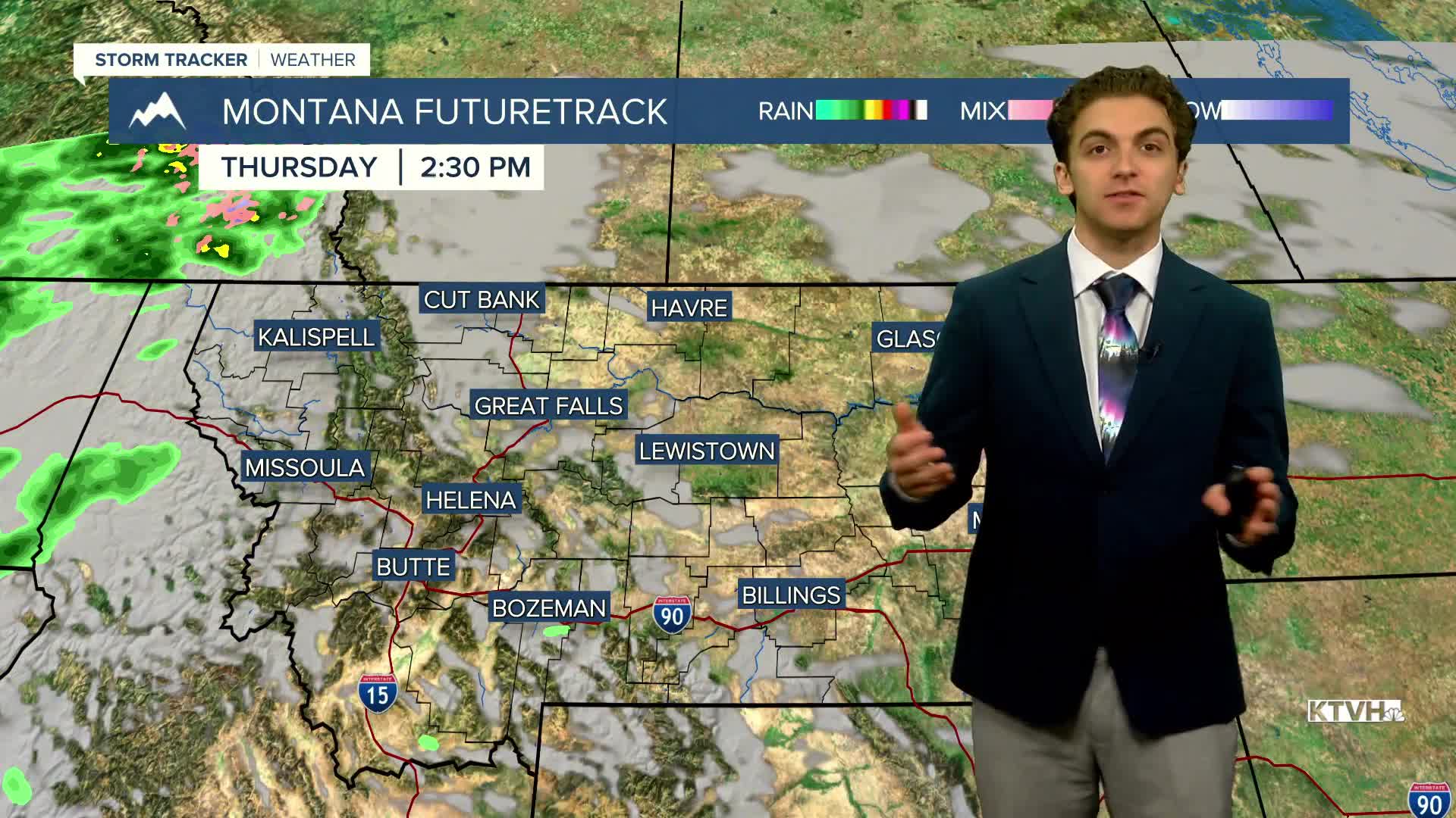
Wind picks up tomorrow out ahead of our next cold front. This warming wind will push temperatures up into the upper 60s to low 70s. This could potentially set some new daily high temperature records across the state. Winds could gust around 50-60 MPH near the Rocky Mountain Front.
A slow-moving cold front comes in on Friday, bringing more wind, rain, and snow. Scattered showers will develop by Friday morning and stick around through most of the day. Some snow may fall near the Hi-Line Friday night. High temperatures drop into the 40s and 50s
There may be some mountain showers left on Saturday, but the weekend trends drier with highs in the 40s and 50s.
A stronger front comes through early next week that will bring colder-than-normal air and the chance of lower elevation snow.
——————————————————————————————————————————
WEATHER ALERTS:
NONE
——————————————————————————————————————————
Helena Temperature Records Today:
High: 75 (1999)
Low: -20 (1959)
AVG: 44/24
Great Falls Temperature Records Today:
High: 74 (1999)
Low: -20 (1959)
AVG: 45/25