


A WINTER STORM WARNING ends Saturday morning.
A COLD WEATHER ADVISORY in northeast Montana ends Sunday morning.
WINTER WEATHER ADVISORY ends Saturday morning.
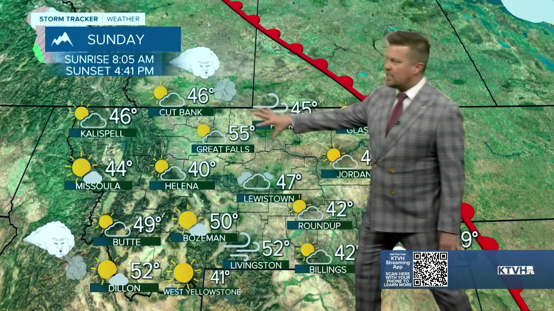
Who needs the weekend after this week's weather? While the weekend starts cold and snowy, it will end on a much warmer note with some places warming more than 50 degrees. The arctic airmass will slowly retreat this weekend from southwest to northeast. Some snow and areas of light freezing rain will continue into Saturday morning. Northeast Montana will start out in the arctic air with temperatures below zero, but southwest Montana will stay warm in the 40s for highs. The warmer air should push temperatures above freezing for areas like Great Falls and Lewistown through Saturday night. Sunday will be a much warmer day for these locations with highs reaching the 40s and 50s. Northeast Montana and the Hi-Line should see the arctic air retreat later Sunday. Skies will be partly cloudy. Monday will be a warmer day across the state. Highs will top out in the 40s and 50s, even close to 60 for Great Falls. Skies will be partly to mostly cloudy with a strong chinook wind. The warmer temperatures will start melting the snow, creating slushy/sloppy conditions. The next strong storm arrives on Wednesday with powerful wind, falling temperatures, and a mix of rain and snow showers. After this storm system, temperatures should be more consistently cold through Christmas. There's a good chance much of Montana will have a white Christmas.
Have a great weekend,
Curtis Grevenitz
Chief Meteorologist
