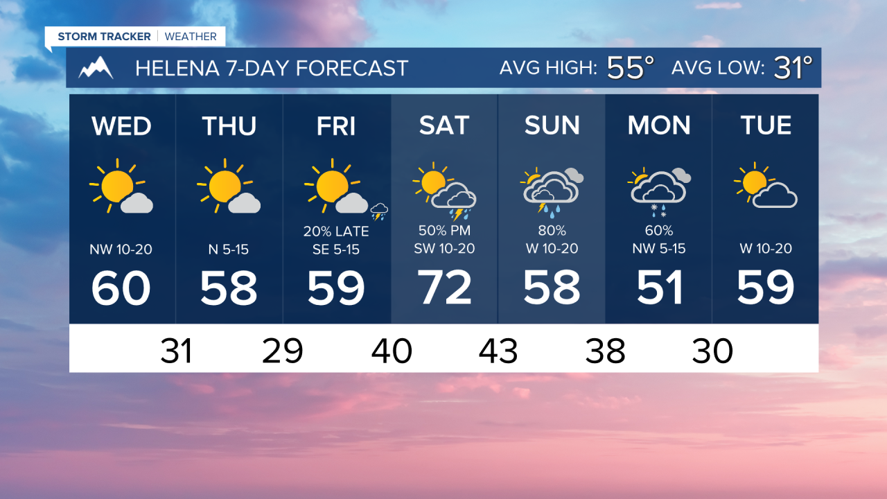


WEDNESDAY, APRIL 8TH: Winds will die down in the morning throughout central Montana, but will still be gusty throughout the afternoon in the eastern portion of the state. Temperatures will be cooler behind the front. Morning lows are in the 20s and 30s statewide. Afternoon highs will only reach the 40s and 50s for the plains. Some valleys like Helena, may crack the low 60s
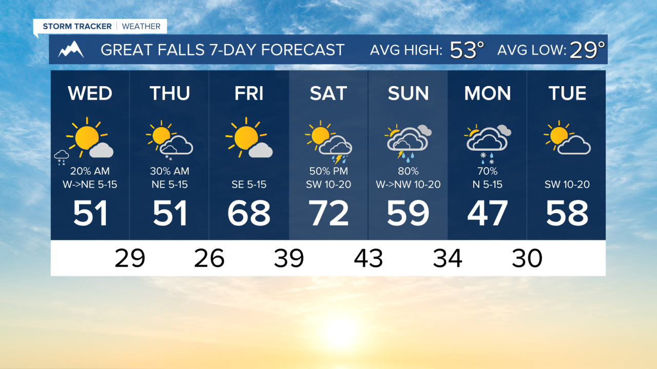
A few morning snow showers will impact northeast Montana on the backside of the low-pressure system. Impactful accumulation is not expected, but snow falling with strong winds can impact driving conditions.
THURSDAY, APRIL 9TH: A shortwave disturbance bringing isolated snow showers will move through north-central Montana on Thursday. This may bring snowflakes in the morning around Greta Falls, but it is not likely that this snow will stick. Helena will be dry under mostly clear skies. Morning lows will be in the 20s and 30s again. Highs will reach the 50s.
FRIDAY, APRIL 10TH: Friday will be a beautiful day with highs warming into the 60s for most areas, with a few spots potentially hitting 70 under mostly sunny conditions. A couple of thunderstorms will move into southwest Montana. These should stay south of Helena.
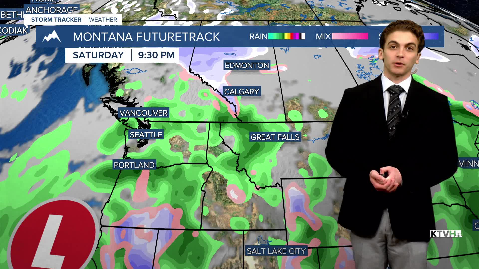
SATURDAY, APRIL 11TH: A warm, moist southwest flow moves into the area, which will prompt the formation of scattered showers and thunderstorms Saturday afternoon. Severe weather is not looking likely, but lightning strikes and gusty winds will be produced by some storms. Highs will reach the upper 60s to 70s across the state.
LONG-RANGE FORECAST: Wet weather sticks around Sunday and Monday with mountain snow and lower elevation rain. There may be a brief period of a rain/snow mix in lower elevations on Monday morning.
——————————————————————————————————————————
WEATHER ALERTS:


——————————————————————————————————————————
Helena Temperature Records Today:
High: 80 (2022)
Low: 10 (1982)
AVG: 55/31
Great Falls Temperature Records Today:
High: 79 (1996)
Low: 4 (1982)
AVG: 53/29