


THURSDAY, MAY 14TH: Strong wind gusts continue this morning, approaching 70-85 MPH near the Rocky Mountain Front. The Helena area has gusted near 50 MPH. The wind will continue to stay strong throughout the rest of today. This will create dangerous travel conditions, especially for high-profile vehicles, as well as the potential for isolated power outages and tree damage.
Aside from a bit of rain near the Hi-Line this morning and some lingering showers on the Divide, it will be mostly dry with clearing skies by the afternoon.
High temperatures will be significantly cooler than on Wednesday after hitting the 80s and 90s. Afternoon temperatures reach the 60s for most areas.
FRIDAY, MAY 15TH: The wind will not be as strong as Thursday, but wind gusts will still be approaching 30-40 MPH in the afternoon. Morning lows will dip to the upper 30s and low 40s. Afternoon highs will reach the upper 60s to low 70s. A few showers and a thunderstorm or two may pop up on and west of the Continental Divide and move across the Helena area in the mid-morning hours, but most areas stay dry.
SATURDAY, MAY 16TH: Another storm system comes through the state for the weekend. This will bring high elevation snow and low elevation scattered light rain, and perhaps a thunderstorm or two. Highs will only reach the upper 50s and low 60s. Winds will continue to gust between 30 and 40 MPH.
SUNDAY, MAY 17TH: Snow levels will drop by Sunday morning. It is becoming more likely that some lower elevations can at least witness some wet snowflakes falling mixed with rain, but accumulation seems unlikely. Some good moisture should be coming through regardless of the precipitation type. A few inches of snow may accumulate in the mountain ranges.
Highs will only reach the 40s and 50s with north winds of about 10 to 20 MPH.
LONG-TERM FORECAST: An overall unsettled pattern will continue next week, with more chances for rain, high elevation snow, and thunderstorms.
——————————————————————————————————————————
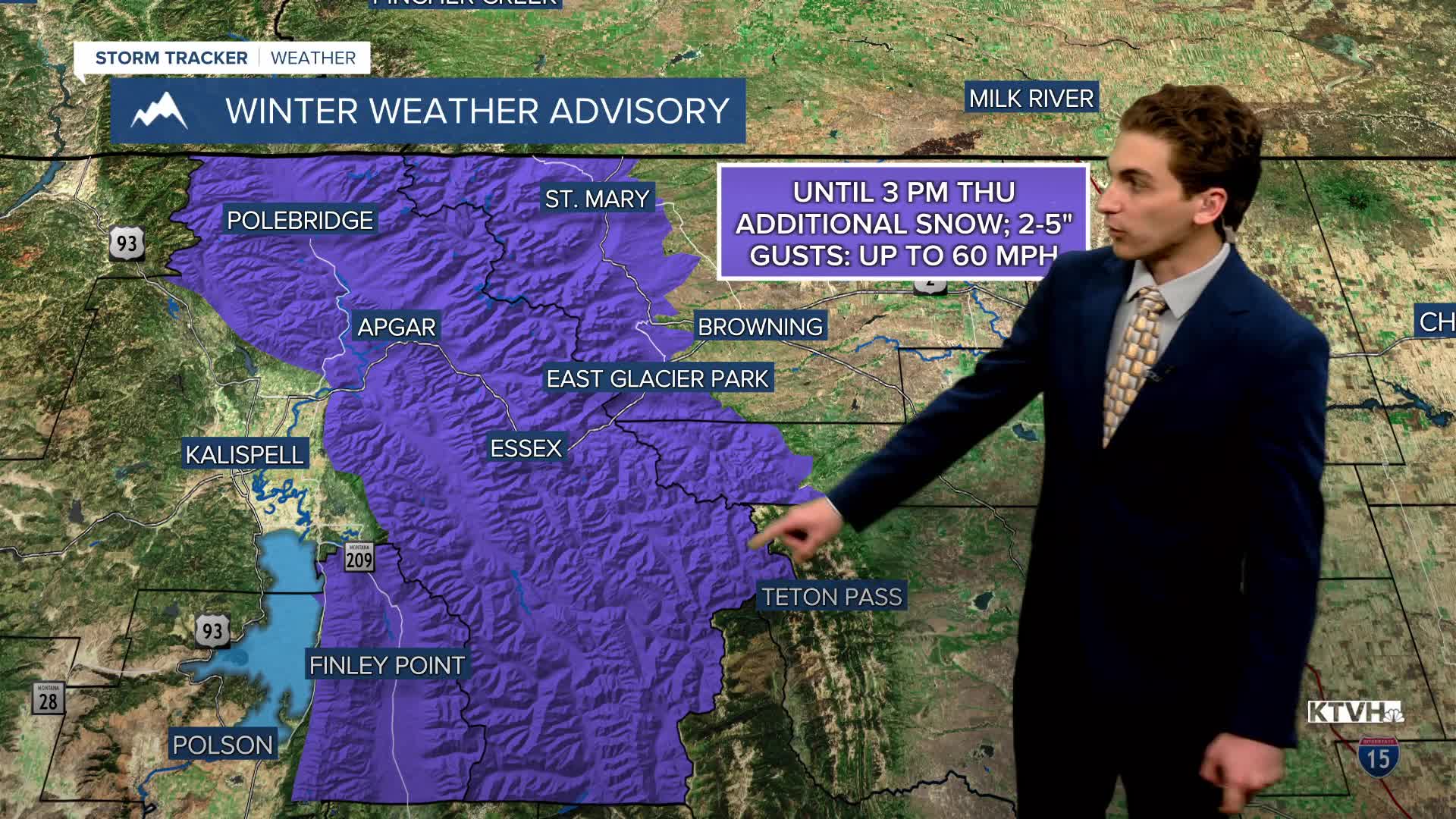
WEATHER ALERTS:


————————————————————————————————————————
Helena Temperature Records Today:
High: 88 (1936)
Low: 25 (1995)
AVG: 66/41
Great Falls Temperature Records Today:
High: 95 (1936)
Low: 26 (2004)
AVG: 64/38


