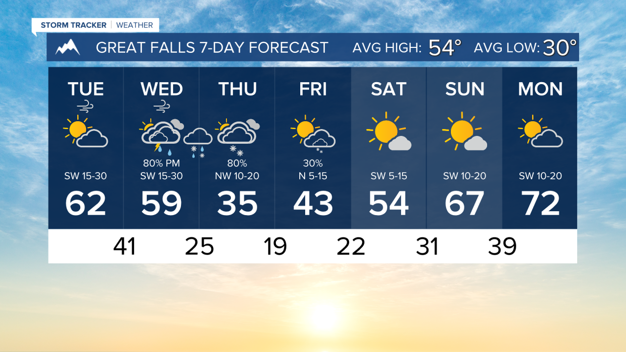


TUESDAY, APRIL 14TH: We are in between storm systems. Winds are already gusting near 60 MPH on the slopes of the Rocky Mountain Front. The Browning and East Glacier areas should be prepared to have gusts near 60 MPH for the rest of the day. The Great Falls area will gust to around 40 MPH later this afternoon. The Helena Valley will have gusts around 30 MPH.
Mountain showers will move in on and west of the divide late tonight and into early tomorrow morning. Otherwise, the rest of the day will be dry.
Afternoon temperatures will reach the upper 50s to low 60s under partly to mostly cloudy conditions.
WEDNESDAY, APRIL 15TH: Winds will remain gusty through the night for most areas. Helena may see a reduction in wind speed by Wednesday morning, but it will pick back up again after the sun rises. Gusts will approach 30-40 MPH out of the west again.
Wind will once again push high temperatures into the 50s and 60s, but we will have a bit more cloud cover this time around.
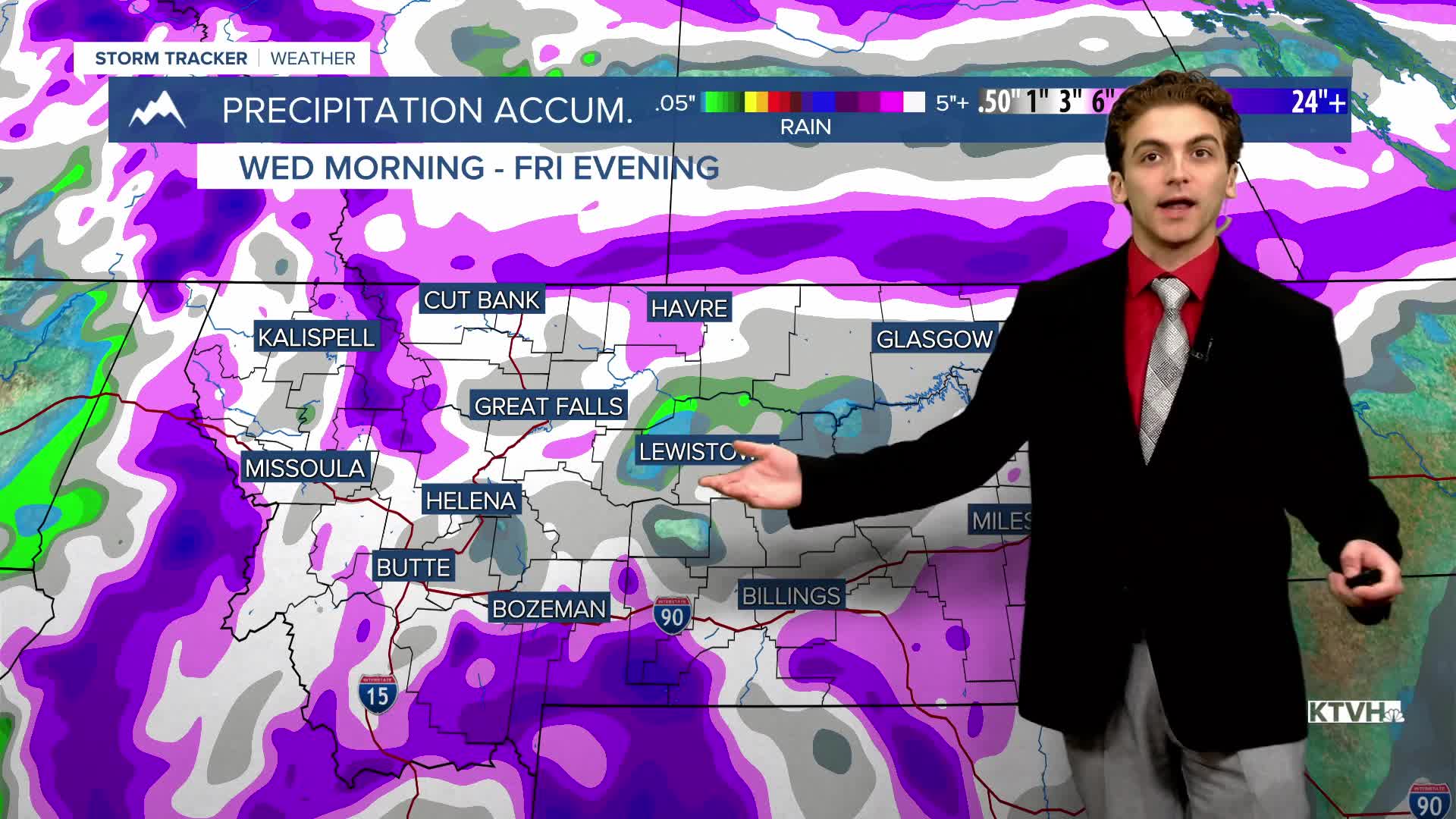
There will be mountain rain and snow showers on and west of the divide for most of the day. A few pop-up showers and thunderstorms will move into the Helena area in the afternoon before the arrival of the cold front. The boundary will arrive on Wednesday evening, bringing a burst of rain, converting to snow.
THURSDAY, APRIL 16TH: Intermittent snow will fall throughout the day on Thursday with much colder air behind the cold front. Morning lows will dip into the 20s and low 30s.
In terms of snow accumulation, this is mainly looking to be a mountain snow event. However, light snow is expected in most valleys and the plains. Generally speaking, around 1-3" may fall in lower elevations, with Helena being on the lower end of that range.
Expect mostly cloudy conditions with afternoon highs only reaching the 30s and low 40s.
FRIDAY, APRIL 17TH: Colder air sticks around to close out the workweek. Atmospheric instability in the afternoon will pop numerous snow showers over the mountains near the Continental Divide. Snow accumulation will be minimal, but a few snow showers could produce heavy bursts of snow for a short time. High temperatures will reach the 40s.
LONG-RANGE FORECAST: The weekend will be warmer and drier. Another storm system will come in next week.
——————————————————————————————————————————
WEATHER ALERTS:


——————————————————————————————————————————
Helena Temperature Records Today:
High: 78 (2024)
Low: 10 (2022)
AVG: 56/32
Great Falls Temperature Records Today:
High: 79 (2008)
Low: 3 (1986)
AVG: 54/30