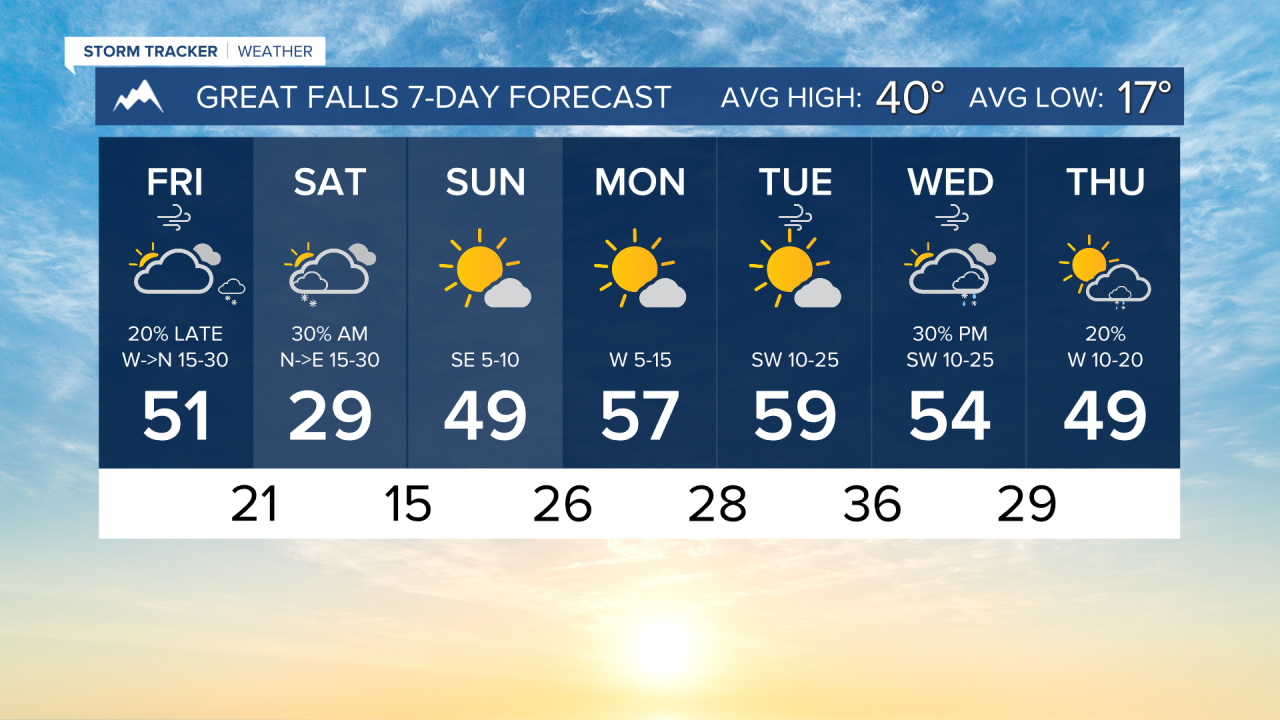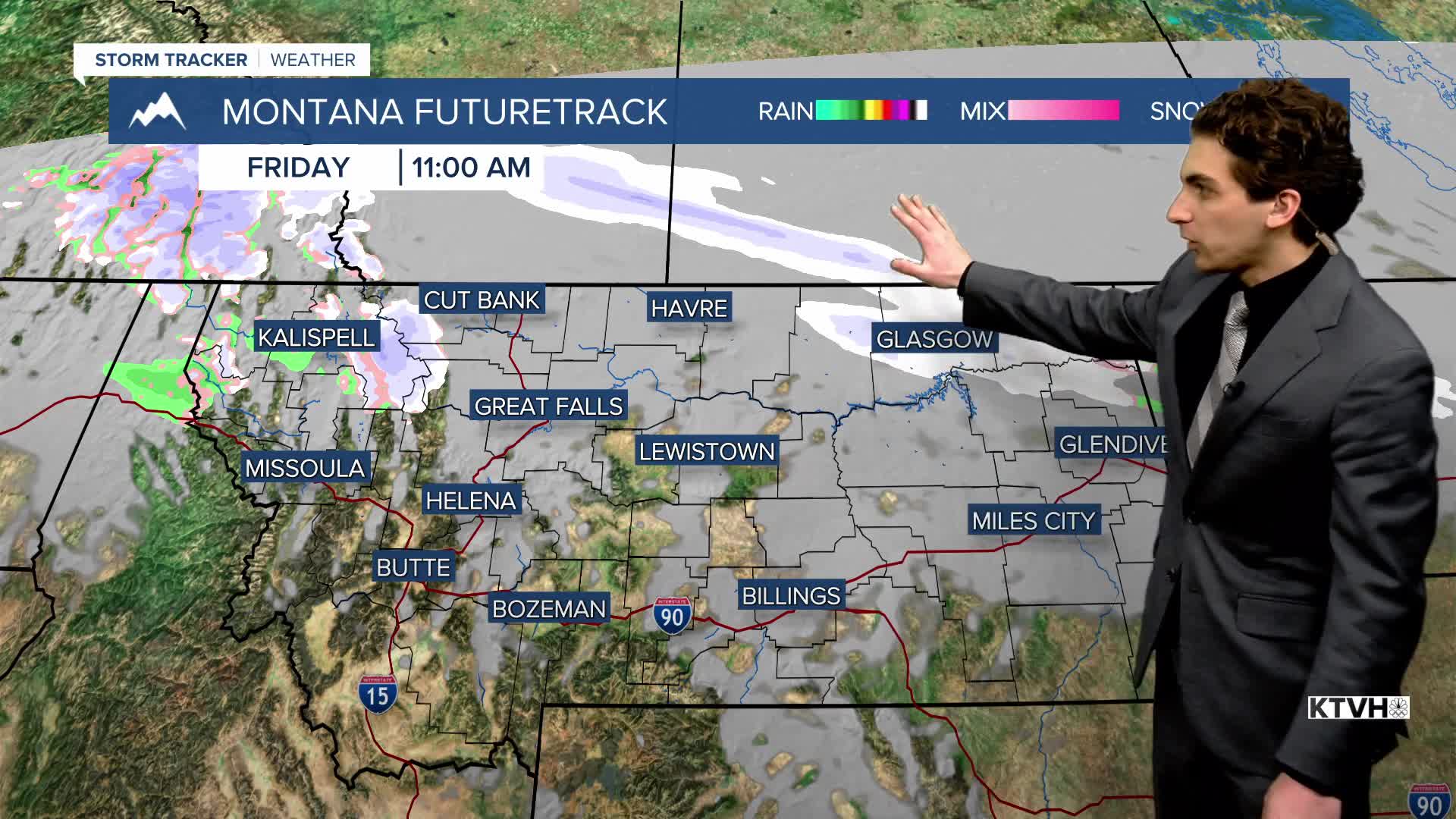


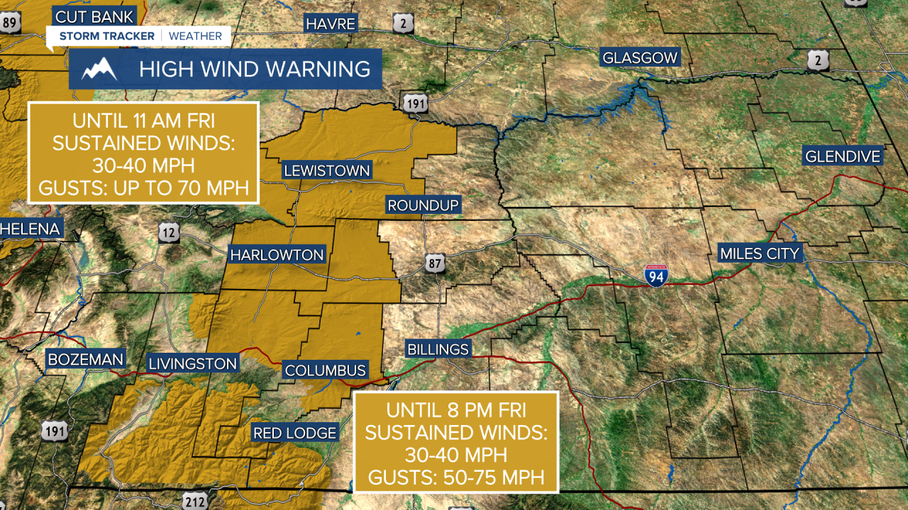
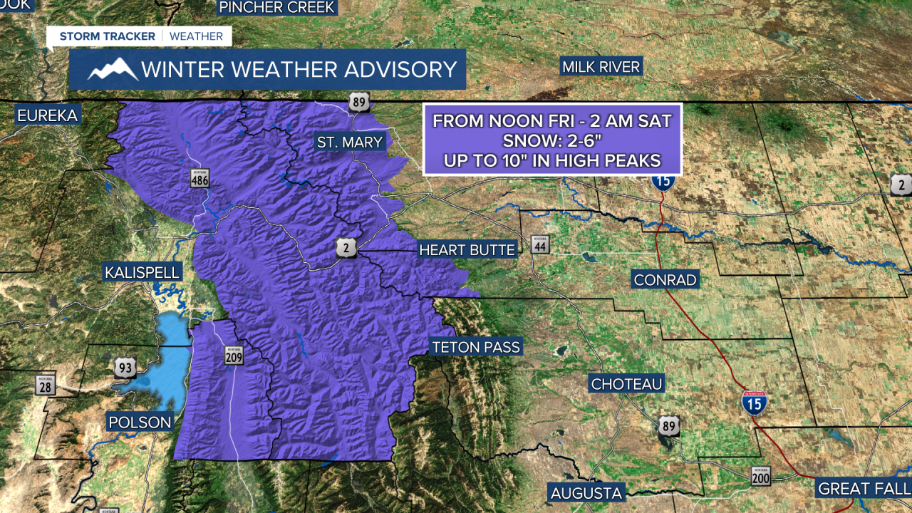
FRIDAY, FEBRUARY 27TH: Gusty west winds will still stay in the forecast through the morning, but a Canadian front from the north will reduce the wind threat from north to south by Friday evening in the plains. The Continental Divide will remain windy throughout the day, with gusts around 50-60 MPH. Highs will reach the 40s and 50s before arctic air arrives, with a bit of lower-elevation snow northeast of the Great Falls area.
SATURDAY, FEBRUARY 28TH: The final day of February will be colder for most, with near-to-below-average temperatures, except briefly in the plains. The Helena Valley should remain out of the coldest air. Highs will reach the upper 40s in the capital city.
Light snow is expected in Glacier National Park, on the Hi-Line, and throughout northeast Montana. Around 1-3 inches may fall across a wide area in the plains. Up to 7" could fall in the Little Rockies, where a Winter Storm Warning is in effect. Snow is not expected to reach Helena, and just some flurries or a dusting near Great Falls.
SUNDAY, MARCH 1ST: Temperatures begin to warm as the cold front weakens. The sun will come out for most of the state. Highs will reach the 40s and the low 50s.
MONDAY, MARCH 2ND: An upper-level ridge builds back over Montana, allowing temperatures to warm much above normal. Highs will reach the upper 50s under mostly sunny skies.
LONG-RANGE FORECAST: Warmer air returns for most of the first week of March with highs in the 50s and 60s through at least Wednesday. A Total Lunar Eclipse will also be visible in our area in the early morning hours of March 3rd. More to come on that.
——————————————————————————————————————————
WEATHER ALERTS:


——————————————————————————————————————————
Helena Temperature Records Today:
High: 69 (1932)
Low: -22 (1890)
AVG: 41/20
Great Falls Temperature Records Today:
High: 70 (1992)
Low: -22 (1917)
AVG: 40/17