


Powerful Chinook winds roll in tonight and last through Friday morning. Gusts could reach 100 MPH near the Rocky Mountain Front and 60 to 70 MPH east of I‑15, especially on Thursday.
TUESDAY, FEBRUARY 24TH: Rain and snow showers will be around the southern half of the state for most of the day. Expect snow converting over to rain near the Helena area tomorrow morning, with scattered showers in the afternoon. Heavy snow is expected in the Beartooth Mountains, with up to 2 feet accumulating through Wednesday.
Winds scale down briefly on Tuesday. with gusts around 10-20 MPH in the plains. Wind will be light in the Helena Valley.
Temperatures will also be slightly cooler with highs in the upper 30s to 40s.
Today is your day to prepare for several days of stronger winds. Bring loose items indoors and pay attention to the forecast over the coming days.
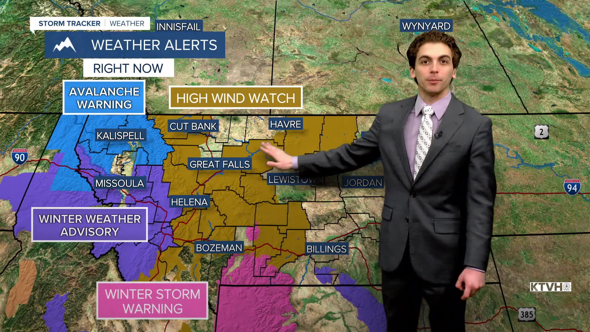
WEDNESDAY, FEBRUARY 25TH: A High Wind Watch has been issued for most of central Montana. Gusts will be around 60-70 MPH in the plains of north-central Montana. The Helena Valley will have gusts around 65 MPH. The wind will be strongest in the afternoon.
Highs will reach the 40s for most locations. with mostly sunny skies.
THURSDAY, FEBRUARY 26TH: Winds are expected to be the strongest on Thursday. Gusts could be approaching 60-70 MPH for much of north-central Montana and the Helena Valley. The Rocky Mountain Front has the potential to gust around 100 MPH.
Highs will reach the upper 40s and low 50s. A chinook arch cloud will develop over the plains.
FRIDAY, FEBRUARY 26TH: Gusty west winds will still be in the forecast through the morning, but an arctic front from the north will reduce the wind threat by Friday afternoon in the plains. Highs will reach the 40s and 50s before the arctic air arrives with a bit of lower elevation snow around the Great Falls area and Hi-Line.
LONG-RANGE FORECAST: Arctic air will stick around in the plains through the weekend. There is still a bit of uncertainty on just how far south the colder air will make it. Warmer air returns to begin March.
——————————————————————————————————————————
WEATHER ALERTS:
NWS WEATHER AND HAZARDS VIEWER
——————————————————————————————————————————
Helena Temperature Records Today:
High: 69 (1995)
Low: -18 (1922)
AVG: 40/19
Great Falls Temperature Records Today:
High: 68 (1995)
Low: -22 (2023)
AVG: 39/16


