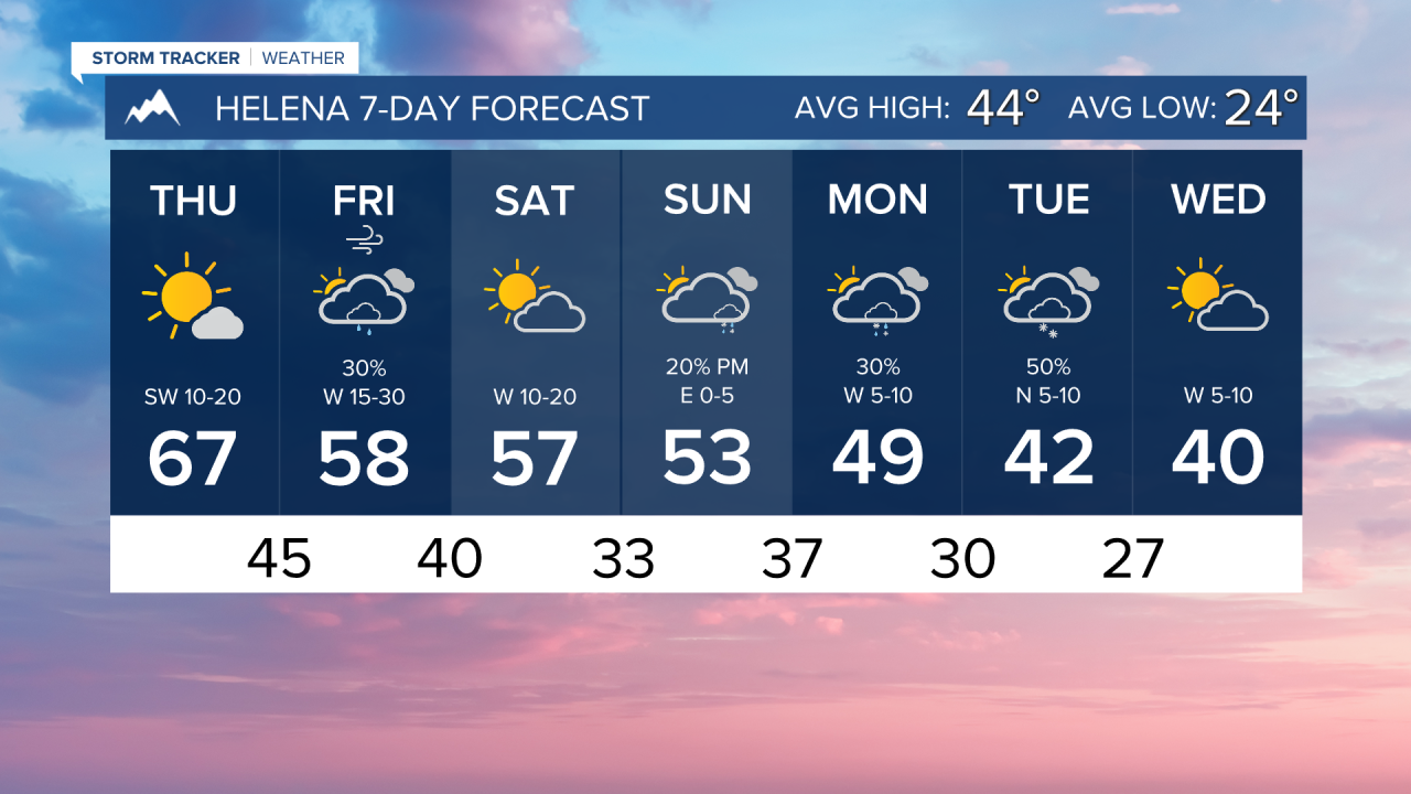


We could see another November day with record warmth across the state. Down-sloping wind will allow afternoon temperatures to reach the upper 60s to even the low 70s.
Helena's record for the day is 71°, set back in 1999. We are forecasting 67°. Great Falls' record for the day is 69°, set back in 1990. We are forecasting 70°.
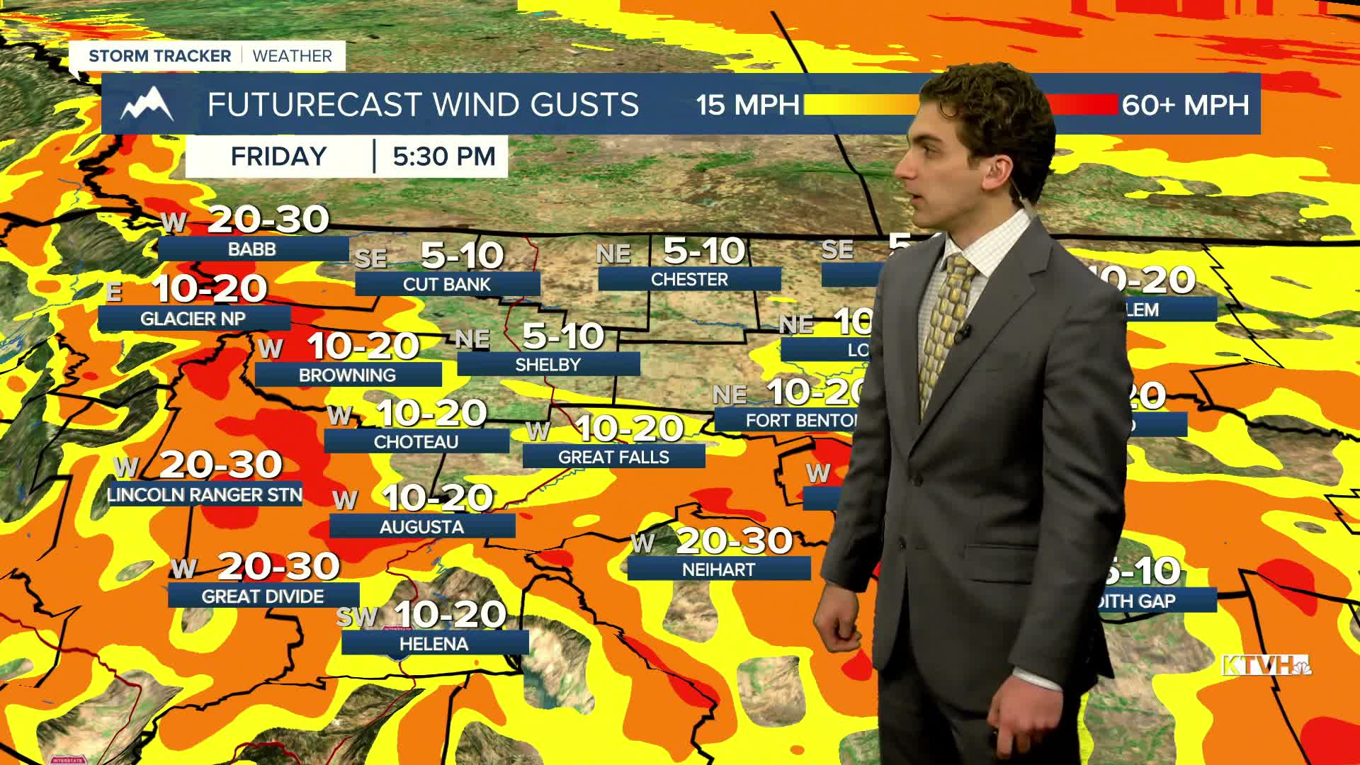
The wind picks up this afternoon out ahead of our next cold front. Winds could gust around 60-80 MPH near the Rocky Mountain Front.
A slow-moving cold front is expected to arrive on Friday, bringing increased wind, rain, and snow. Scattered showers will develop by Friday morning and stick around through most of the day. Some snow may fall near the Hi-Line Friday night. High temperatures drop into the 50s.
The weekend trends drier with the cold front falling apart. Highs reach the low-to-mid-50s.
A stronger front is expected to arrive next week, bringing colder-than-normal air and the potential for rain and snow at lower elevations.
——————————————————————————————————————————
WEATHER ALERTS:
A DENSE FOG ADVISORY continues for the Flathead/Mission Valleys until 10 AM Thursday
A DENSE FOG ADVISORY continues for the Lower Clark Fork Region until 10 AM Thursday
A HIGH WIND WARNING has been issued for Eastern Glacier National Park and adjacent foothills and plains from noon Thursday until 5 PM Friday
A HIGH WIND WARNING has been issued for the Southern Rocky Mountain Front and adjacent foothills and plains from 3 PM Thursday until 5 PM Friday
A HIGH WIND WARNING has been issued for Eastern Glacier, Western Toole, and Central Pondera Counties from 5 PM Thursday until 5 PM Friday
A LAKE WIND ADVISORY has been issued for Fort Peck Lake from 5 PM Thursday until 8 PM Friday
A WIND ADVISORY has been issued for the Beartooth Foothills and Livingston Area from 5 PM Thursday until 8 PM Friday
——————————————————————————————————————————
Helena Temperature Records Today:
High: 71 (1999)
Low: -35 (1959)
AVG: 44/24
Great Falls Temperature Records Today:
High: 69 (1990)
Low: -23 (1955)
AVG: 45/24