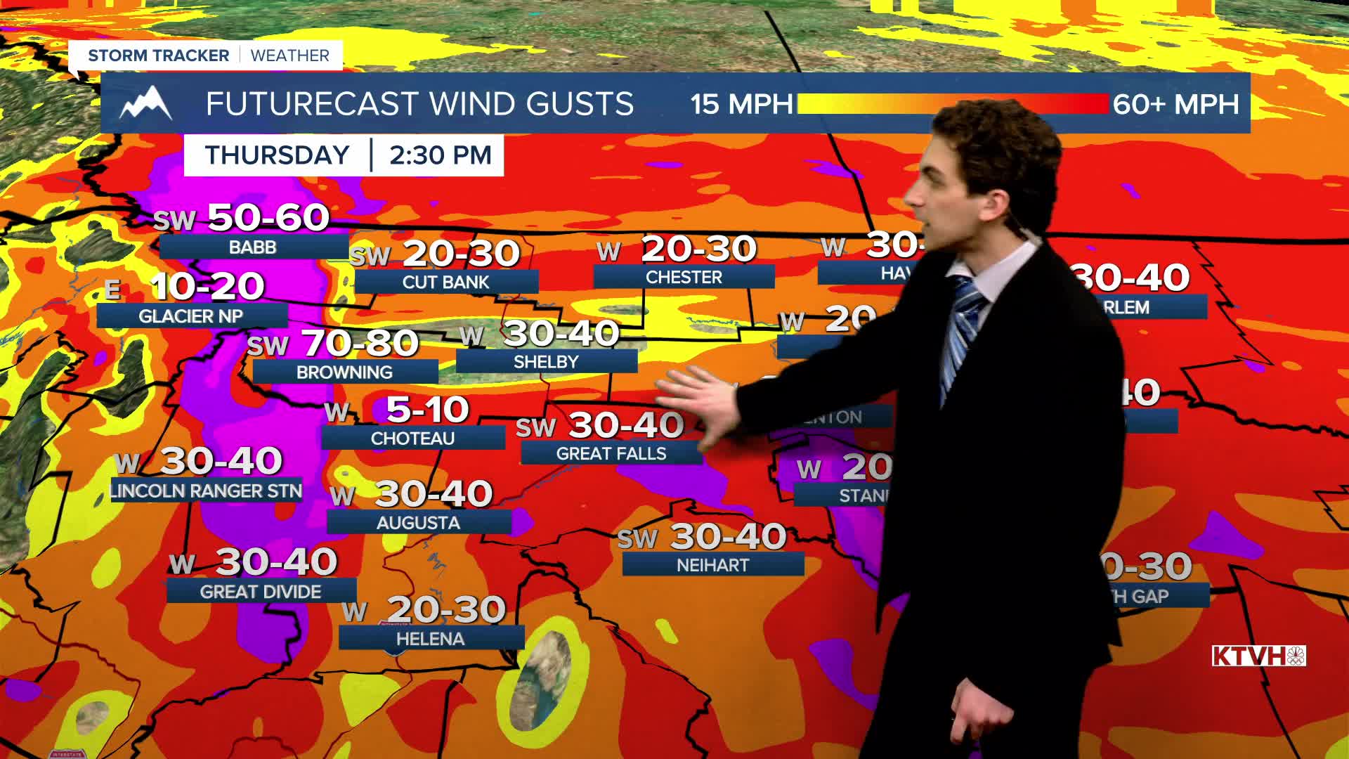


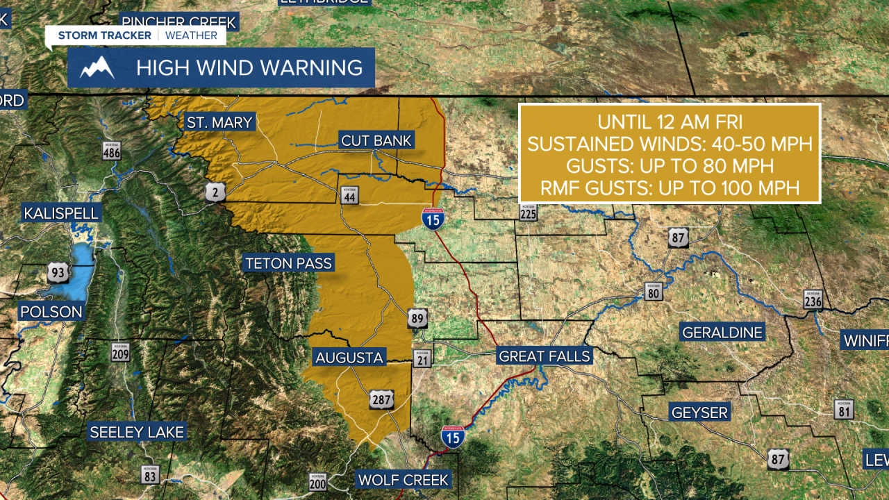
THURSDAY, MARCH 19TH: West of I-15 is where the strongest winds will be today in north-central Montana. We have already had multiple recorded triple-digit gusts near the Rocky Mountain Front this morning. A High Wind Warning continues for the Rocky Mountain Front for the rest of the day.
The rest of the plains will still be windy, but not meet the High Wind Warning criteria. Expect winds to max out around 40-50 MPH through most of north-central Montana, east of I-15. The Helena area will have wind developing in the afternoon with gusts of up to 40 MPH.
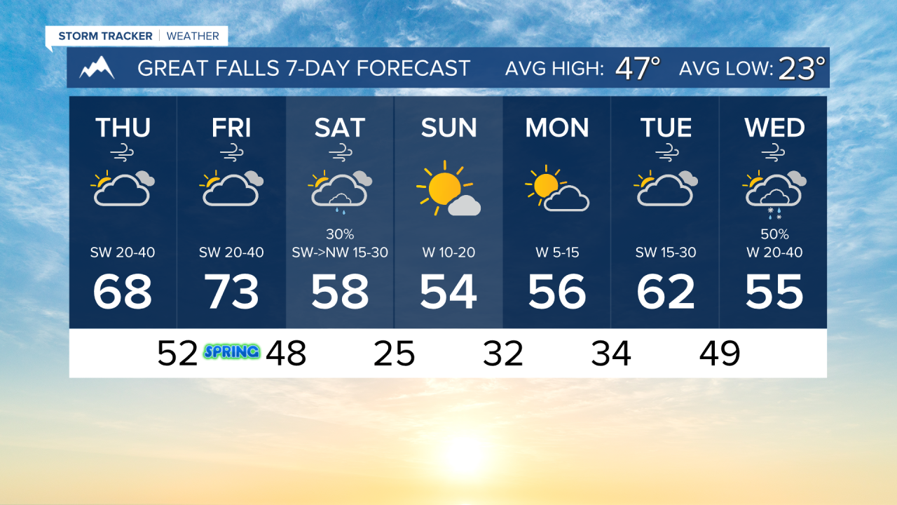
Highs will reach the upper 60s to mid 70s across the state today. Several high temperature records for the last day of winter, including Helena's, are in jeopardy today. Helena should reach a high of about 72 degrees. North-central Montana, although having the strong downslope winds, should be a few degrees cooler due to increased cloud cover.
FRIDAY, MARCH 20TH: The first day of Spring will feel more like Summer. High temperatures will reach the 70s for most areas. Some afternoon highs will be close to the low 80s in south-central Montana. Daily record highs will be broken. Helena and Great Falls should reach the mid-70s.
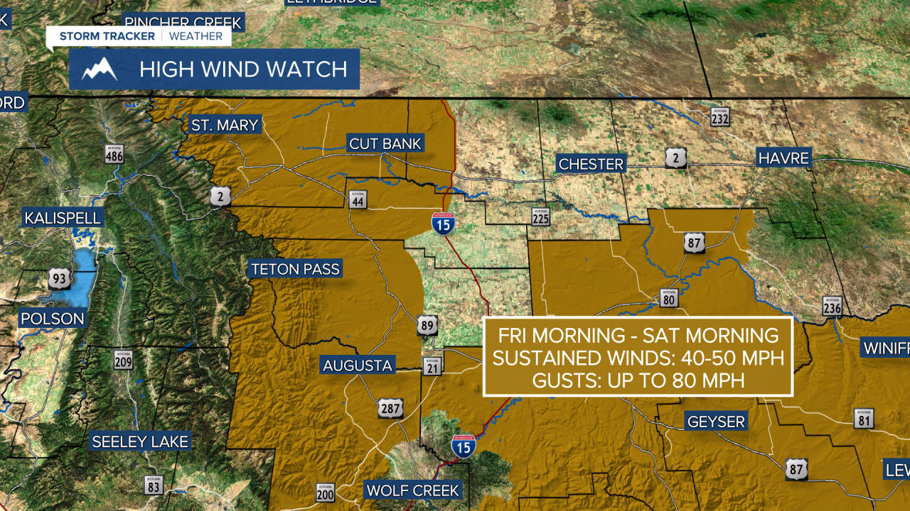
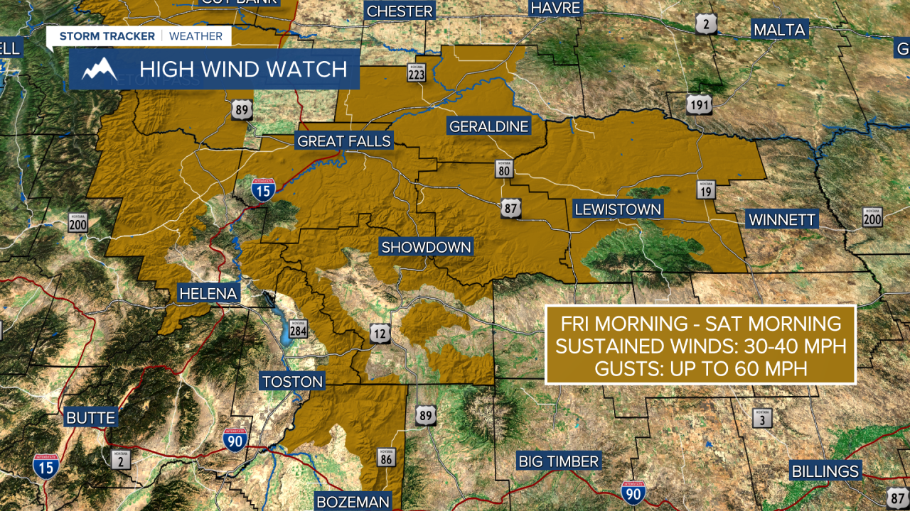
It still will be windy across the plains. High Wind Watches are in effect for the Great Falls area and most of the central Montana mountains, as far west as MacDonald Pass. The Helena Valley is not included in the watch. Gusts will be approaching 50-60 MPH yet again. Helena could gust near 40 MPH. We will be dry under partly to mostly cloudy skies.
SATURDAY, MARCH 21ST: The morning will continue to be windy and mild, but a cold front will begin to usher in some change. A few rain showers will move from northwest to southeast through the state. High temperatures will only reach the 50s and 60s before cooler air comes in behind the front by the afternoon. Wind will also decrease behind this boundary. Expect mostly rain in the lower elevations. There may be a few light snow showers coming through Saturday night near the Hi-Line, but accumulations should be very minimal.
SUNDAY, MARCH 22ND: Sunday will be a beautiful, early spring day. Most of our morning lows will dip below freezing, so watch out for some patchy ice where we see precipitation fall on Saturday. Afternoon temperatures will reach the 50s with weaker winds. It will be mostly sunny and dry.
LONG-RANGE FORECAST: Next week will begin with temperatures near normal and dry. Another weather system moves in around Wednesday.
——————————————————————————————————————————
WEATHER ALERTS:

——————————————————————————————————————————
Helena Temperature Records Today:
High: 71 (1997)
Low: -8 (1906)
AVG: 49/26
Great Falls Temperature Records Today:
High: 71 (1928)
Low: -10 (1906)
AVG: 47/23