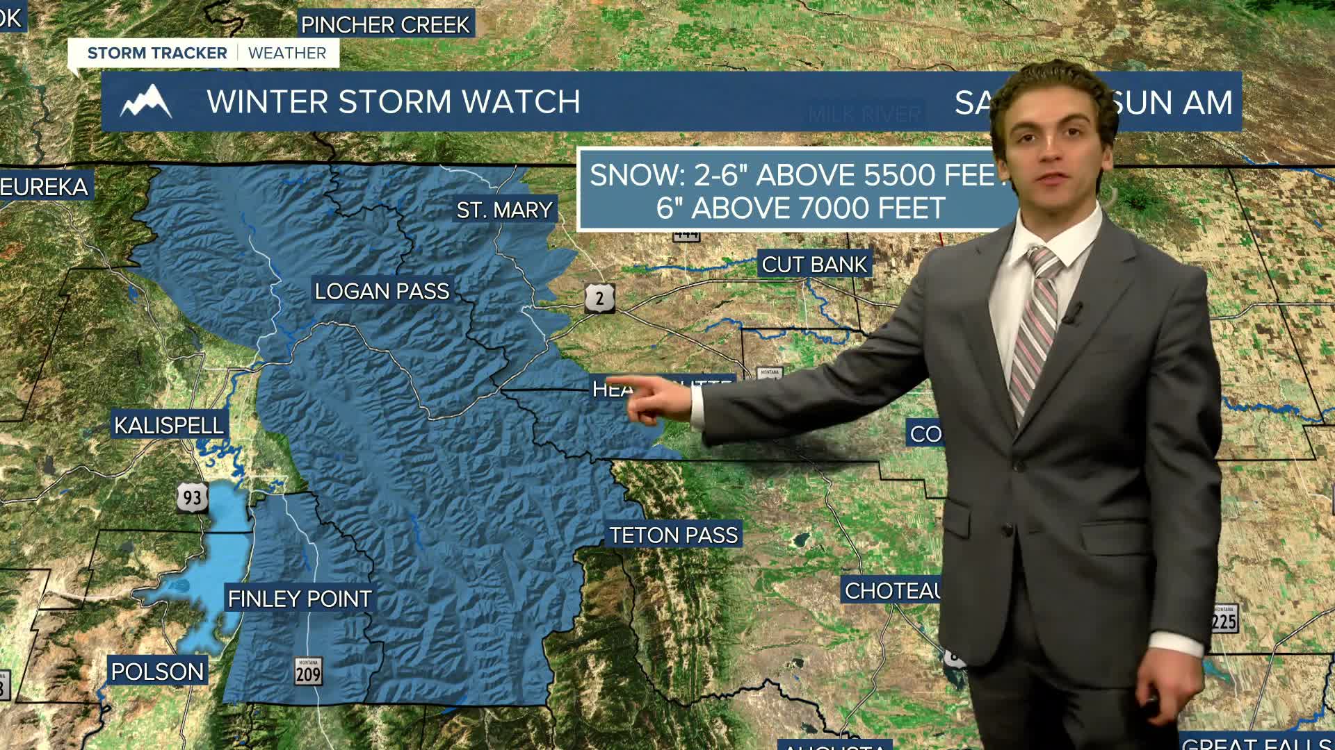


The first Winter Storm Watches of the season have been issued for portions of Montana's higher terrain, where a major fall storm will bring rain and snow over the weekend.
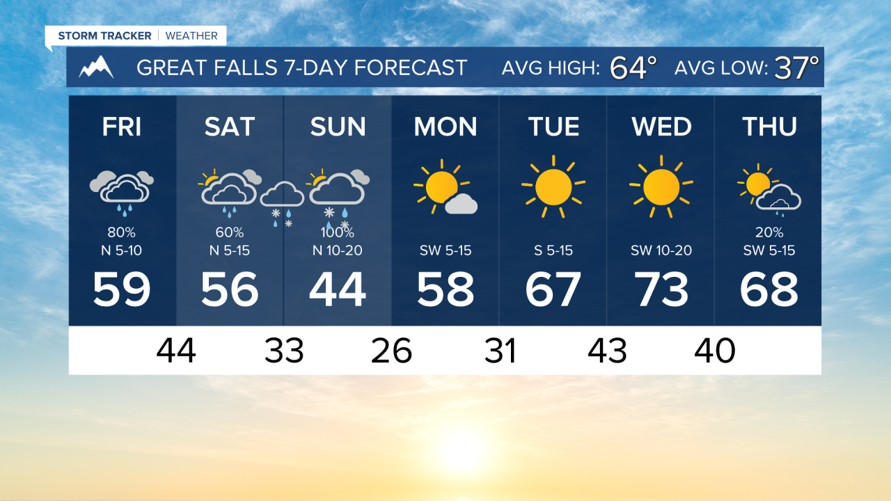
Rain and cloud cover will continue over portions of Montana today with highs in the 50s and low 60s. A few thunderstorms are possible this afternoon, south of the main band of rain, where there will be a bit of instability. The threat of lightning will mainly be confined to southwest Montana, possibly as far north as Helena.
A cold front from the north will move through the state Saturday afternoon and evening. This will lower snow levels and allow for some accumulation in the mountains. The freezing point is expected to lower to about 5-6k feet by Sunday morning, allowing for snow at mountain passes. Some flakes may fly in lower elevations as well, but accumulation is unlikely.
The first freeze for many lower elevations will come on Monday morning behind the storm system. Clear skies will allow for cooler morning temperatures next week.
Expect cold mornings and warming afternoon temperatures early next week under clear to mostly clear skies
——————————————————————————————————————————
WEATHER ALERTS:
A WINTER STORM WATCH has been issued for the East Glacier Park Region from late Saturday night through Sunday morning
A WINTER STORM WATCH has been issued for the West Glacier Park Region from late Saturday night through Sunday morning
A WINTER STORM WATCH has been issued for the Absaroka/Beartooth Mountains and Crazy Mountains from Saturday morning through Sunday afternoon
A WINTER STORM WATCH has been issued for the Gallatin and Madison County Mountains and Centennial Mountains from Saturday evening through Sunday afternoon
A WINTER STORM WATCH has been issued for Pryor/Northern Bighorn Mountains from Saturday evening through Sunday afternoon
——————————————————————————————————————————
Helena Temperature Records Today:
High: 85 (2011)
Low: 18 (1999)
AVG: 65/39
Great Falls Temperature Records Today:
High: 91 (1943)
Low: 17 (1999)
AVG: 64/37