For the latest updates on the Jericho Mountain Fire, follow this link.
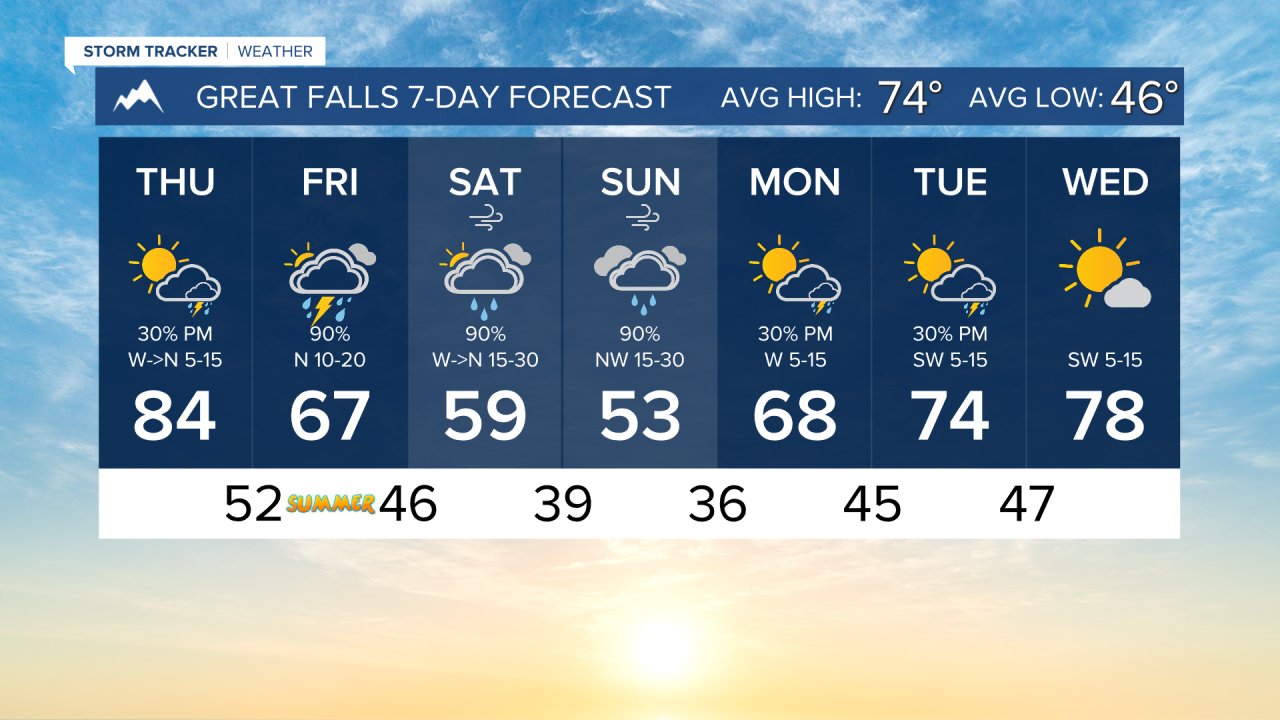
Today will be another warm day, but thunderstorms will develop in the afternoon across southwest Montana. A couple of storms may turn severe with strong wind gusts. Highs will still reach the 80s in western Montana. The plains will have air temperatures reach the 90s.
A cold front begins to move into the state on Friday. More isolated severe storms are possible, but heavy rain will accompany these storms. Flash flooding will be a concern for a section of the Hi-Line, west of Havre.
This cold front significantly lowers temperatures heading into the first few days of summer. Highs will only reach the 50s and 60s, while lows drop into the 30s. Snow levels drop on Saturday night to between 5000 and 6000 feet. Rainy conditions will affect a lot of the lower-elevation locations.
A warming trend will begin next week with less storm activity.
——————————————————————————————————————————
WEATHER ALERTS:
A WINTER STORM WATCH has been issued for the East Glacier Park Region Zone from Saturday afternoon until Sunday morning
A WINTER STORM WATCH has been issued for the Glacier National Park higher elevations, including Going-to-the-Sun Road and Logan Pass, Marias Pass, Polebridge, and the backcountry of the Flathead National Forest from Saturday afternoon until Sunday morning
——————————————————————————————————————————
Helena Temperature Records Today:
High: 93 (1988)
Low: 36 (1972)
AVG: 76/49
Great Falls Temperature Records Today:
High: 95 (1974)
Low: 34 (2024)
AVG: 74/46
Have a great Wednesday!
Joey Biancone
Meteorologist