


Powerful winds are forecasted over the next two days across much of the state, with the most intense winds coming through on Wednesday. Heavy rain and mountain snow, squalls, and a thunderstorm or two will accompany the wind.
Highs have already been hit for many locations this morning in the 50s. The rest of the day will be in the 40s. A few showers will be around Helena, especially in the morning. Expect partly to mostly cloudy conditions.
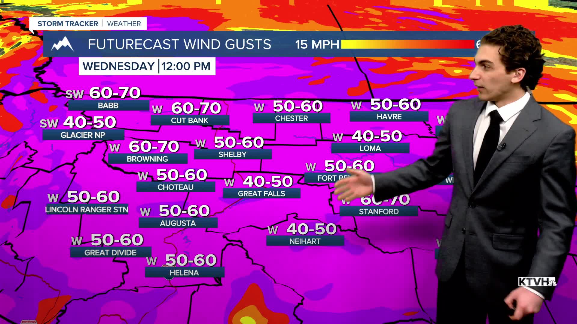
The wind will be gusty today around the state. High Wind Warnings are in place for much of central Montana for gusts approaching 50-70 MPH. The wind will decrease slightly this afternoon, but pick back up again overnight.
A cold front will move through the state on Wednesday morning, bringing heavy snow to the Continental Divide and potentially blizzard conditions with very gusty winds. Up to a foot of snow is possible on the Rocky Mountain Front and Glacier National Park. A heavy burst of rain in lower elevations and snow squalls over mountain passes will form along this front as well. A few thunderstorms are even possible.
Some light snow showers will form around Helena on Wednesday afternoon and evening. Accumulation should stay less than an inch, with a flash freeze possible Thursday morning.
Another shot of rain and snow will come in on Friday, associated with an atmospheric river, with cooler air heading into the weekend.
——————————————————————————————————————————
WEATHER ALERTS:
NWS Weather and Hazards Viewer
——————————————————————————————————————————
Helena Temperature Records Today:
High: 60 (1942)
Low: -36 (1964)
AVG: 32/14
Great Falls Temperature Records Today:
High: 63 (1980)
Low: -36 (1964)
AVG: 35/16


