Light freezing rain and mountain snow will cause minor travel impacts to western and central Montana this morning. The afternoon will be drier and slightly warmer.
Winter weather advisories are in effect for lower elevations, including Helena, Bozeman, Livingston, Havre, and Shelby, this morning, with a forecast of a few hundredths of an inch of ice accumulation.
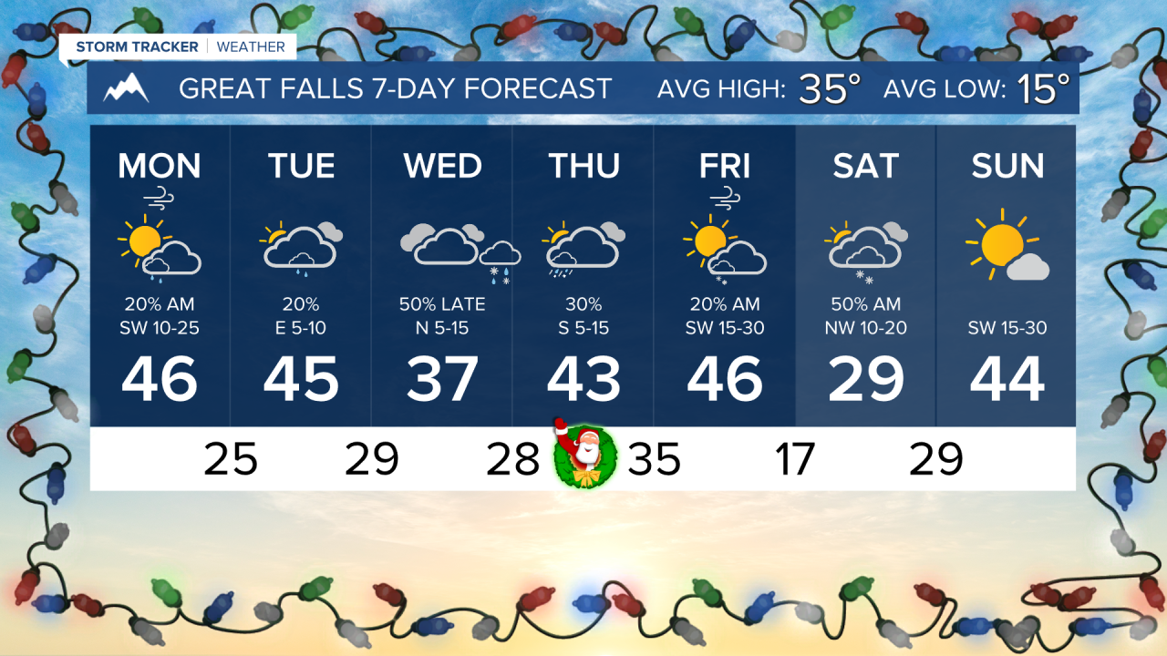
High temperatures today will reach the 40s for most locations. But arctic air will be creeping in north of US Highway 2.
The Arctic air will be moving in and out of north-central Montana this week. Several rounds of lighter precipitation will be affecting the state over the next few days as well.
There may be a rain/snow mix in lower elevations overnight on Christmas Eve, but I am not expecting a widespread white Christmas for most in the state.
Colder air will enter at the beginning of the weekend, but a ridge of high pressure builds on Sunday and into early next week.
——————————————————————————————————————————
WEATHER ALERTS:
NWS Weather and Hazards Viewer
——————————————————————————————————————————
Helena Temperature Records Today:
High: 58 (1933)
Low: -35 (2022)
AVG: 31/13
Great Falls Temperature Records Today:
High: 57 (1933)
Low: -32 (2022)
AVG: 35/15