


It's going to be another windy week across the Treasure State. Gusts will be approaching 60-80 MPH for most areas in the plains. Helena will be gusty Monday night as well.
The colder temperatures will finally disappear in the Helena Valley for now. The wind will blow out the inversion this afternoon and evening. Highs will range from the 40s to the low 60s across the state. Helena will reach around 52 degrees. Great Falls will be approaching another record high today.
The wind has already been picking up this morning in north-central Montana. It will take a bit longer to blow out the inversion in the Helena Valley, but I expect the wind to start picking up early this afternoon, with the peak coming after dark.
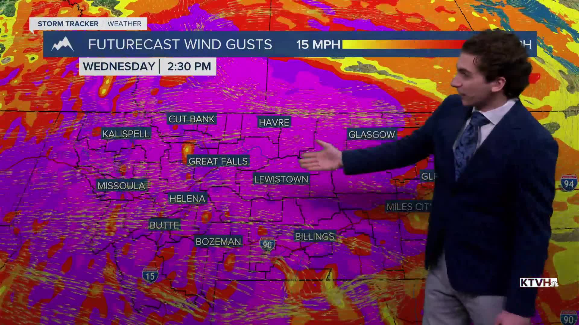
Another round of powerful wind comes through Tuesday night into Wednesday. Most of the state will record gusts between 50 and 70 MPH.
Impactful rain and snow will fall in northwest Montana and the Continental Divide over the next few days. Libby is still under a Flash Flood Watch until Wednesday. Up to 16 inches of snow will fall along the Rocky Mountain Front through that same timeframe.
A cold front that is bringing the wind of Wednesday morning will also bring snow, lower elevation rain, and mountain snow. Impacts to the higher-populated areas seem minimal as of this forecast, outside of the wind.
Another shot of rain and snow will come in on Friday with cooler air heading into the weekend.
——————————————————————————————————————————
WEATHER ALERTS:
A HIGH WIND WARNING continues for the Rocky Mountain Front and adjacent foothills and plains, Eastern Glacier, Western Toole, and Central Pondera Counties, and Eastern Toole and Liberty Counties until 8 AM Tuesday
A HIGH WIND WARNING has been issued for Cascade County below 5000ft, Judith Basin County, and Judith Gap from noon Monday until 11 AM Tuesday
A HIGH WIND WARNING has been issued for Eastern Pondera and Eastern Teton Counties, Western and Central Chouteau County, Bears Paw Mountains and Southern Blaine, Upper Blackfoot and MacDonald Pass, and Little Belt and Highwood Mountains from noon Monday until 11 AM Tuesday
A HIGH WIND WARNING has been issued for Northern Blaine County from noon Monday until 11 AM Tuesday
A HIGH WIND WARNING has been issued for Hill County from noon Monday until 11 AM Tuesday
A HIGH WIND WARNING has been issued for the Snowy and Judith Mountains and Fergus County below 4500ft from noon Monday until 11 AM Tuesday
A HIGH WIND WARNING has been issued for the Snowy and Judith Mountains and Fergus County below 4500ft from noon Monday until 11 AM Tuesday
A HIGH WIND WARNING has been issued for the Beartooth Foothills and Livingston Area from 5 PM Monday until 11 AM Tuesday
A HIGH WIND WARNING has been issued for Phillips County from 5 PM Monday until 11 AM Tuesday
A HIGH WIND WARNING has been issued for the Crazy Mountains from 5 PM Monday until 2 PM Tuesday
A HIGH WIND WARNING has been issued for Judith Gap, Southern Wheatland, Melville Foothills, and Northern Sweet Grass from 5 PM Monday until 2 PM Tuesday
A WIND ADVISORY continues for the Beartooth Foothills and Livingston Area until 5 PM Monday
A WIND ADVISORY has been issued for the Kootenai/Cabinet Region and Lower Clark Fork Region from 5 PM Monday until 3 AM Tuesday
A WIND ADVISORY has been issued for the Flathead/Mission Valleys from 7 PM Monday until 5 AM Tuesday
A WIND ADVISORY has been issued for the Potomac/Seeley Lake region from 7 PM Monday until 5 AM Tuesday
A WIND ADVISORY has been issued for the West Glacier region from 7 PM Monday until 5 AM Tuesday
A FLASH FLOOD WATCH continues for Libby until Wednesday afternoon
A HIGH WIND WATCH has been issued for the Bitterroot/Sapphire Mountains, Butte/Blackfoot Region, and Missoula/Bitterroot Valleys from Tuesday evening until Wednesday afternoon
A HIGH WIND WATCH has been issued for the Kootenai/Cabinet Region and Lower Clark Fork Region from Tuesday evening until Wednesday afternoon
A HIGH WIND WATCH has been issued for the Flathead/Mission Valleys from Tuesday evening until Wednesday afternoon
A HIGH WIND WATCH has been issued for the Potomac/Seeley Lake Region from Tuesday evening until Wednesday afternoon
A HIGH WIND WATCH has been issued for Eastern Pondera and Eastern Teton Counties, Western and Central Chouteau County, Bears Paw Mountains and Southern Blaine, Upper Blackfoot and MacDonald Pass, and Little Belt and Highwood Mountains from Tuesday evening until Wednesday evening
A HIGH WIND WATCH has been issued for the Rocky Mountain Front and adjacent foothills and plains, Eastern Glacier, Western Toole, and Central Pondera Counties, and Eastern Toole and Liberty Counties from Tuesday evening until Wednesday evening
A HIGH WIND WATCH has been issued for the Interstate 90 Corridor between Bozeman and Whitehall, Gates of the Mountains, Helena Valley, Big Belt, Bridger and Castle Mountains, Meagher County Valleys, Elkhorn and Boulder Mountains, Canyon Ferry Area, and Madison River Valley from Tuesday evening until Wednesday evening
A HIGH WIND WATCH has been issued for Snowy and Judith Mountains and Fergus County below 4500ft from Tuesday evening until Wednesday evening
A HIGH WIND WATCH has been issued for Cascade County below 5000ft and Judith Basin County and Judith Gap from Tuesday evening until Wednesday evening
A WINTER STORM WATCH has been issued for the Continental Divide along the Rocky Mountain Front from Tuesday evening until Wednesday evening
A WINTER STORM WATCH has been issued for Highway 83 Bigfork to Swan Lake, Bad Rock Canyon, Essex, Polebridge, Marias Pass, and Glacier National Park from Tuesday evening until Wednesday evening
——————————————————————————————————————————
Helena Temperature Records Today:
High: 57 (1980)
Low: -25 (1924)
AVG: 32/14
Great Falls Temperature Records Today:
High: 62 (2014)
Low: -23 (1922)
AVG: 33/15


