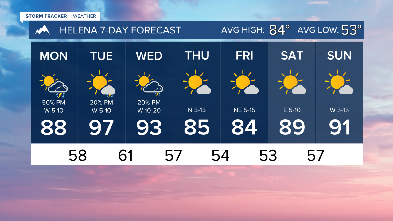


Over the weekend, Helena received about an inch of rainfall. With a little more on the way this evening, that will be very beneficial for the heat we have coming up. Especially on Tuesday when highs reach the upper 90s.
Today's forecast will consist of mostly to partly sunny skies with scattered thunderstorms in southwest Montana. Mostly clear skies will be present in eastern Montana. Highs will reach the upper 80s to low 90s.
There has been significant fire activity across southwest Montana over the weekend. There are five large fires in Madison County alone. The Windy Rock Fire grew to over 800 acres in Powell County and produced heavy smoke, some of which made it to the Helena area. There was even a small fire that ignited in the North Hills of Helena. The Helena fire has been contained.
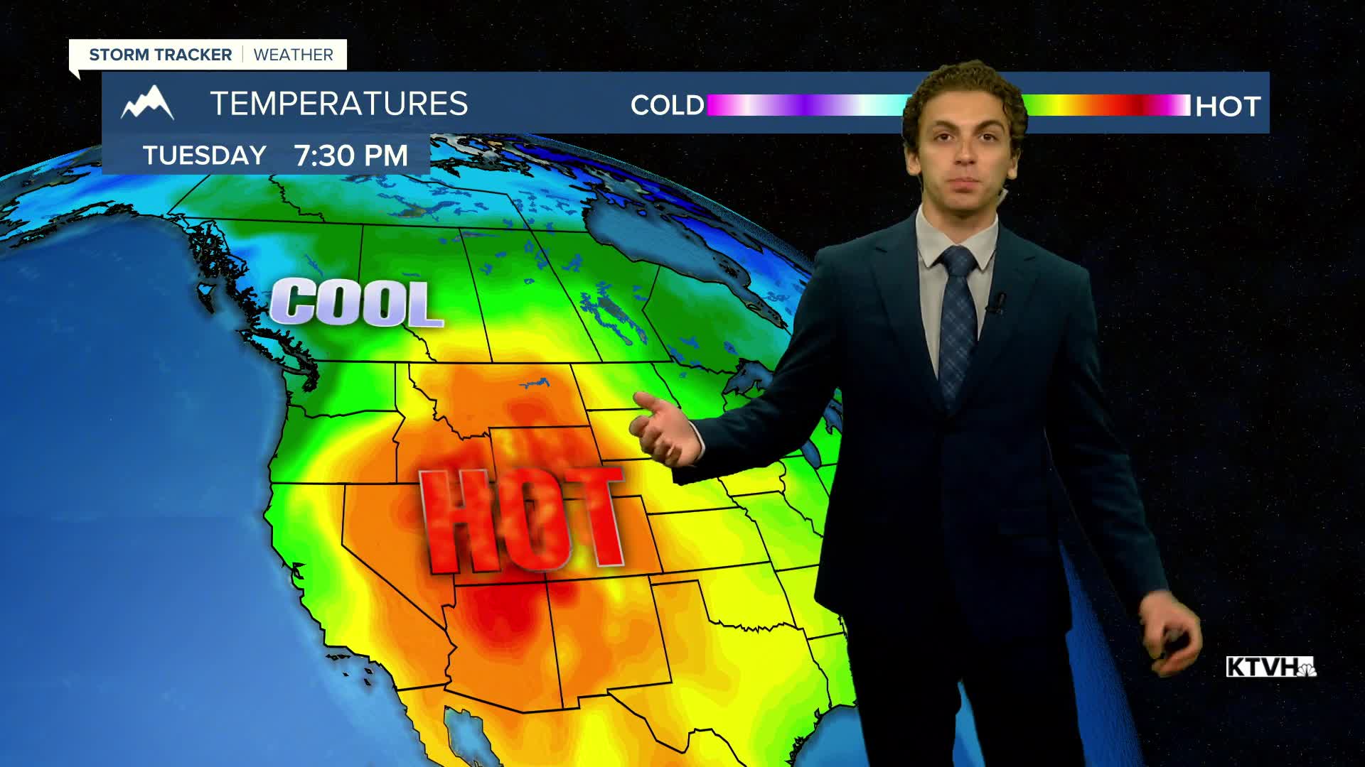
Fire danger stays elevated as temperatures increase into the upper 90s and low 100s statewide on Tuesday. Some isolated showers and thunderstorms form along the Continental Divide in the afternoon.
A cool-down is expected in the form of a cold front on Wednesday and Thursday. Temperatures improve as highs drop back down into the 80s for the remainder of the week with mainly dry conditions.
——————————————————————————————————————————
WEATHER ALERTS:
A HEAT ADVISORY has been issued for Central and Southeast Phillips, Central and Southern Valley, Daniels, Sheridan, Western Roosevelt, Petroleum, Garfield, McCone, Richland, Dawson, Prairie, Wibaux, Northern Phillips, Southwest Phillips, Northern Valley, and Eastern Roosevelt Counties from 10 AM Tuesday until 8:00 PM Wednesday
——————————————————————————————————————————
Helena Temperature Records Today:
High: 100 (2001)
Low: 39 (1995)
AVG: 84/53
Great Falls Temperature Records Today:
High: 101 (1964)
Low: 40 (1987)
AVG: 83/50
Have a great Monday!
Joey Biancone
Meteorologist