


Very unhealthy air is marching into Montana this morning on the heels of a Canadian cold front. This is not a morning you want to be outside for very long.
The cold front will also bring some wind to the state, with the strongest gusts located in northwest Montana. Most areas can expect gusts to reach around 30 MPH. A High Wind Warning has been issued for Sheridan County due to higher confidence in wind gusts exceeding 60 MPH.
A few light showers/sprinkles will form in the upslope region of the Rocky Mountain Front and Little Belt Mountains, but everywhere else will remain dry.
Smoke should begin to move out this afternoon. Air quality should be much better heading into Friday morning.
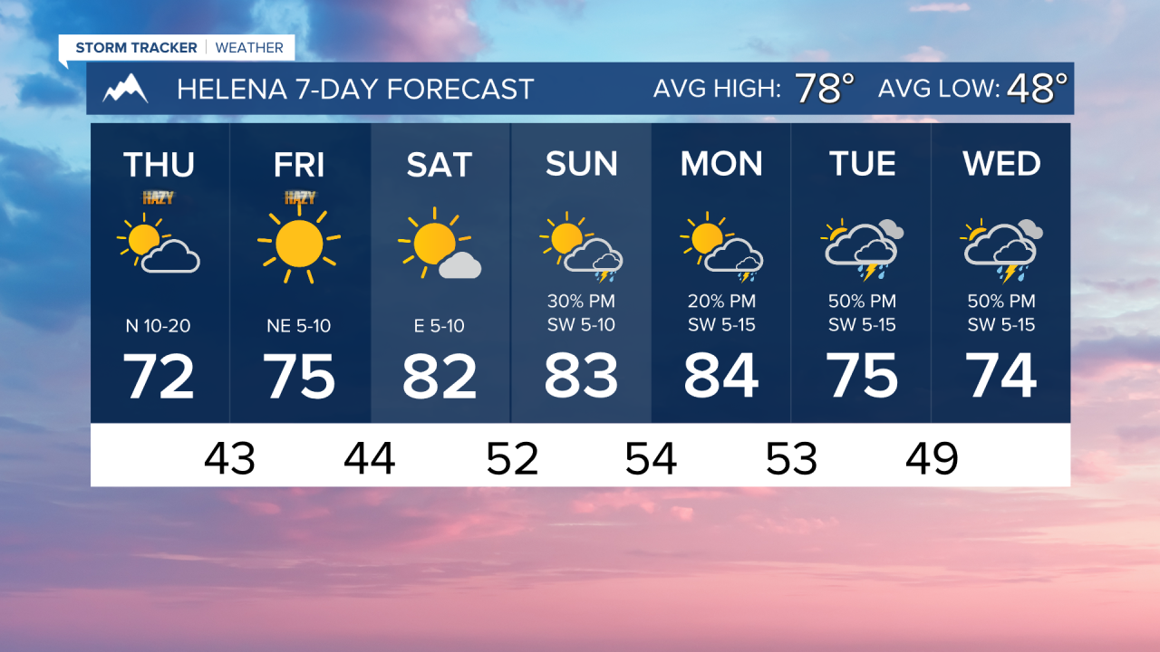
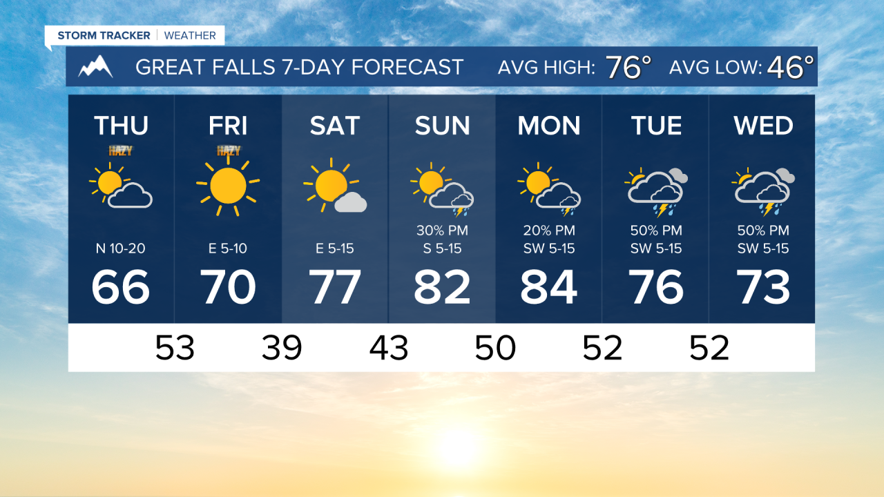
Cooler air will also come into the state today, with highs only reaching the 60s and 70s.
Tomorrow morning will be some of the coolest morning air we have had in a while, with lows dropping into the 30s and 40s.
Clear skies and calm wind are expected tomorrow with daytime highs in the 60s and 70s again.
The weekend will be warmer as highs rise back into the 70s and 80s. Thunderstorms start to work back into southwestern Montana on Saturday, and travel a bit further north and east on Sunday.
Next week, temperatures will be near to slightly above normal with daily thunderstorms in the forecast.
——————————————————————————————————————————
WEATHER ALERTS:
An AIR QUALITY ALERT continues for Flathead, Lake, Lincoln, Mineral, Missoula, Powell, Sanders, and Glacier Counties until 9 AM Thursday
A LAKE WIND ADVISORY continues for Fort Peck Lake until 9 PM Thursday
A WIND ADVISORY continues for Flathead/Mission Valleys until midnight Thursday
A HIGH WIND WARNING has been issued for Sheridan County from 9 AM Thursday until 9 PM Thursday
——————————————————————————————————————————
Helena Temperature Records Today:
High: 96 (1998)
Low: 31 (1962)
AVG: 78/48
Great Falls Temperature Records Today:
High: 94 (2022)
Low: 33 (1929)
AVG: 76/46
Have a great Thursday!
Joey Biancone
Meteorologist