


Air pollutant levels are already unhealthy for sensitive groups this morning for much of western Montana. Smoke will continue to impact the state through tomorrow evening as a second cold front moves through the area.
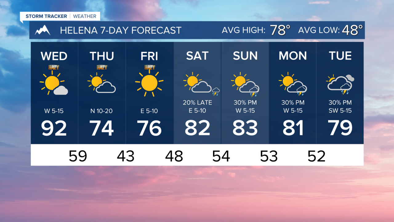
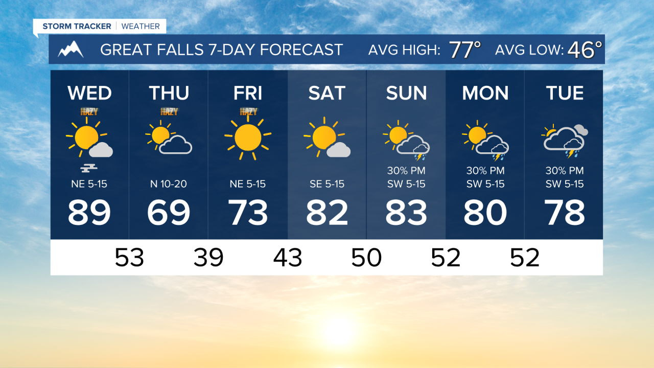
Highs range from the mid-90s to the upper-70s from west to east today under mostly sunny to partly cloudy skies.
Another cold front is expected to move through Montana tomorrow morning, bringing thicker smoke, gusty north winds, and cooler temperatures. Highs only reach the 60s and 70s with a few light rain showers, specifically in upslope locations.
Friday morning will be one of the coldest mornings we've had in a while, with lows dipping down into the upper 30s to 40s. Smoke will start to push out of the area.
Monsoonal moisture will begin to make its way into the state on Saturday, mostly in southwestern Montana. More thunderstorm activity is expected as we head into next week.
——————————————————————————————————————————
WEATHER ALERTS:
An AIR QUALITY ALERT continues for Daniels, Dawson, McCone, Richland, Roosevelt, Sheridan, and Valley Counties until 9 AM Wednesday
A HEAT ADVISORY continues for the Kootenai/Cabinet Region and Lower Clark Fork Region until midnight Wednesday
——————————————————————————————————————————
Helena Temperature Records Today:
High: 99 (2022)
Low: 32 (1958)
AVG: 78/48
Great Falls Temperature Records Today:
High: 102 (2022)
Low: 34 (1956)
AVG: 77/46
Have a great Wednesday!
Joey Biancone
Meteorologist